

Mammoth Mountain Recreational Weather and Travel Forecast
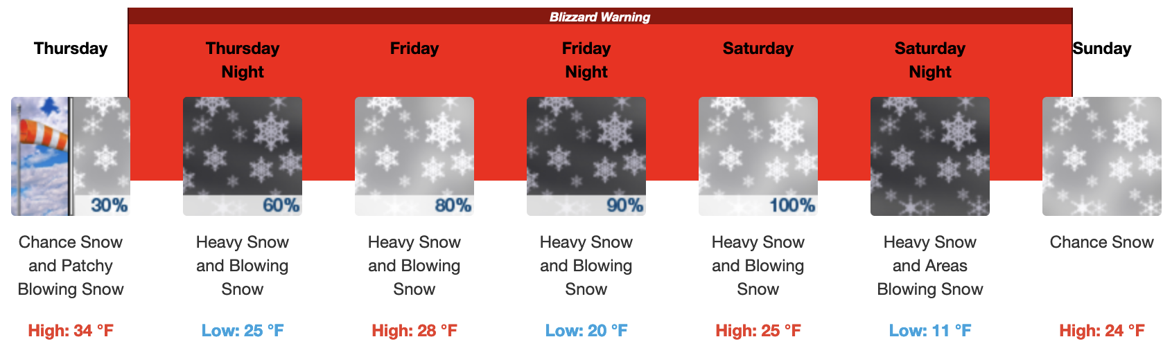
BLIZZARD WARNING IN EFFECT FROM 4 PM THURSDAY TO 10 AM PST SUNDAY
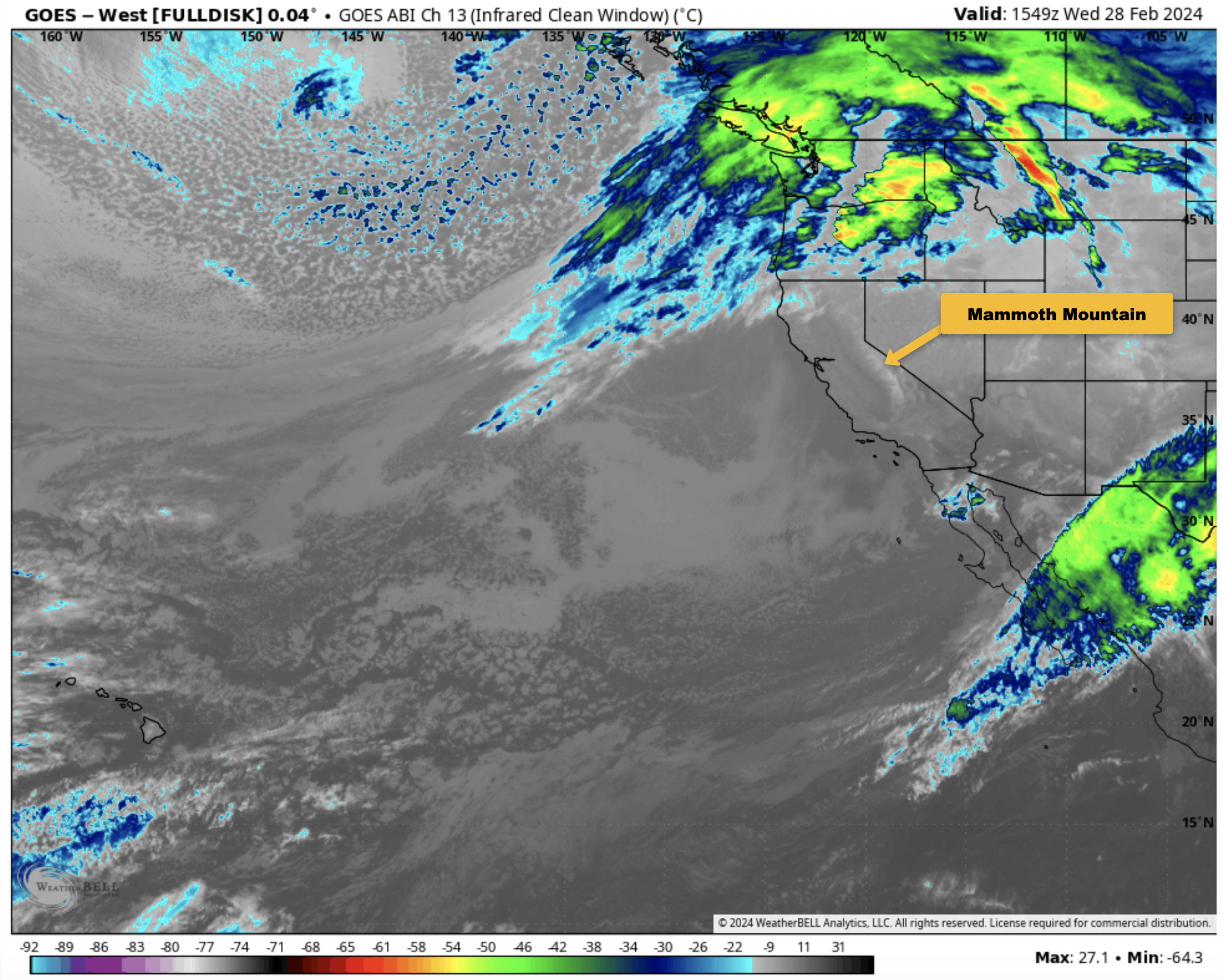
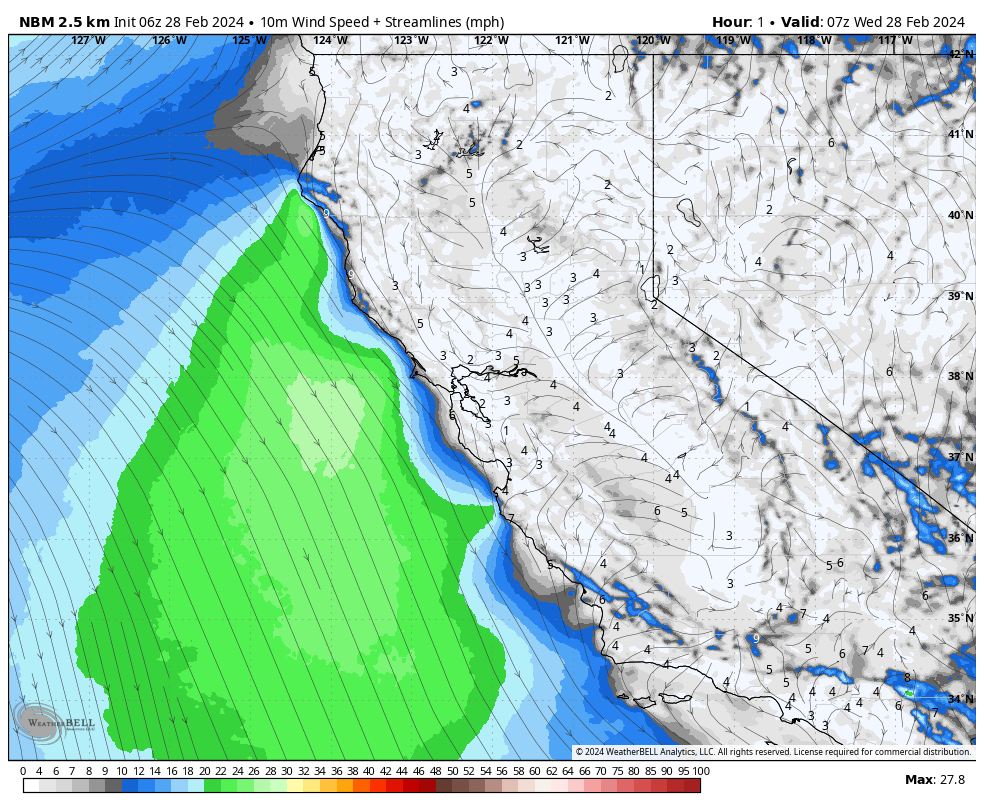
February 28th, 2024 @ 9:34 AM – If you’re heading to the hill on today, expect clear skies with mid-day temperatures in the mid to upper 30s. Winds will be out of the SW will be increasing to 15-25 MPH with gusts to 35+ MPH.
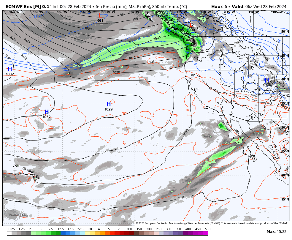
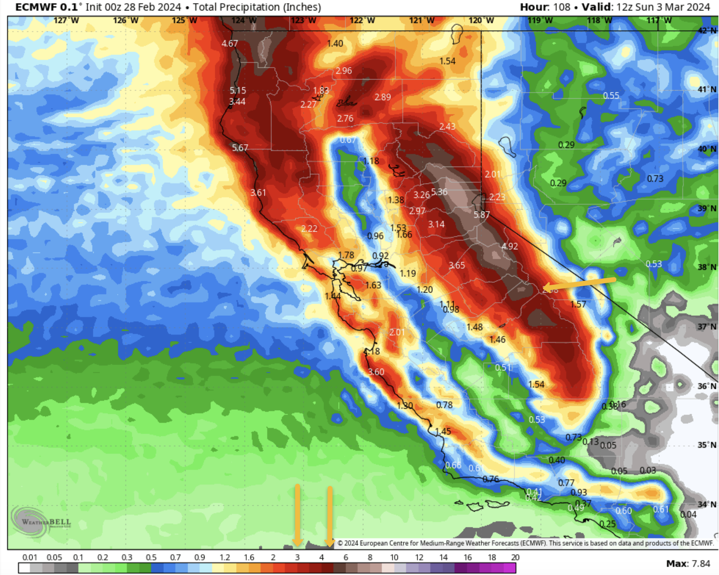
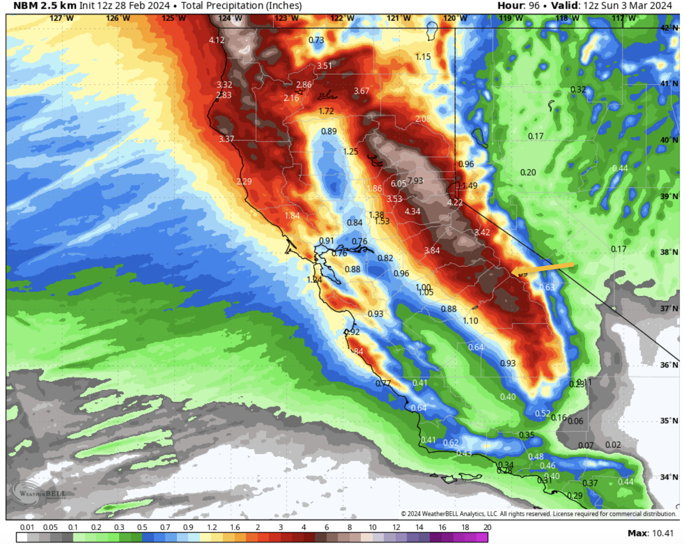
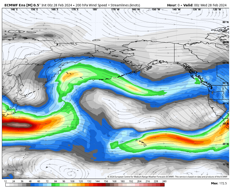
By Thursday, the next strong low-pressure system will be moving into the area, with gusty winds expected. Mid-day temperatures will be in the low to mid-30s with SW winds at 20-30 MPH with gusts to 45-60 MPH at times.
It looks like a decent wind-buff day could be in the making. Snow showers could develop later in the day with 4-8 inches expected Thursday night.
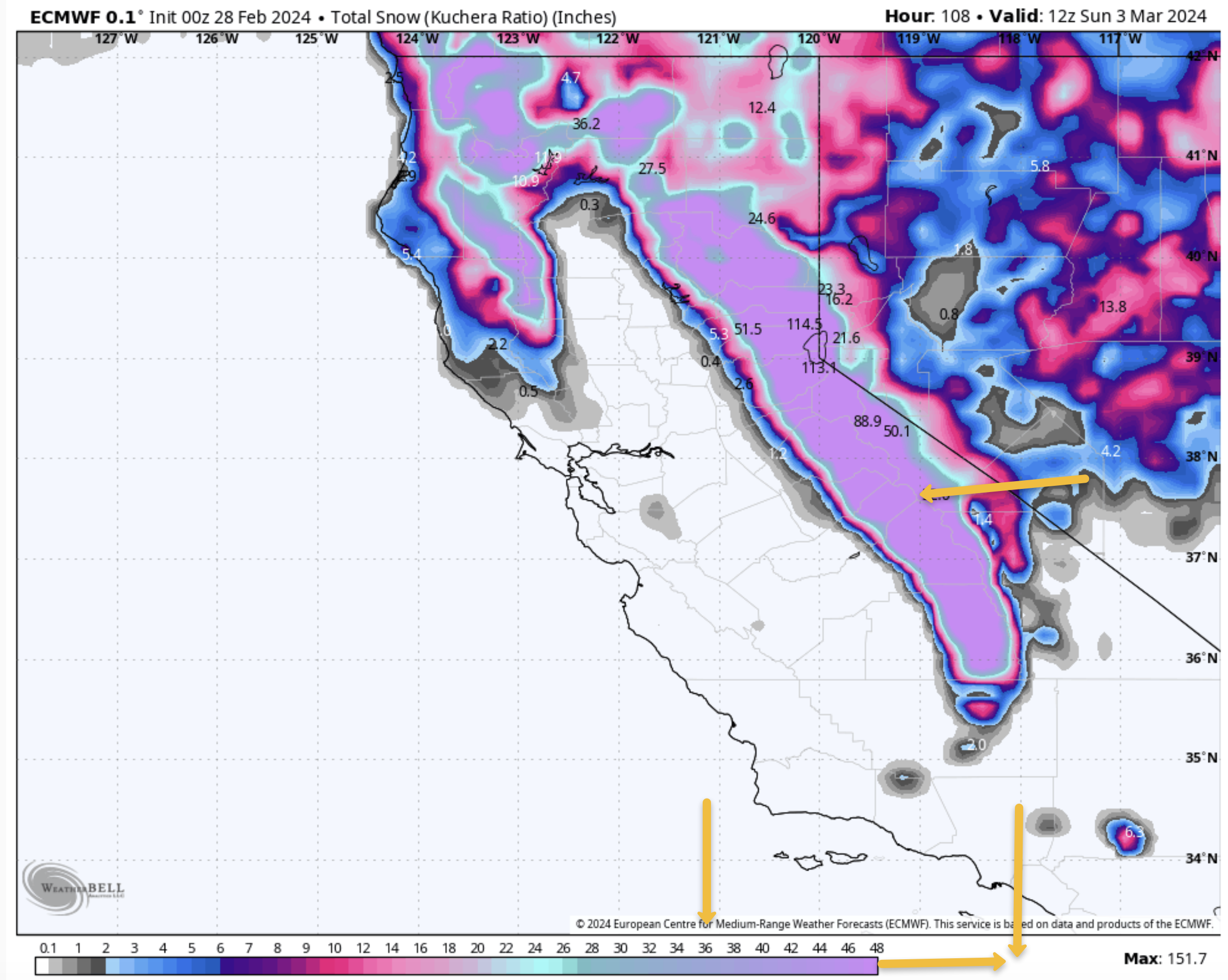
For Friday expect cloudy skies with moderate to heavy snowfall at times. Mid-day temperatures will be in the upper 20s to lower 30s with SW winds at 20-35 MPH with gusts to 45-65+ MPH at times on the lower and mid-mountain. Winds up top will be gusting to 85 MPH at times. Snowfall amounts during the day look to be in the 6-12 inch range.
On Saturday you can expect 1-2 feet of fresh at sunrise with moderate to heavy snowfall that will start to back off by noon. Mid-day temperatures will be in the low to mid-20s with SW winds at 25-35 MPH with gusts to 45-65+ MPH at times. Wind gusts on the upper Mountain will be in the 85-100 MPH range. Snowfall amounts during the day look to be in the 10-18 inch range.
Sunday is looking to be snow showery early with clearing later in the day. Looks like a powder-fest day once the Mountain digs out and gets avy control done.
Travel Forecast: All Winter Roadways should be open and clear Tuesday into Thursday evening. If you plan to travel to Mammoth Lakes next Friday or Saturday expect moderate to heavy snow at times with strong cross winds up to 45-55 MPH at times on 395 from Toms Place to Mammoth Lakes. Snow levels look to drop down to near Bishop early on Saturday. Travel is strongly discouraged during this time period.
My advice is to drive up on Thursday or wait till Sunday. During storms like this most of the ski area will be closed so keep that in mind and bring a good book and shovel while you wait for the lifts to re-open on Sunday.


Weather Summary: Updating… all data below is fresh at of 9:30 AM 2-28
Snowman

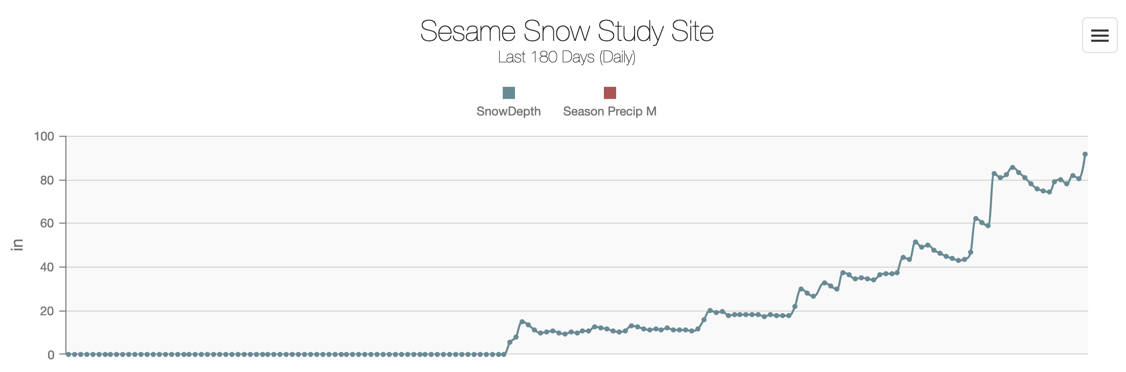
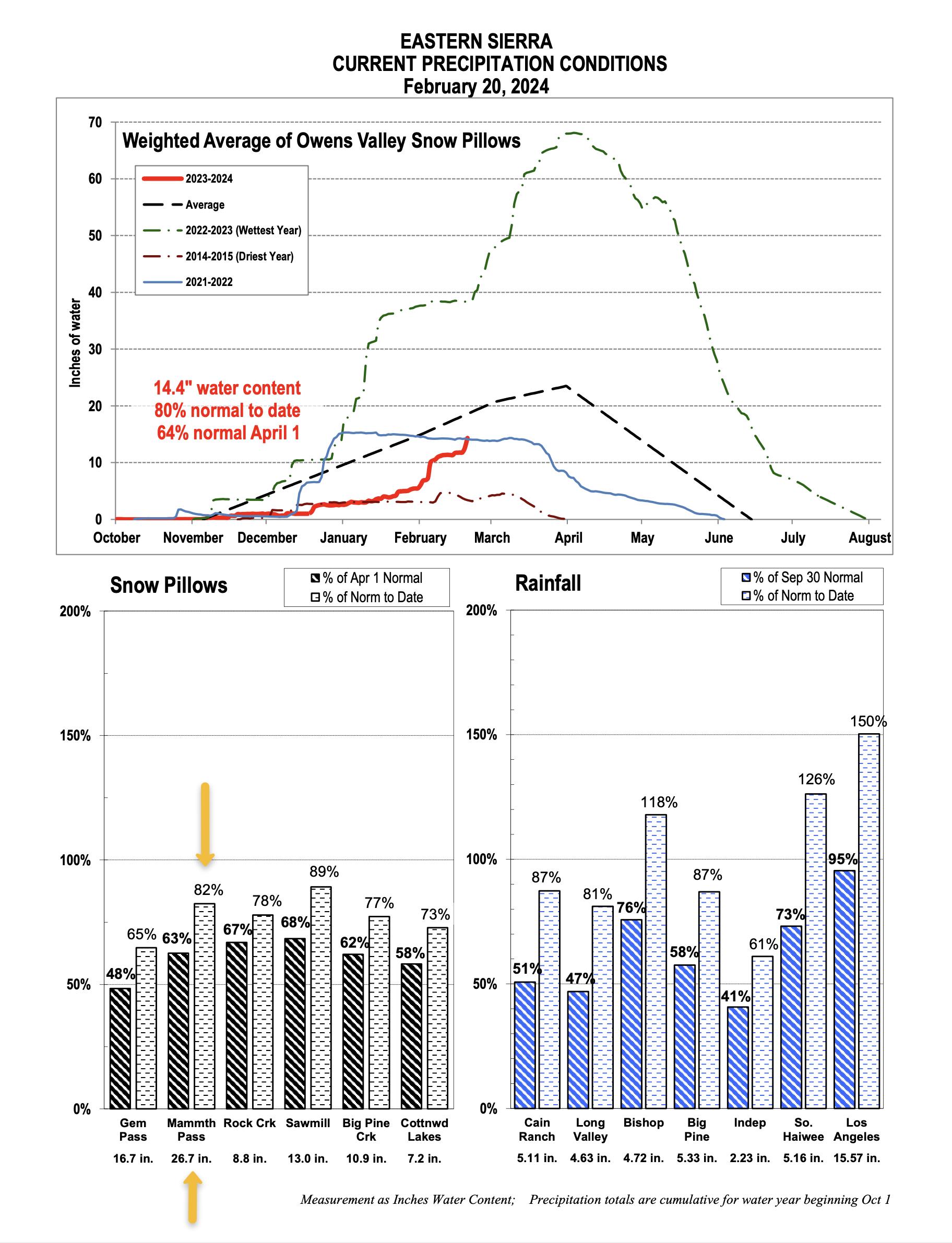
Snow Study Site & Eastern Sierra Snow Pillow
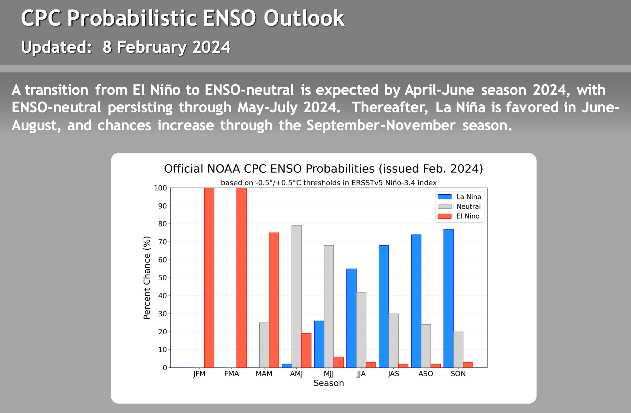
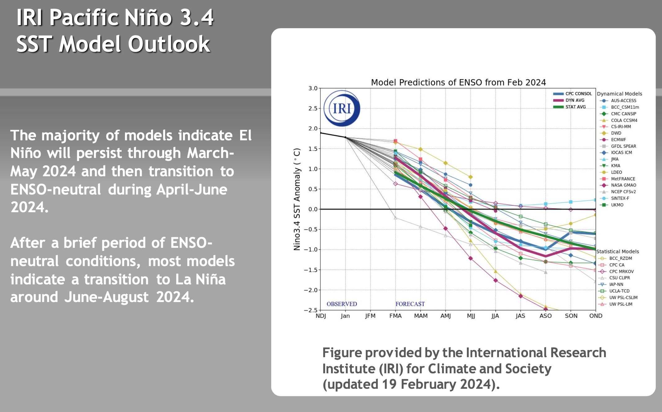
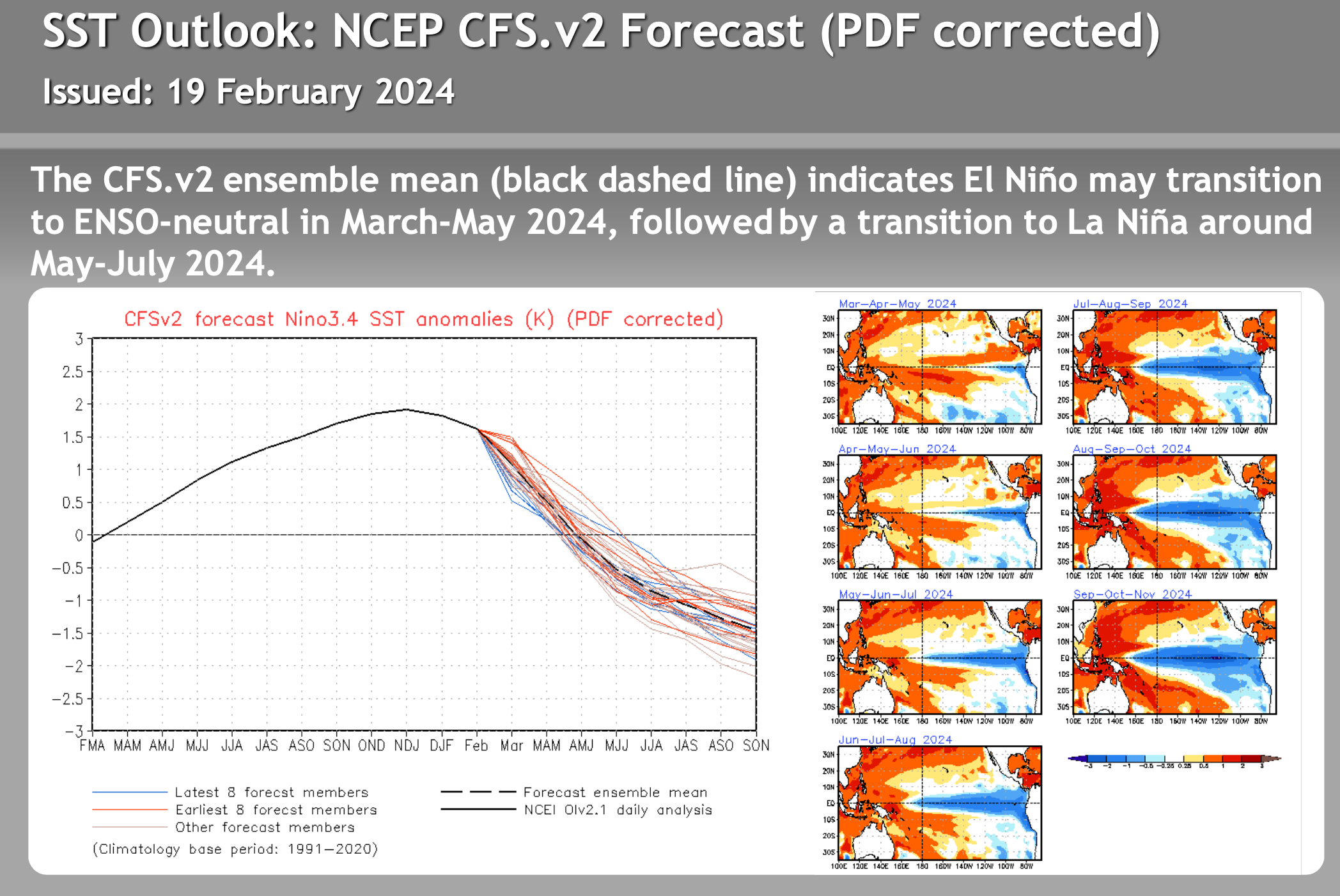
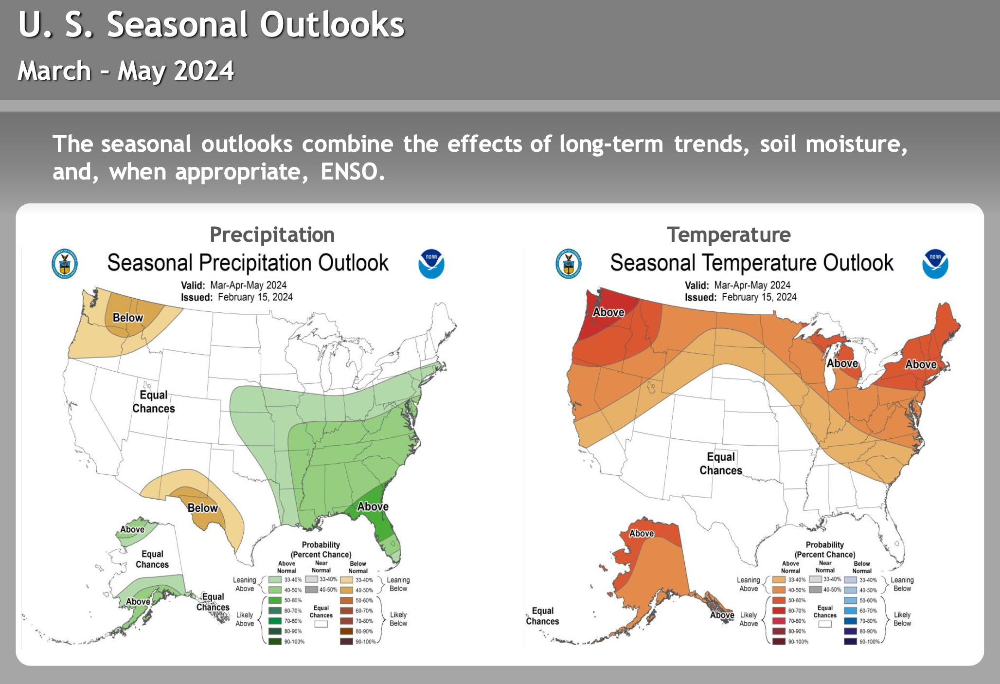
El Nino – La Nina – Neutral Watch


Author – Steve Taylor – The Mammoth Snowman – Over the last 30+ years, Snowman has spent countless hours studying and learning about Mammoth Mountain Weather and Snow Conditions first hand. He has been skiing around the hill with marked ski poles since March of 1991 so he can measure the fresh snowfall amounts out on the hill.
Snowman started blogging this information back in 1990 on the old Mammoth BBS system, then the RSN Forums and then on to MammothSnowman.com in 2004 with Video & Photo Blog reports. (No YouTube back then). Facebook got added to the fold back in 2008 and then the Facebook Group in 2016.
Reports, videos, and photos from the website have been featured on both local TV Stations here in Mammoth and Bishop, along with KTLA, AP, Fox, ABC, CBS, and NBC News.
Click Here to Learn More About the People Who Make MammothSnowman.com a Reality


