

Mammoth Mountain Recreational Weather and Travel Forecast
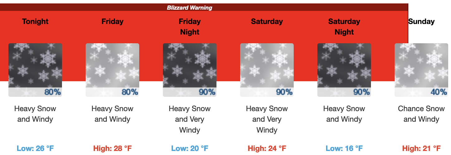
BLIZZARD WARNING IN EFFECT FROM 4 PM THURSDAY TO 10 AM PST SUNDAY
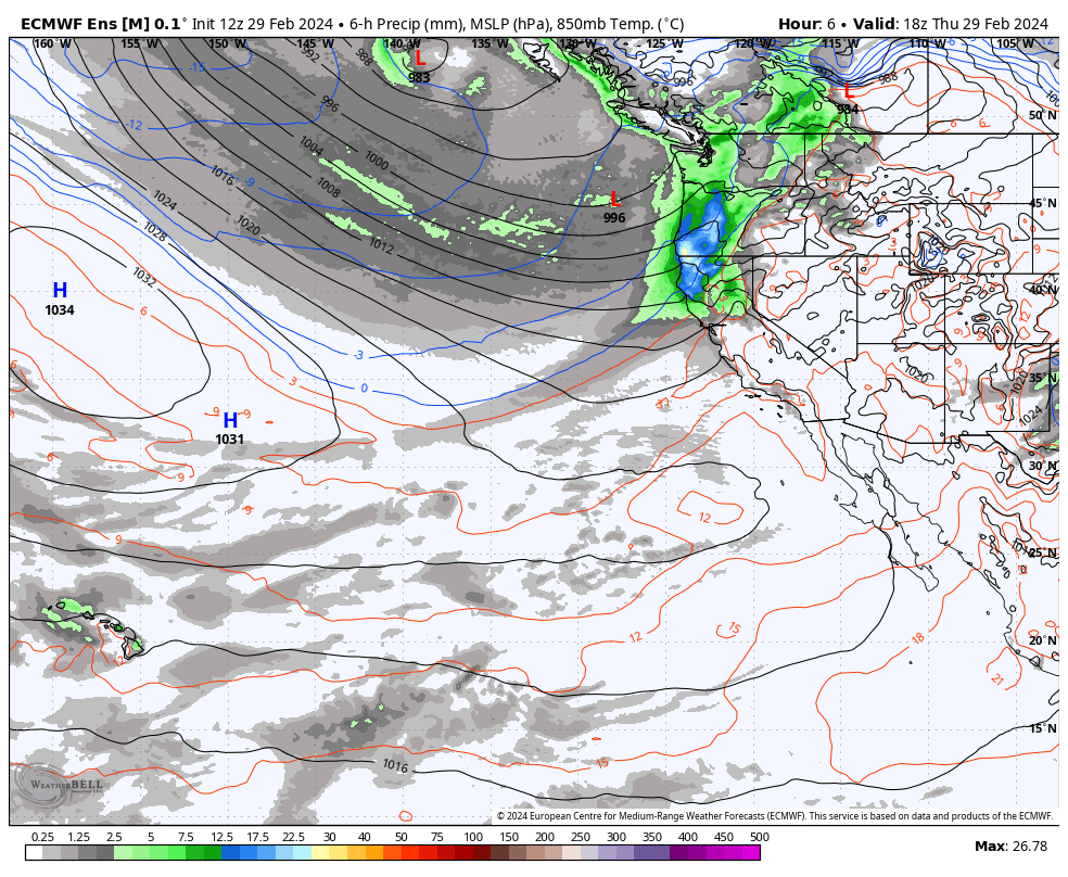
February 29th, 2024 @ 5 PM – The big winter storm that has been hyped for days now is moving into the area with snowfall expected to start accumulating as of this post. Radar shows the leading band of snowfall now down to the Mammoth Mountain area.
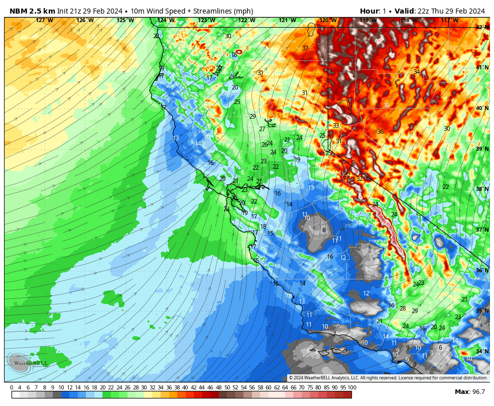
Snowfall accumulations are expected in the 12-18 inches range tonight from Main Lodge to the top. Winds are expected to remain very strong from Mammoth Mountain all the way down into the Owens Valley during the overnight hours.
For Friday expect cloudy skies with moderate to heavy snowfall at times. Snowfall amounts during the day look to be in the 12-18 inch range with snowfall ratios around 10-1. Mid-day temperatures will be in the mid to upper 20s with SW winds at 30-35 MPH with gusts to 55-65+ MPH at times on the lower and mid-mountain. Winds up top will be gusting to 85+ MPH at times.
Friday Night looks like dump night with 20-30 inches possible around the Main Lodge with lots more up top. Snow ratios come up to around 14-1, but accumulations will be limited a bit limited due to snow fracking. All that light snow mixed with the wind will create blizzard conditions. Driving in those conditions can lead to a very bad outcome and even death.
On Saturday the dumpage continues with 18-24 inches of additional snow expected at the Main Lodge. Snow ratios will be in the 13-1- to 14-1 light and dry range. Mid-day temperatures will be in the low to mid-20s with SW winds at 35-45 MPH with gusts to 75+ MPH at times. Wind gusts on the upper Mountain will be in the 85-100+ MPH range.
I expect to see the entire mountain shut down with 395 CLOSED and R3 Conditions in town. Traveling even around town will be close to impossible and is highly discouraged. If you do travel and get stranded you can expect a very long wait for help.
The storm will keep pounding the area into Saturday night before backing off very early on Sunday morning.
Sunday is looking to be snow showery early with a possible break by the afternoon hours. Looks like a possible mid-day powder-fest day once the Mountain digs out and gets avy control done on Lincoln Mountain (Chair 22). No idea if the weather will break soon enough for crews to get the top opened on Sunday.
Travel Forecast: Travel is strongly discouraged on 395 Friday into mid-day Sunday. As stated above you can expect 395 to close down possibly as early as Friday Evening and into Sunday morning.
Snowman


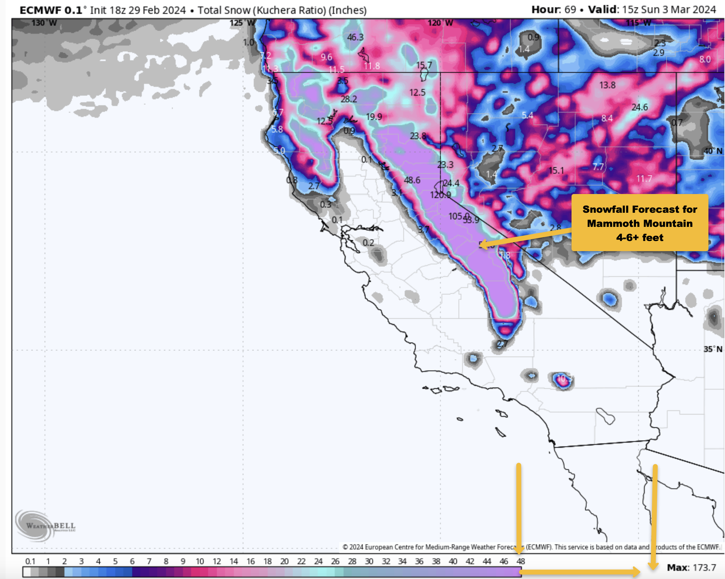
Weather Summary – March will come in roaring in like a Lion with the largest weather system of the season. QPF amounts are in the 4-6+ inch range and that should add up to 4-6 feet of new snow on Mammoth Mountain.
Snow ratios will start around 10-1 and then go way up. However, with the strong winds expected snowfall accumulations will not be as high as they could be with snowflake fracking taking place. What happens is the high winds rip apart the snowflakes limiting maximum accumulations.
The Wind is expected to back off near the back part of the storm so there will still be some great powder turns to be had next Sunday and Monday when the mountain gets lifts dug out and open again when there is a short break in the action. This is not a one-and-done weather pattern as there is more snow lined up to hit Mammoth Mountain late next Tuesday in Thursday.
 Winds are forecast to continue to be very strong into late Saturday before they back off a bit to moderate to strong on Sunday. The strong winds along with cold temperatures and high ratio snowfall will create blizzard conditions at times Friday into Sunday.
If you’re planning to drive up my advice is to cancel your plans until at least mid-day on Sunday not Monday. The second system coming in the middle of next week does not look like it will have very strong winds more moderate with a few stronger gusts at times.
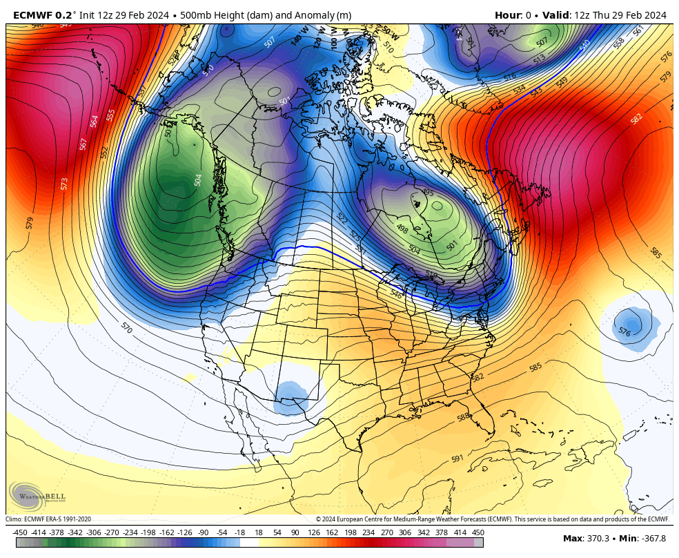
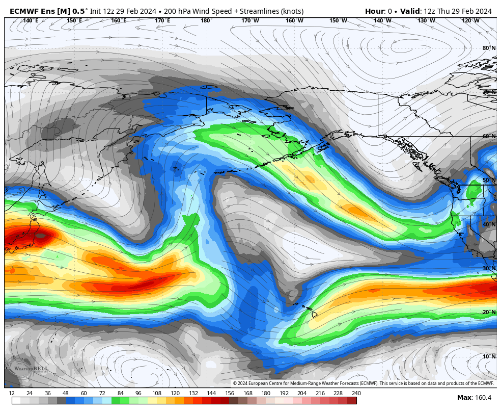
The 500 MB Anomaly GIF below shows how strong this low-pressure system is.
 The ECM model has 4-6 feet of new snow tonight into Sunday afternoon.
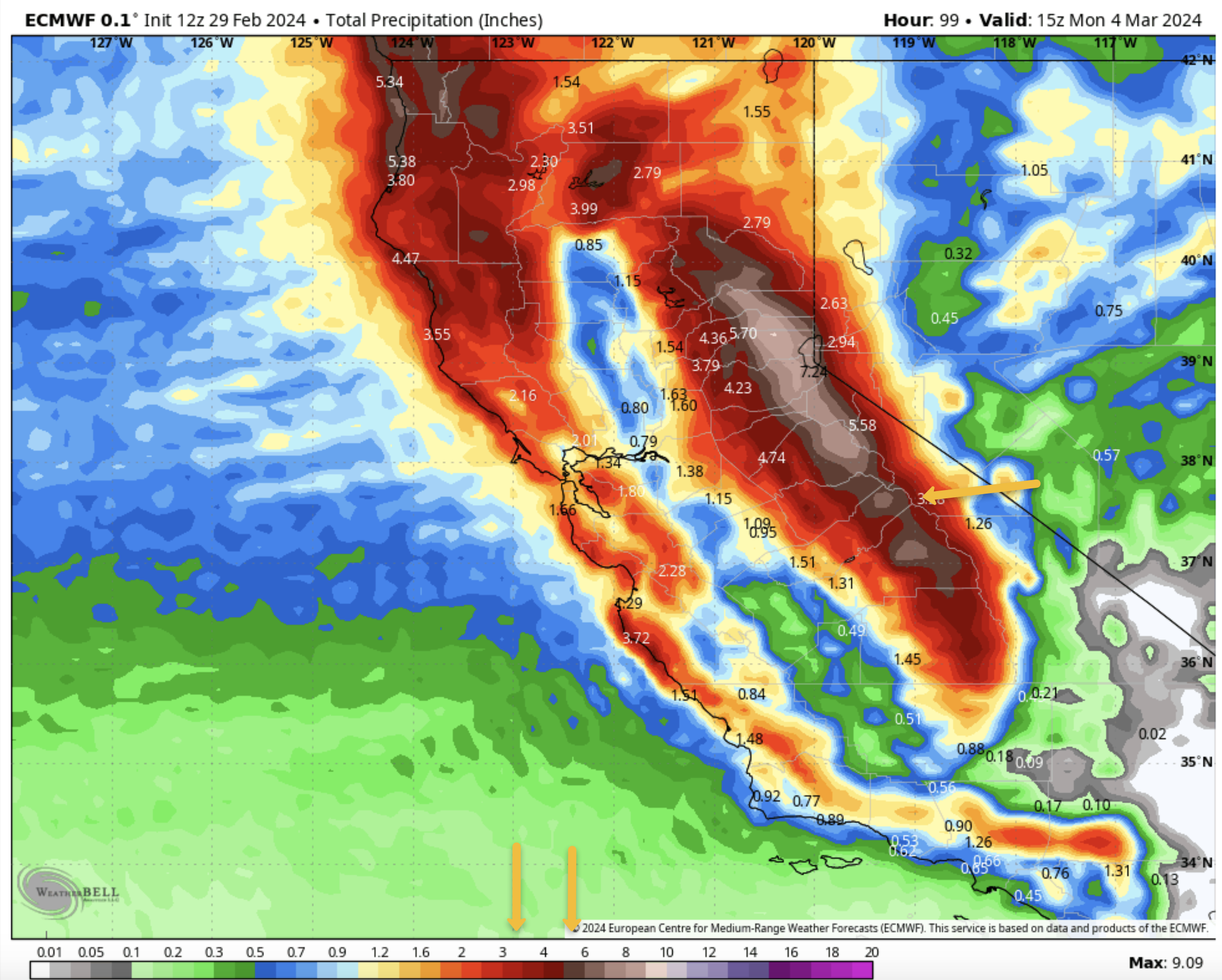
 The QPF forecast from the ECM is 4.5 inches with the GFS at 6.2 inches on the latest model runs.
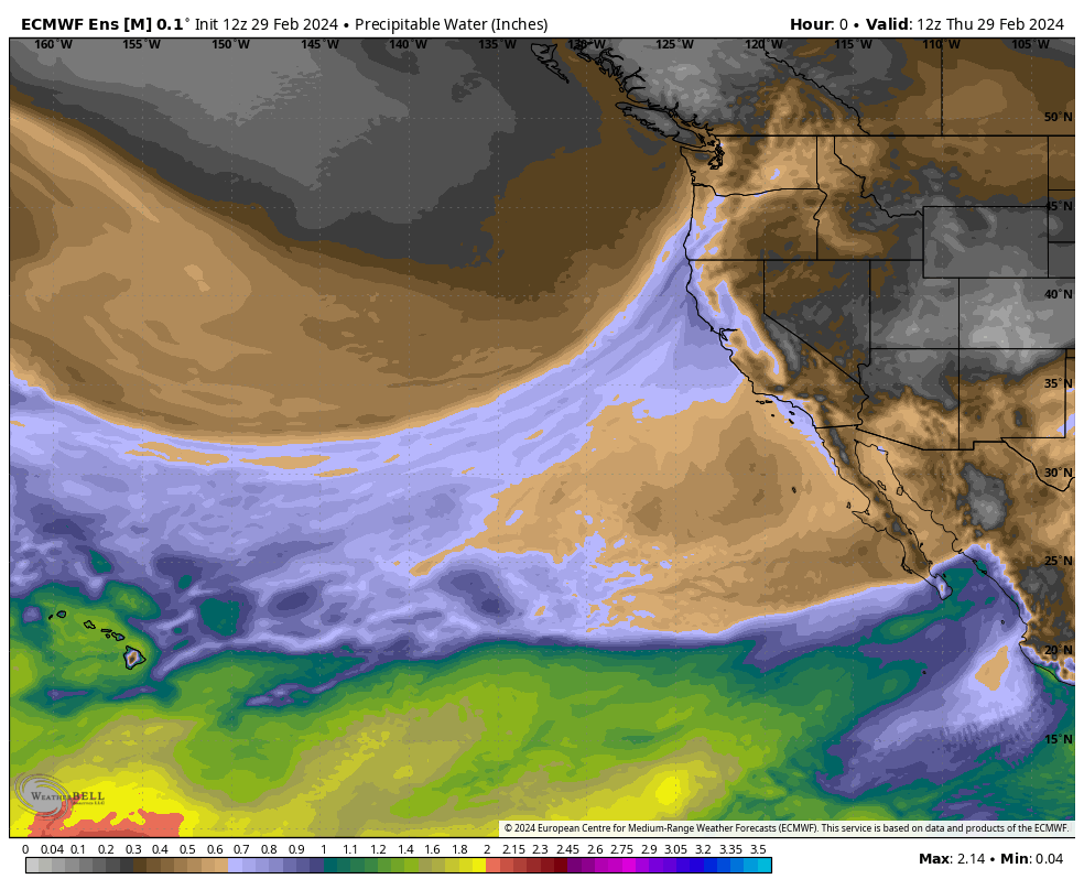
 There is a nice moisture tap for this first and second system to work with.
 After a week of warmer temperatures March is going back to much colder weather. Way too early for spring to set in so the cold is a welcome sign.
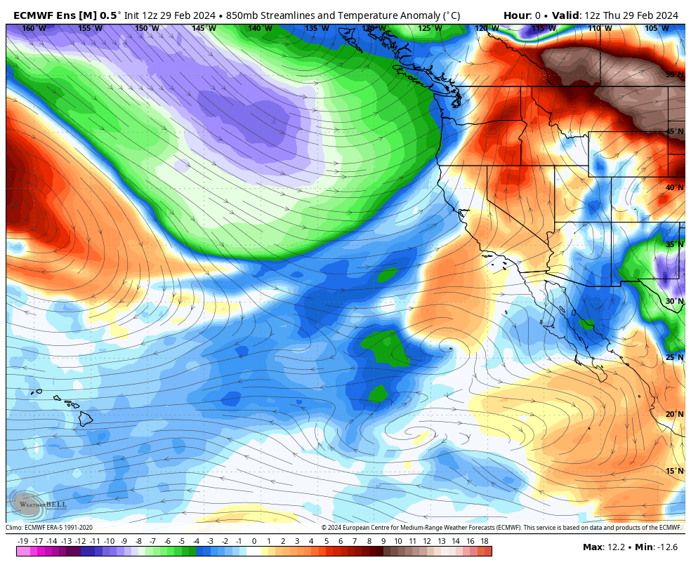 The jet stream will be coming right over Mammoth Mountain over the next 3 days. The gig below goes out to day 15 and shows this taste of winter might get a big boost later in the month.
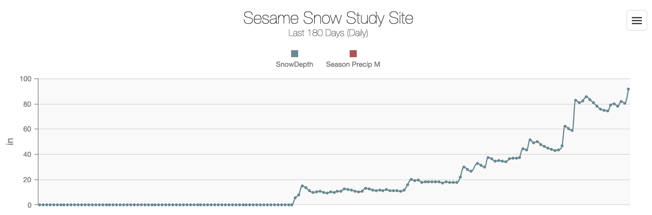
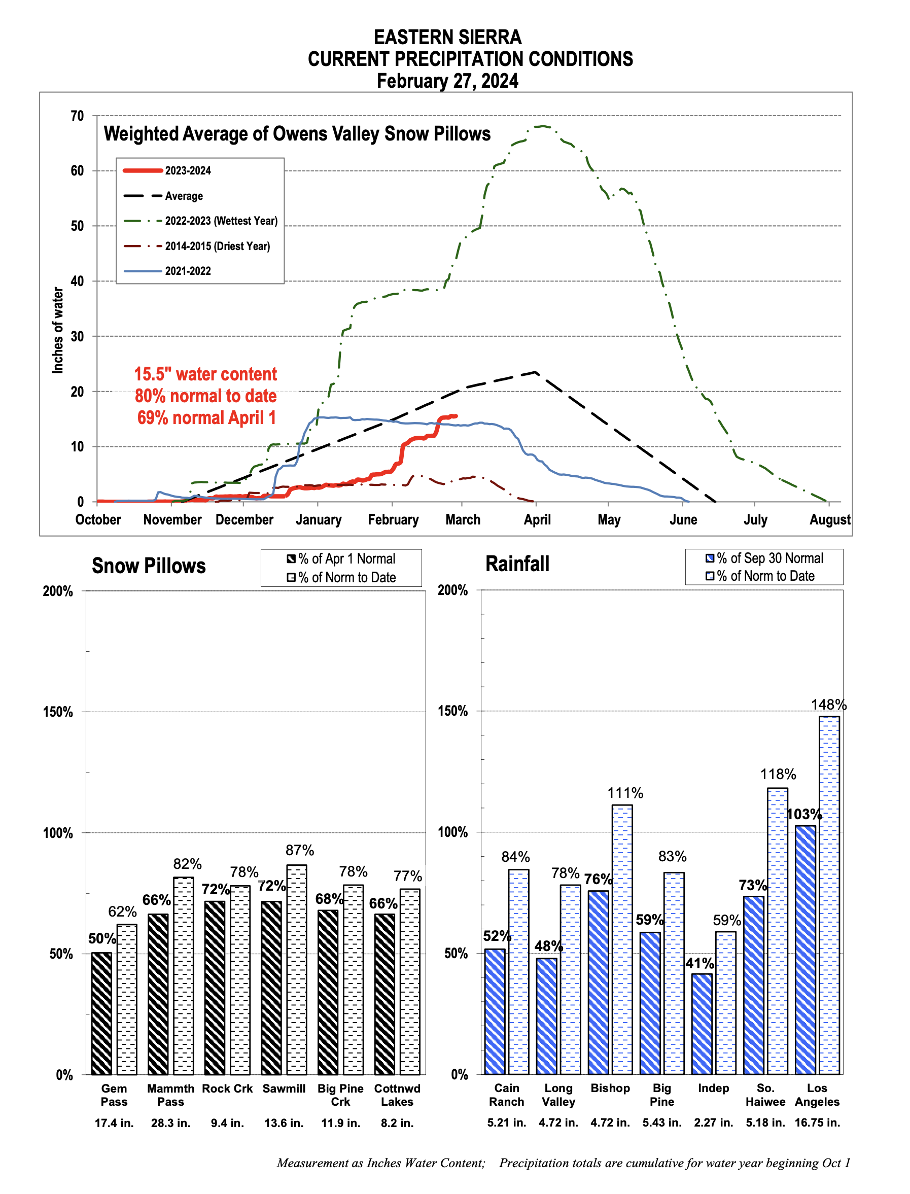
Snow Study Site & Eastern Sierra Snow Pillow
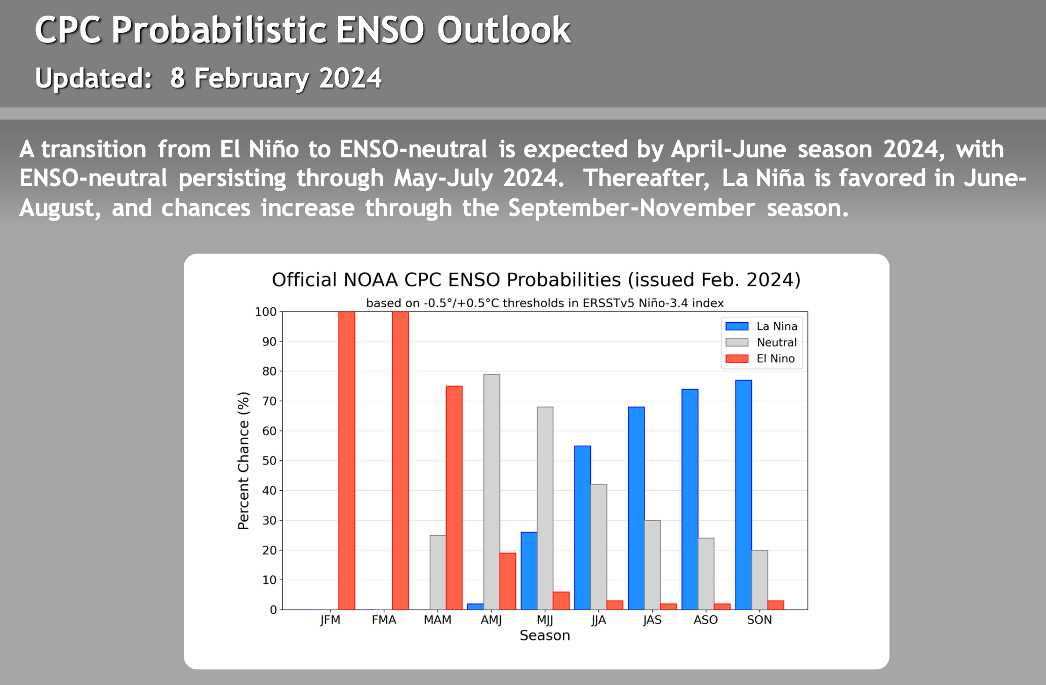
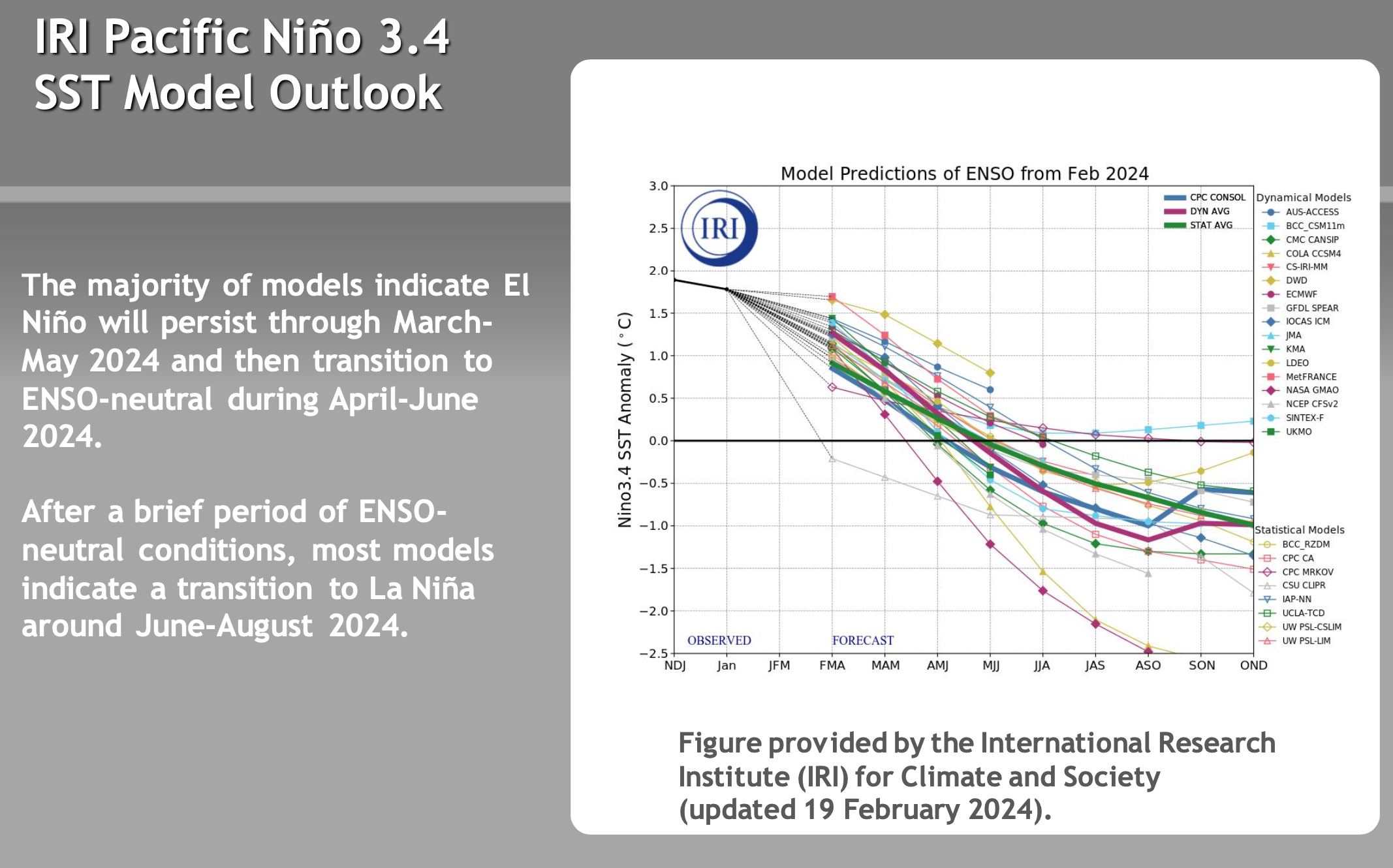
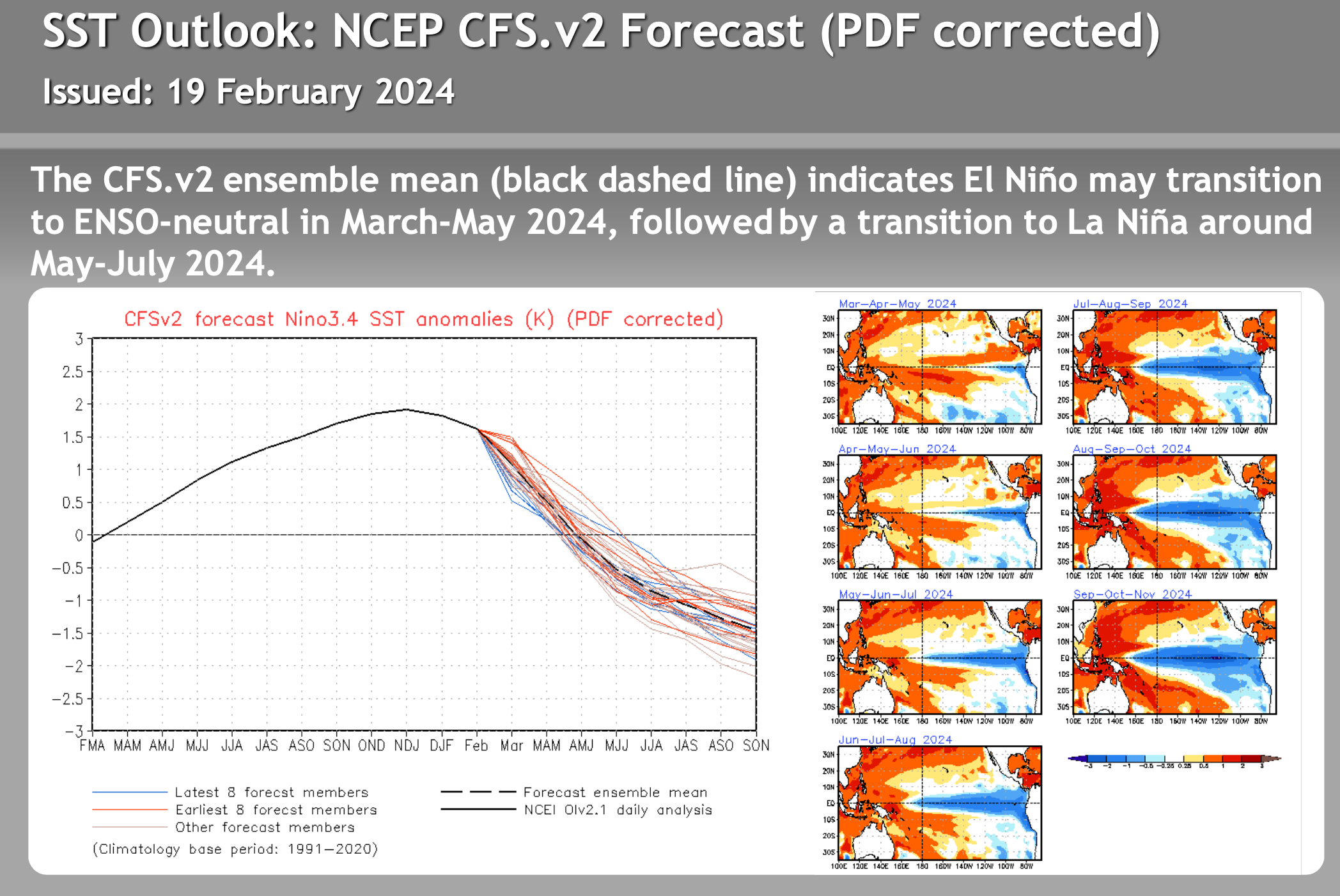
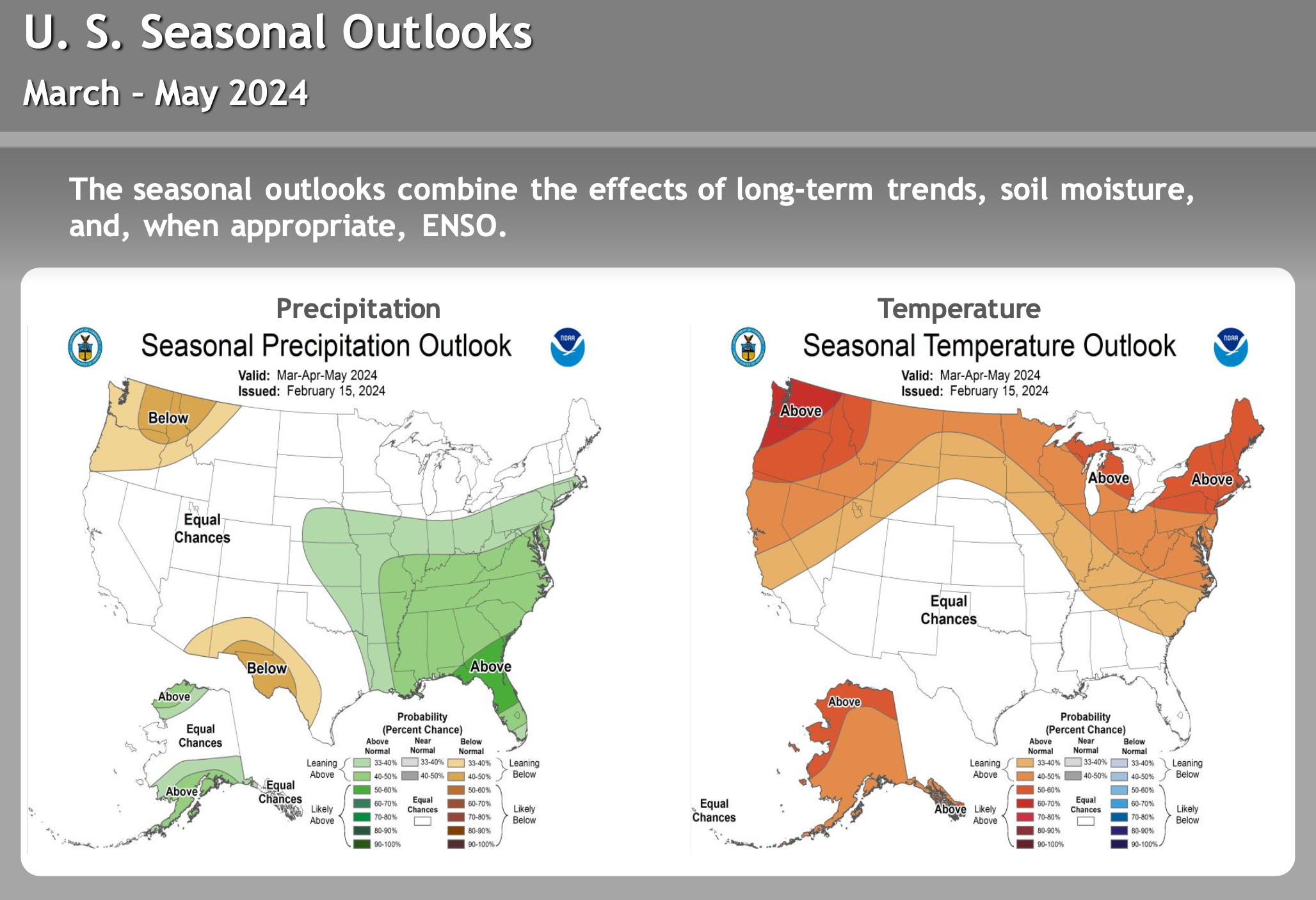
El Nino – La Nina – Neutral Watch


Author – Steve Taylor – The Mammoth Snowman – Over the last 30+ years, Snowman has spent countless hours studying and learning about Mammoth Mountain Weather and Snow Conditions first hand. He has been skiing around the hill with marked ski poles since March of 1991 so he can measure the fresh snowfall amounts out on the hill.
Snowman started blogging this information back in 1990 on the old Mammoth BBS system, then the RSN Forums and then on to MammothSnowman.com in 2004 with Video & Photo Blog reports. (No YouTube back then). Facebook got added to the fold back in 2008 and then the Facebook Group in 2016.
Reports, videos, and photos from the website have been featured on both local TV Stations here in Mammoth and Bishop, along with KTLA, AP, Fox, ABC, CBS, and NBC News.
Click Here to Learn More About the People Who Make MammothSnowman.com a Reality


