
May 8th, 2024 @ 11 AM – Mammoth Mountain Weather: Clear skies over Mammoth Mountain and the Eastern Sierra this morning.
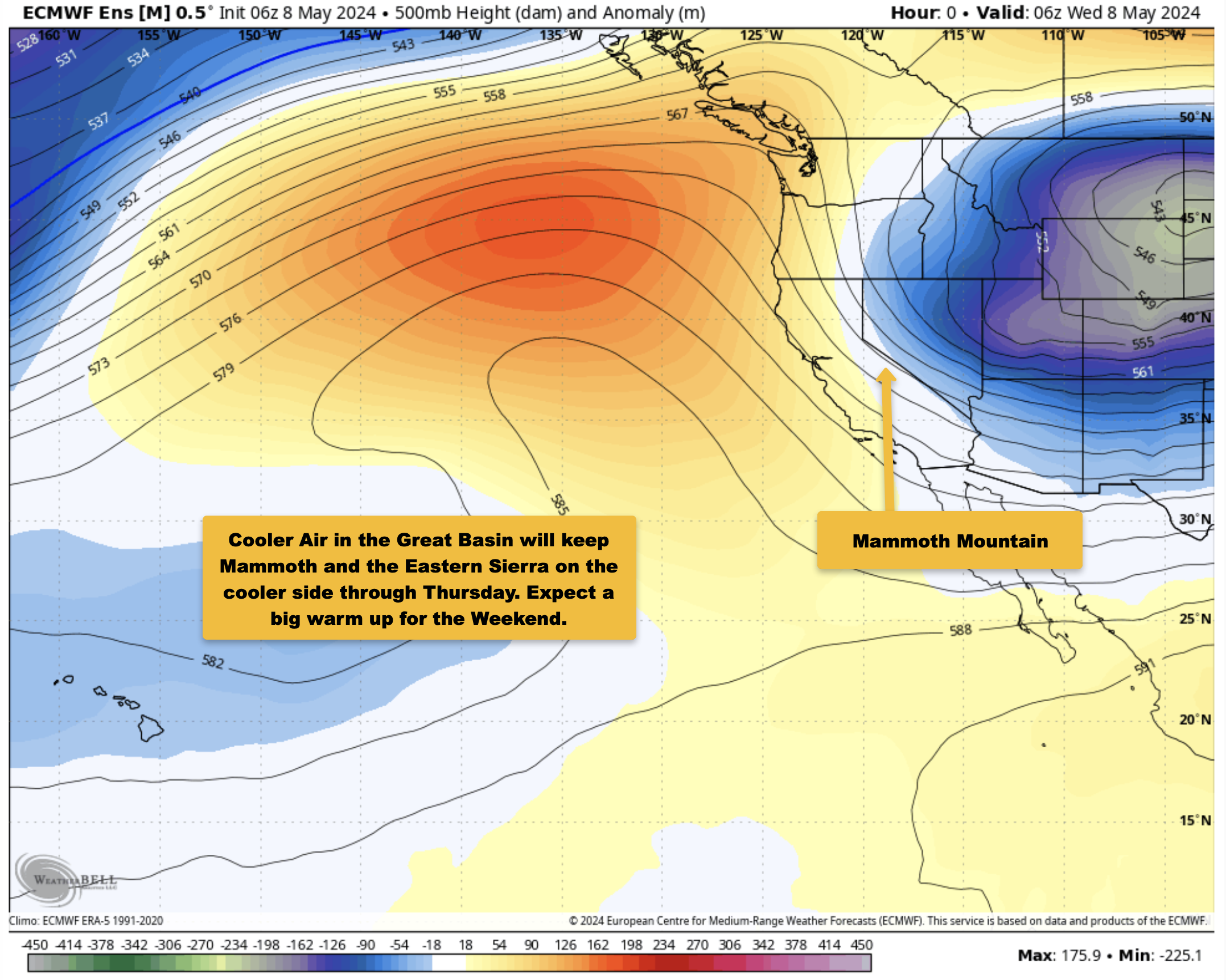
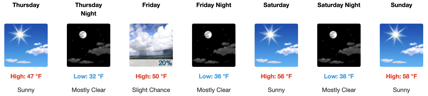
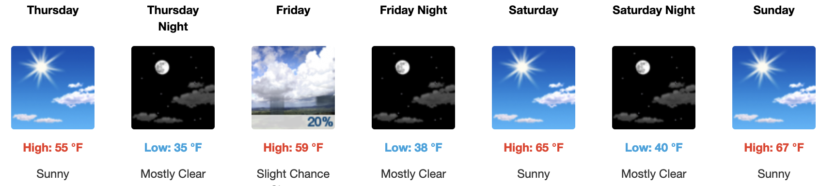
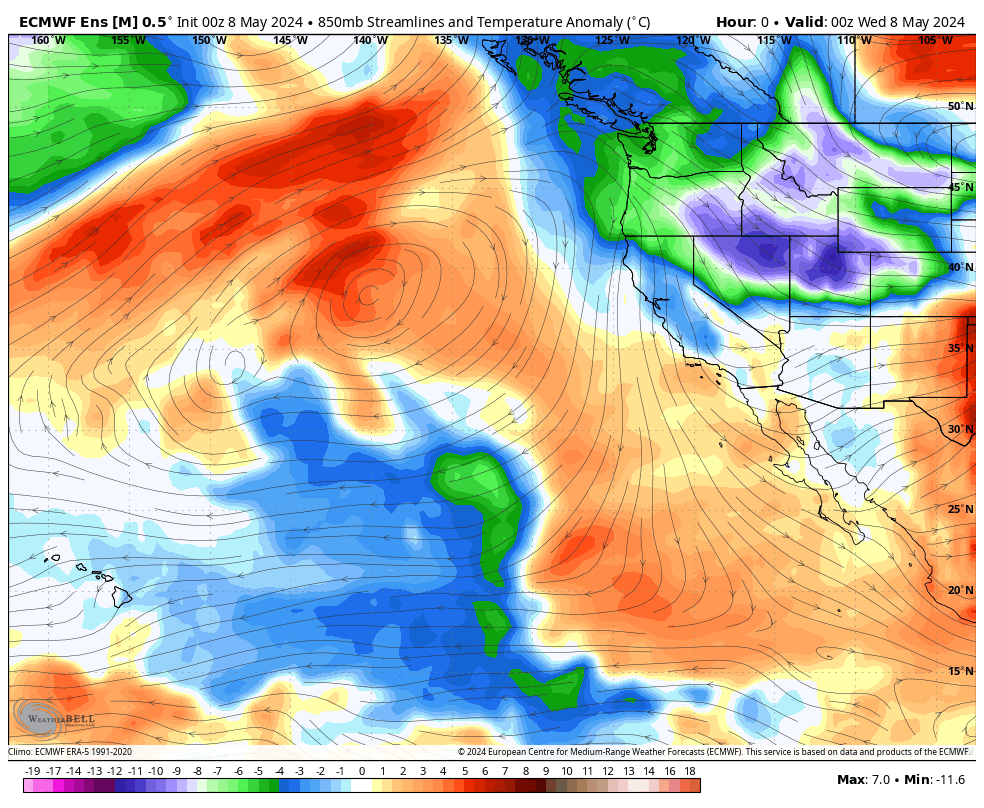
The short-term weather forecast calls for clear, sunny skies, with warming temperatures and cool temperatures today into Thursday along the N to NE winds on Mammoth Mountain and down in the Bishop area.
By Friday, the area will start to see a slow warm-up that will eventually lead to above-average temperatures for this time of year by the weekend and into the following week.
If you’re going to be outdoors for some recreation, here is what you can expect,
For today and Thursday, expect clear skies, mid-day temperatures into the mid-40s around Main Lodge, and winds out of the NE at 5-10 MPH. Over the mid and upper mountain, temperatures will be in the mid to upper 30s, with a NE wind at 15-30 MPH. Overnight lows will be cold in the low to mid-20s, delaying the daily conversion to wet spring corn snow each morning.
On Friday, winds should shift back to the SW, and temperatures will begin to warm up; there will also be a few build-ups leading to a slight chance of showers over the higher elevations with snow levels above the 10,500-foot level.
Over the upcoming weekend, expect a nice warm-up into the upper 40s to low 50s around Main Lodge with a return of light to moderate, at times, SW winds. Night-time lows will come up into the low to mid-30s for Mammoth Mountain and the high country.
Lower elevations will also be windy and cool the next couple of days, with a nice warm-up by the weekend. By Saturday, Mammoth Lakes should see the lower 60s, with mid-to-upper 60s to lower 70s from Crowley to Toms Place. Down in the Bishop and Mill Pond areas, look for the mid-80s by the weekend with light afternoon winds.
Snowman


![]()

MLSP GIF out 10 Days

Temperature Anomaly GIF
Wind Forecast GIF
 QPF Forecast Image
QPF Anomaly Chart for the next 7 Days


Mammoth Mountain Weather – The Long-Range Fantasy Outlook
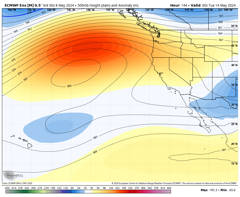
5-8-24 – In the Long-Range Fantasy Outlook we see dry and warm weather in the area right through the 22nd of the month.
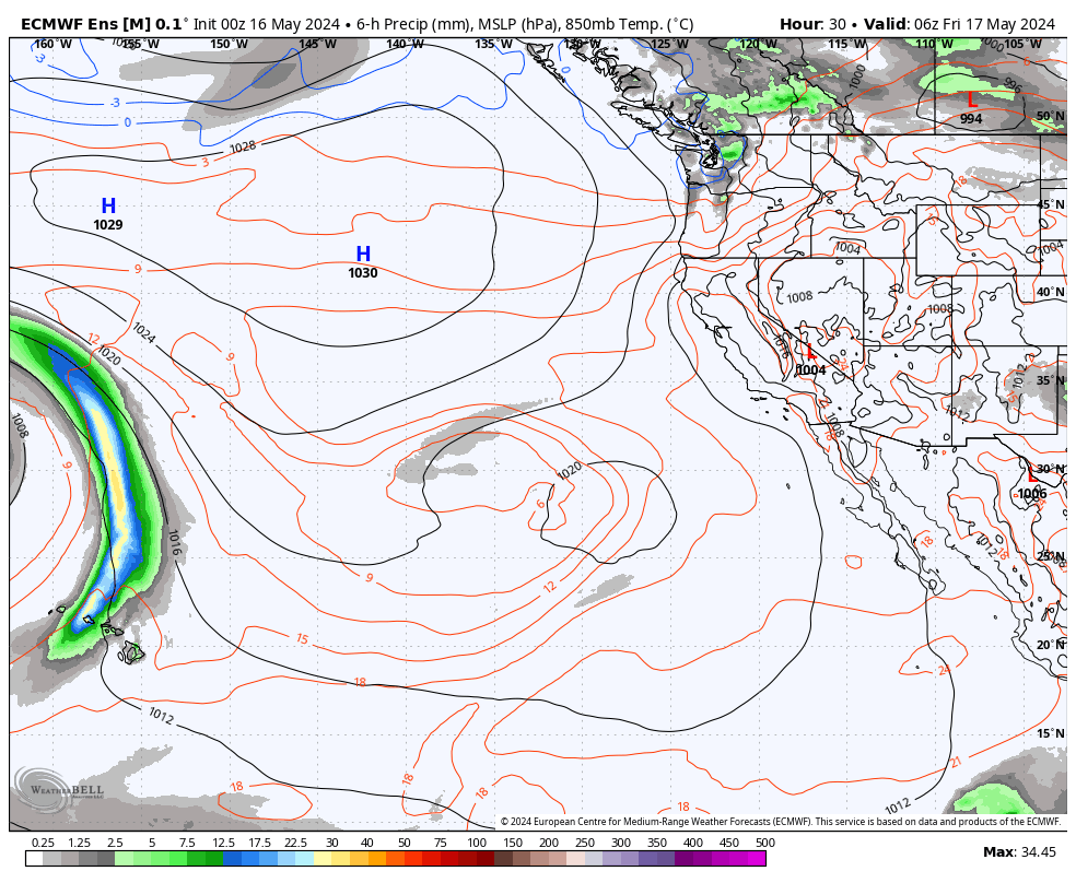
In the first gif below you will see right out at day 16th there is a small low showing up. This low is much deeper on the GEFS and is worth watching how it might effect the area.
Overall the long range forecast for the rest of this month is calling for average to above average temperatures with below average precipitation. Over May is a drier month so below average precipitation does not really mean much.
For the upcoming month of June expect above average temperatures with below average precipitation.
Thanks for your support, Mammoth Snowman


* Mammoth Mountain and Eastern Sierra Weather is updated several times a week by local Steve Taylor. The goal is to provide detailed weather forecasts presented in an easy-to-read format. This isn’t a Hype, one-and-done model-run website. It’s just the basic facts from how I see it after 40 years of being involved in the local weather and recreation. And yes, I use Weather Bell for my forecasting data.
——————-

Author – Steve Taylor – The Mammoth Snowman – Over the last 30+ years, Snowman has spent countless hours studying and learning about Mammoth Mountain Weather and Snow Conditions first hand. He has been skiing around the hill with marked ski poles since March of 1991 so he can measure the fresh snowfall amounts out on the hill.
Snowman started blogging this information back in 1990 on the old Mammoth BBS system, then the RSN Forums and then on to MammothSnowman.com in 2004 with Video & Photo Blog reports. (No YouTube back then). Facebook got added to the fold back in 2008 and then the Facebook Group in 2016.
Reports, videos, and photos from the website have been featured on both local TV Stations here in Mammoth and Bishop, along with KTLA, AP, Fox, ABC, CBS, and NBC News.
Click Here to Learn More About the People Who Make MammothSnowman.com a Reality


