Powder Forecast – Friday December 11th, 2020
Ted Schlaepfer CCM —- Mammoth Mountain WeatherGuy
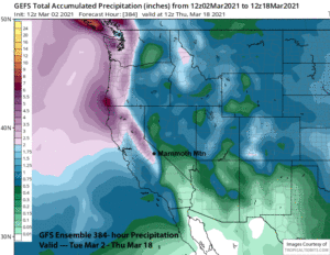
Snowfall forecasts are valid at the Sesame snow course (Main Lodge) for the prior 24 hours as reported in the 6-7 AM morning snow report.
**Snowfall forecast confidence ranges from very low (1) to very high (5)
Sat 12/12 = 6 – 8” (H20 = 0.65” – 0.85”) **4
Sun 12/13 = 0 – 1”
Mon 12/14 = 4 – 5” (H20 = 0.50” – 0.60”) **3
Tue 12/15 = 0”
Wed 12/16 = 0”
Thu 12/17 = 0”
Fri 12/18 = 0 – 6”
Sat – Mon 12/19 – 21 = 3 – 9”
December Snowfall = 0”
December Forecast = 25 – 40”
Detailed 4-day Snowfall Forecast:
Sat 12/12 — Moderate snowfall from overnight tapers off during the morning hours and ends by midday, accumulations 6-8” from overnight and up to 10” up top.
Sun12/13 — Dry during the morning hours with increasing winds, then light to moderate snowfall starts during the afternoon and continues Sunday evening before ending overnight, accumulations 3-4” and up to 6”+ up top by Monday morning.
Mon 12/14 and Tue 12/15 – No snowfall expected both days.
Forecast Summary:
Short Term (Days 1 – 4):
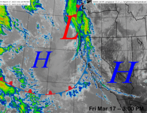
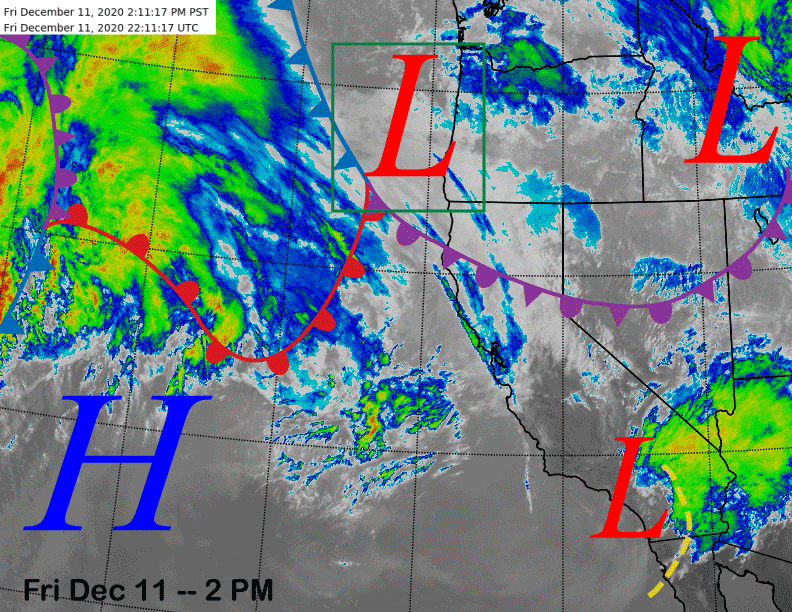
The infrared satellite image (below) this afternoon shows a fairly complicated picture across the Eastern Pacific and West Coast. The area of concern in the short-term is a low-pressure system currently situated just off the Oregon coast (green box) that will move southeastward through eastern CA and Nevada overnight and early tomorrow.
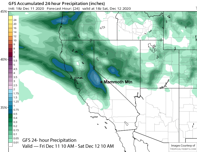
Abundant subtropical moisture will be pulled into the system along a strengthening warm front off the CA coast and snowfall should start in Mammoth this evening and peak in the overnight hours before tapering off during the morning tomorrow and ending midday. Model QPF is around 0.50”-0.75” for the event (image below) with the GFS showing about 0.65” with snow levels around 6500-7000’. Looks like about a solid 6” of snow for Main and maybe up to 10” up top. This snowfall was not predicted in the last update and only showed up on the radar in the last day or so. File this as why you should always bring chains when you travel to the mountains.
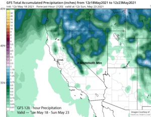
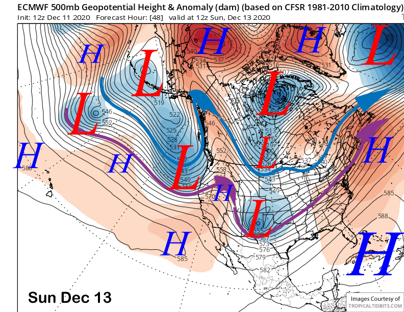
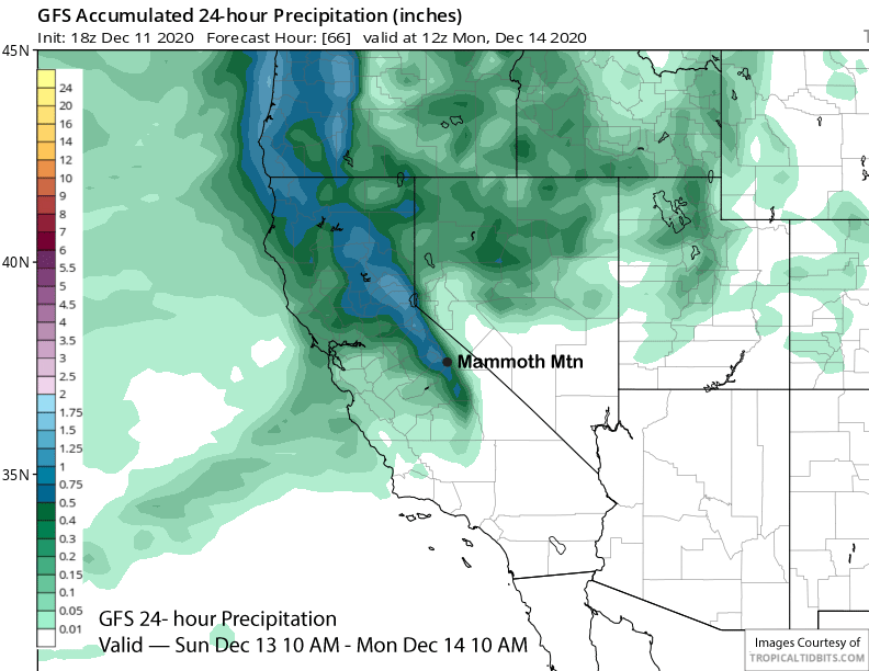
The storm system and upper-level trough (image below) that we were eyeing is then expected to move into the Mammoth area Sunday afternoon with light to moderate snowfall Sunday evening and overnight. Most of the rain/snow will be north of Mammoth (two images below), but models are still suggesting over a half an inch of liquid is possible or a solid few inches of base type snowfall for Main and 6”+ up top. Snow levels should be around 7000 feet.
Dry weather is expected to return during the day Monday and continue Tuesday with generally seasonable temperatures and not too strong of winds.
Long Range (Days 5+):
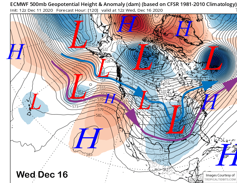
The longer-range guidance is still not showing an extended wet pattern for Mammoth, although there are some chances for snowfall during the period. Models do agree that high pressure will continue to build over CA through next Wednesday (image below) for dry weather through mid-week.
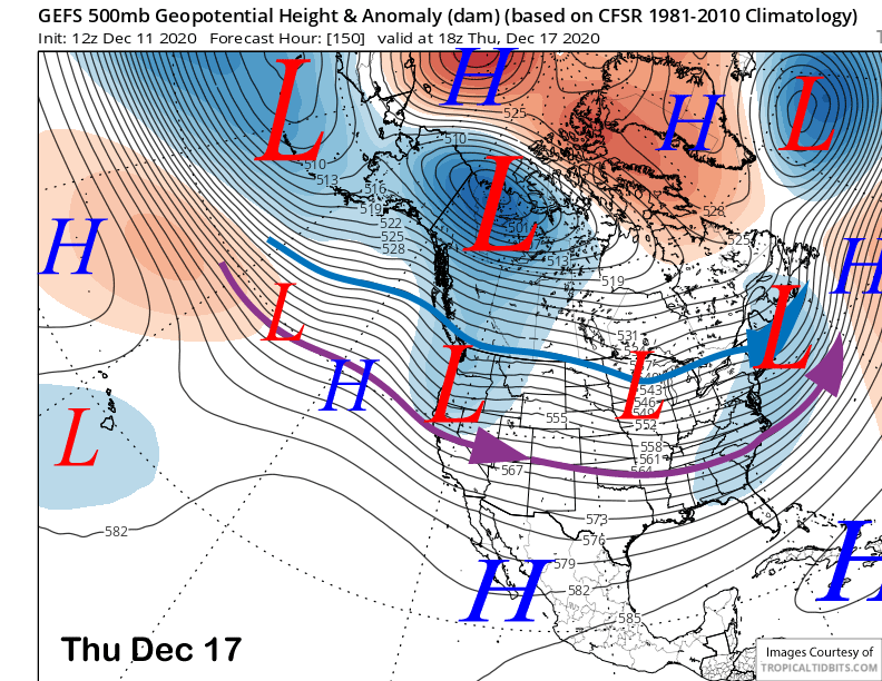
Then the ECM model moves a couple weak short-wave troughs into the state end of the week (image below) under a split jet stream flow. That would mean mostly just passing clouds and maybe flurries for Mammoth under that scenario, but the GFS ensemble is favoring a stronger trough to move through the state around Thursday next week (two images below). That model has done better lately and it would indicate another chance for snow, but nothing significant, maybe a few to six inches.
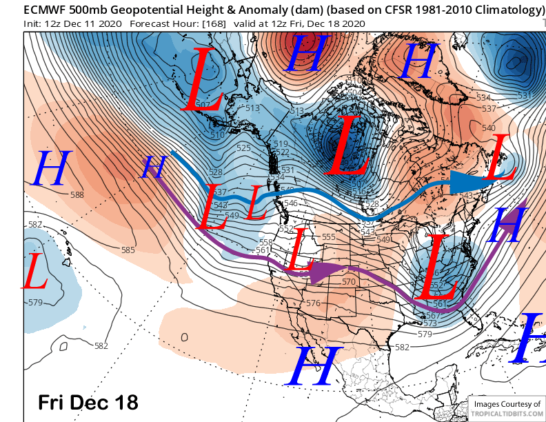
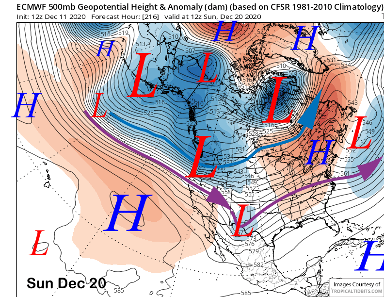
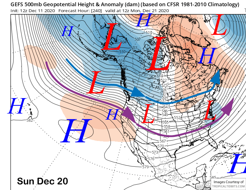
The ECM 12Z deterministic run then moves a very strong zonal jet into the PacNW and NorCal Sunday (image below) with the southern boundary moving into Mammoth for more snowfall. However, the GFS ensemble mean has that zonal Pacific flow farther north and weaker with weak riding over CA (two images below) that would keep the precipitation farther northward. The ECM mean is farther northward as well.
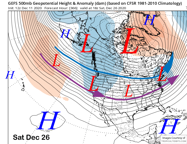
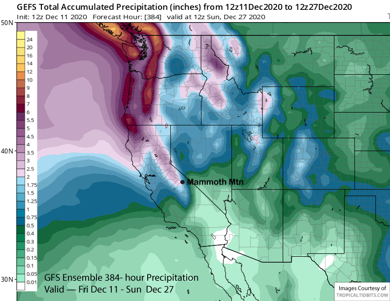
The super long-range guidance keeps the Pacific zonal flow ongoing into the Pacific Northwest through the extended period that is a typical La Nina pattern, but does not move the jet southward into CA again end just after Christmas (image below). So there could be a 5-7 day dry period or longer. Total QPF for the period is around 2” (two images below), so there could be an inch of liquid with a few storms after the ones this weekend, but nothing major is expected yet.
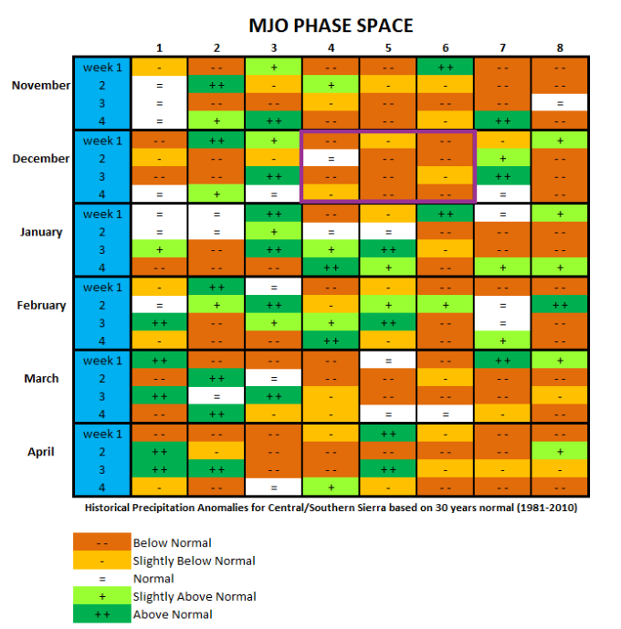
The below normal precipitation this month is likely associated with the MJO (image below) that is basically been stuck in phases 4 and 5 and is forecast to remain there until around Christmas, a position that is typical during La Nina. According to my handy MJO/precipitation chart (two images below), phases 4 through 6 (purple box) are associated with below average precipitation in the Central/Southern Sierra during December. So it is no surprise snowfall has been mostly absent.
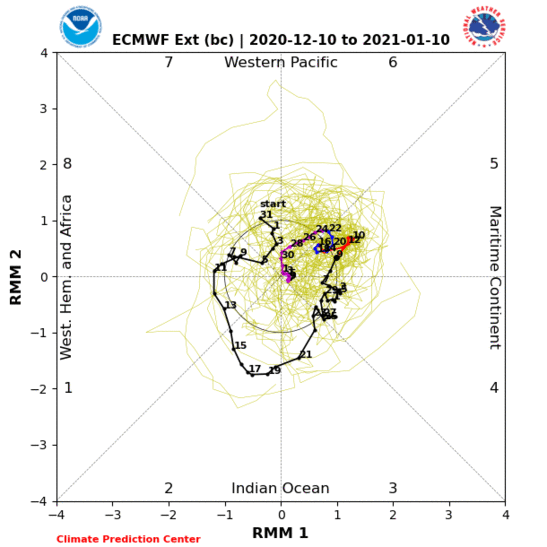
Also evident on the MJO phase diagram forecast is that the ensembles are all over the place with the track/amplitude. The mean favors it to become very weak by end of the month and early January while quickly moving it around the globe. If it does moves back to phases 4 and 5 by the middle of January though, then a period of above normal snowfall is possible. The season is still young. WG