Powder Forecast – Friday, January 29th, 2021
Ted Schlaepfer CCM —- Mammoth Mountain WeatherGuy
Snowfall forecasts are valid at the Sesame snow course (Main Lodge) for the prior 24 hours as reported in the 6-7 AM morning snow report.
**Snowfall forecast confidence ranges from very low (1) to very high (5)
Sat 1/30 = 3 – 4” (H2O = 0.25”)*4
Storm Total = ~97” (H2O = ~9.00”)
Sun 1/31 = 0”
Mon 2/1 = 0”
Tue 2/2 = 2 – 4” (H2O = 0.25” – 0.50”)*2
Wed 2/3 = 12 – 16” (H2O = 1.50” – 1.75”)*3
Thu 2/4 = 0”
Fri 2/5 = 0“
Sat – Mon 2/6 – 2/8 = 0 – 3”
January Snowfall = 105”
January Forecast = ~110”
Detailed 4-day Snowfall Forecast:
Sat 1/30 and Sun 1/31 – No snowfall expected both days
Mon 2/1 – Light to moderate snowfall may develop early in the morning and may continue at times overnight. Accumulations 2 – 4” by Tuesday AM; 4”+ up top
Tue 2/2 – Moderate to heavy snowfall is expected during the day and evening before tapering off overnight. Accumulations 12 – 16” by Wednesday AM, ~18” up top
Forecast Summary:
Short Term (Days 1 – 4):
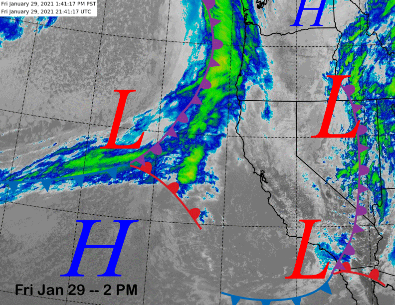
The infrared satellite image (below) this afternoon shows that the storm system that delivered the epic snowfall over the past few days having now moved eastward with snowfall now ending. Overall, the storm pretty much didn’t disappoint with about 8 feet at Main and close to 10 feet up top.
Dry weather returns tonight with the next system off the coast expected to stay well northward of Mammoth. The dry weather will continue through the weekend as weak high pressure builds over Central California.
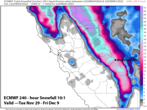
The next storm system is still expected for early next week as the ECM model has now come into line with the GFS and GFS ensemble mean from the last post. It moves the trough southward off the coast (image below) before swinging it inland Tuesday and Tuesday night. The southwest flow ahead of the trough will pull in extra moisture and also increase the orographic effects against the Sierra during passage.
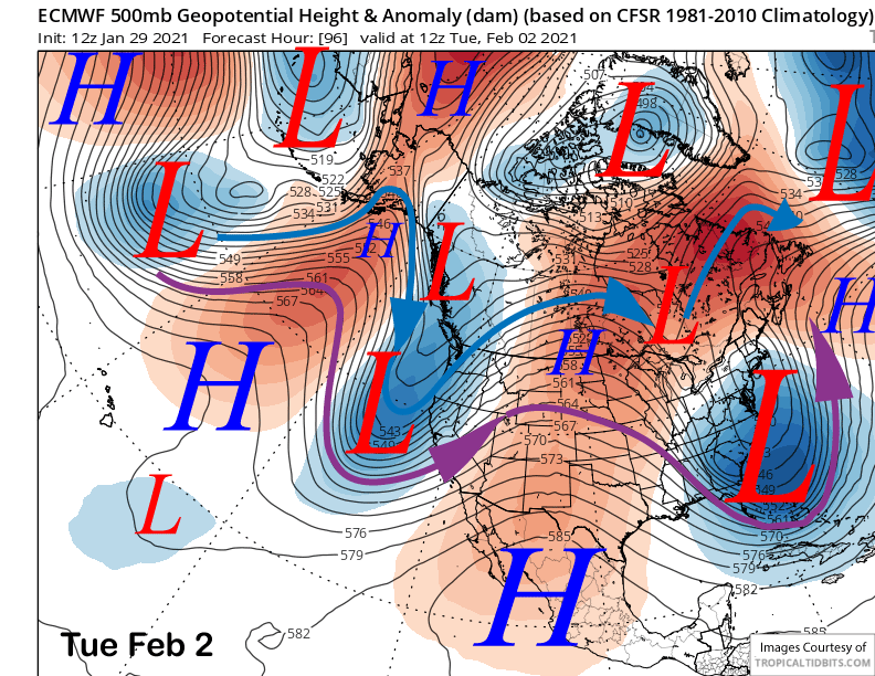
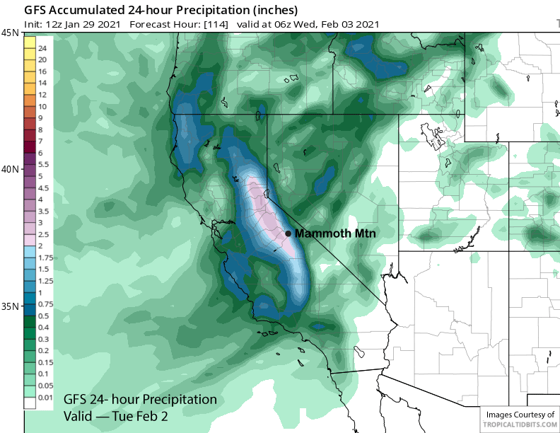
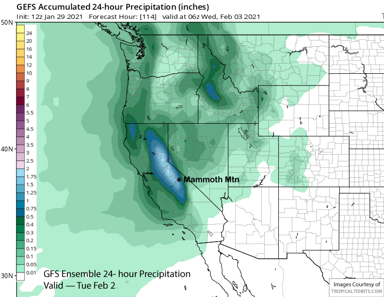
The model guidance is mostly in agreement that about 2” liquid (image below) will occur with the storm with both the ECM and GFS ensemble means having about 1.5” (two images below). Snow totals will likely exceed foot at Main and around 20” up top.
It looks like snowfall will start Monday under the moist up-slope flow with the main period of snowfall expected Tuesday during the day and evening before tapering off overnight. That means there could be a couple riders of the storm days on Monday and especially Tuesday followed by a bluebird powder day Wednesday.
This system will be different as snow levels will be initially higher Monday and around 6000-7000 feet with snow levels around 5500 for the bulk of the snowfall before falling to below 2000 feet as the snowfall in winding down. That means it will be wetter Sierra cement type snowfall followed by a fluffy top layer at the end when the colder air arrives.
Long Range (Days 5+):
The longer-range guidance says that the period of storminess will come to an end by the middle part of the week and dry weather will likely last for at least a few days under seasonable or seasonably cold temperatures that should keep all that new snowfall pristine.
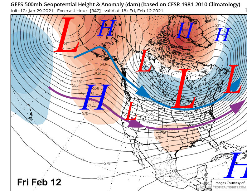
The guidance does move an inside slider type short wave southward around Friday next week (image below) that will probably not produce any snowfall other than flurries, but likely increase the NE winds along with colder temperatures. The guidance is establishing the long-wave trough farther eastward next week, but exactly how far eastward is still uncertain.
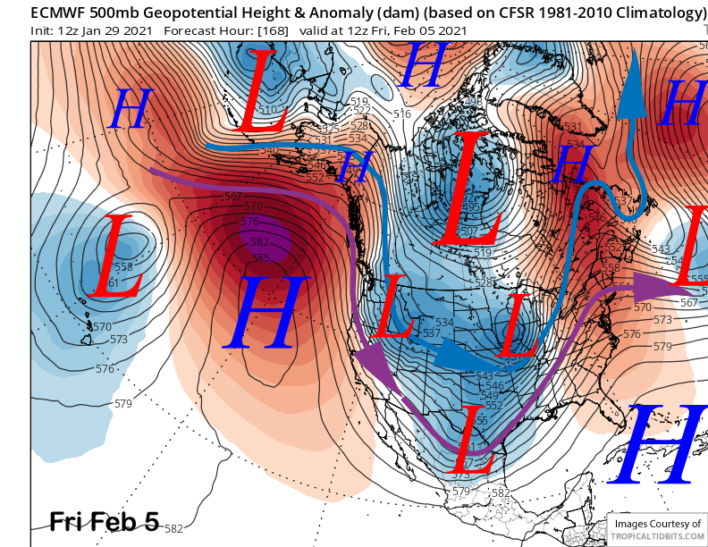
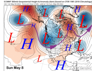
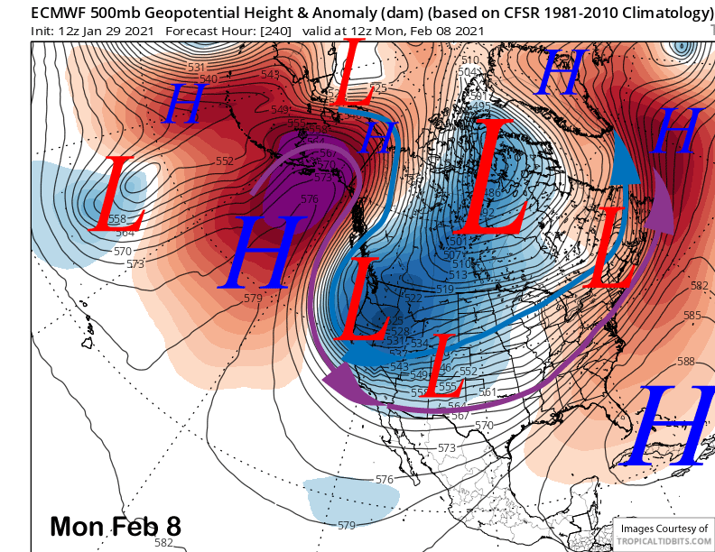
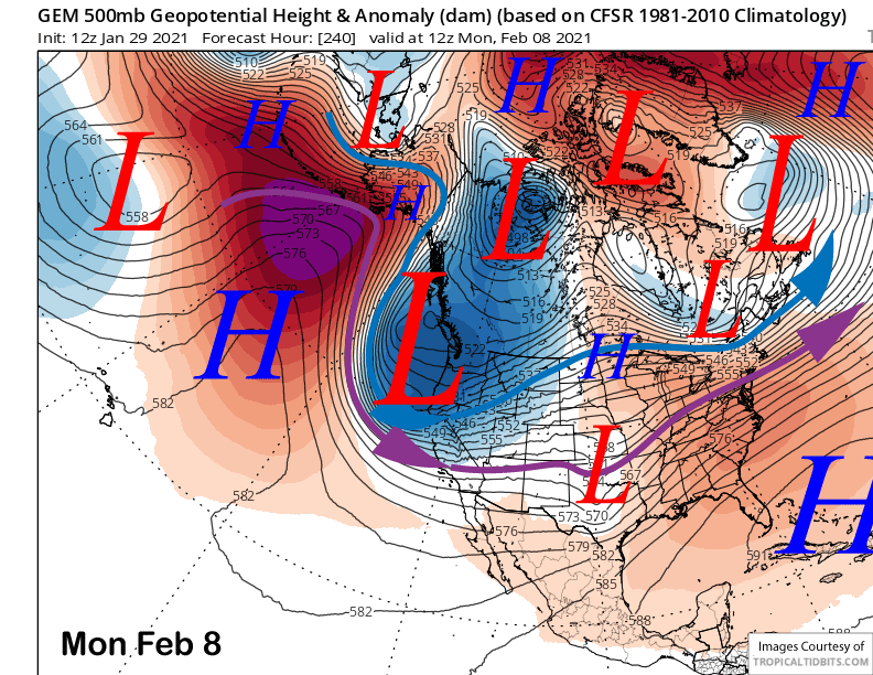
The ECM and Canadian models are farther west with the trough and move a deep high-latitude type system southward into CA early over the following week (images below). This scenario would result in a storm system delivering cold, dry powder to Mammoth under bitterly cold temperatures. With a good base now, this could lead to really fun powder days of super fluffy snow.
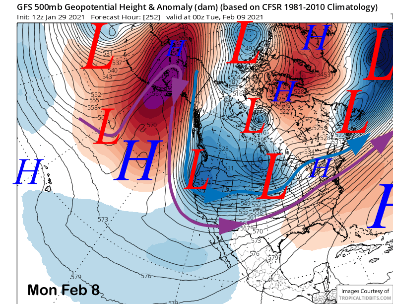
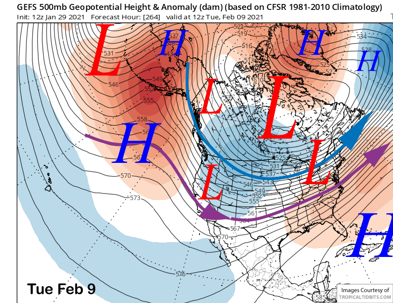
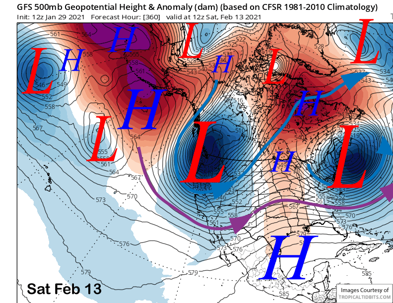
The GFS on the other hand, is farther east with the southward moving weather system and long-wave trough and has less over-water trajectory before moving into CA (image below). That would mean less snowfall and slightly colder temperatures versus the other scenario. The GFS ensemble mean is even father east (image below) and doesn’t even really support the GFS solution. So hopefully the operational models are onto a new trend by having the trough farther westward than currently being projected by the ensembles.
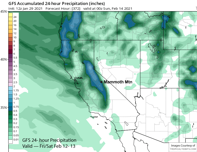
The GFS operational model eventually does move a similarly deep high latitude trough in CA later in the period (image below) and has good precipitation associated with it (image below) adding up to over an inch. That would also lead to epic powder.
But we will just have to wait and see as the GFS ensemble mean that has been doing the best lately in the longer time periods (it did a good job with the current event) is not favoring strong West Coast troughing through the forecast period. It only suggests a weak system or two (image below) around mid-month and nothing strong like the operational models.
The ECM climate model has ridging and drier weather third week of February before having the trough in the mid-continent retrogressing westward over the West Coast over the last part of the month and into early March. The CFS is suggesting the same thing, but is faster by about a week. That scenario would lead to more powder days at some point. WG