Powder Forecast –Tuesday November 9th, 2021
Ted Schlaepfer CCM —- Mammoth Mountain WeatherGuy
Snowfall forecasts are valid at the Sesame snow course (Main Lodge) for the prior 24 hours as reported in the 6-7 AM morning snow report.
**Snowfall forecast confidence ranges from very low (1) to very high (5)
Wed 11/10 = 10 – 12” (H20 = ~1.60”) **5
Thu 11/11 = 0”
Fri 11/12 = 0”
Sat 11/13 = 0”
Sun 11/14 = 0”
Mon 11/15 = 0”
Tue 11/16= 0”
Wed – Fri 11/17 – 19 = 0”
November Snowfall = 10”
November Forecast = 15– 30”
Detailed 4-day Snowfall Forecast:
Wed 11/10 through Sat 11/13 – No snowfall expected all days.
Forecast Summary:
Short Term (Days 1 – 4):
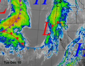
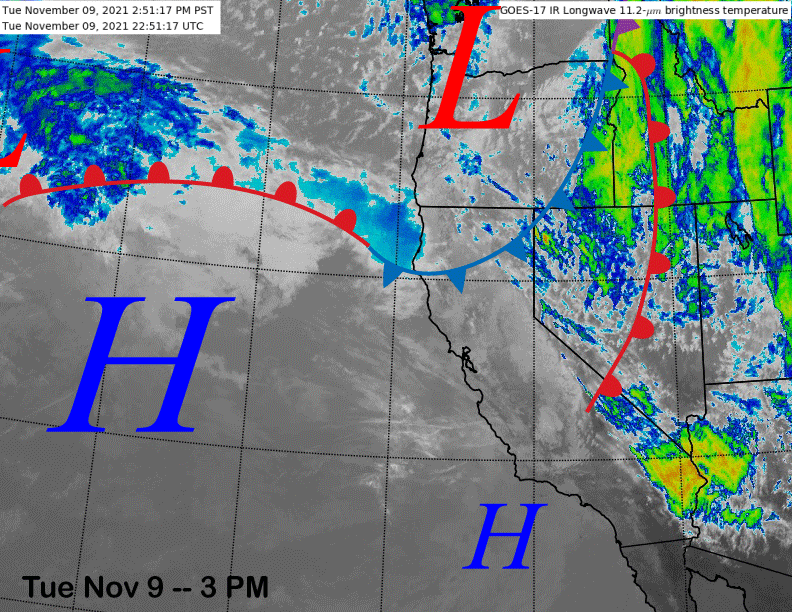
The current infrared satellite image (below) shows a weather system departing central CA and another weaker one moving through the PacNW. It looks like the storm delivered around 10-12” of snow around Main Lodge with about 1.6” inches of liquid and generally more than the ECM predicted, but less than the GFS and Canadian models.
High pressure (image below) will build into California tomorrow and Thursday resulting in fair weather and unseasonably warm temperatures by Friday and over the weekend when freezing levels will rise to nearly 13,000 feet.
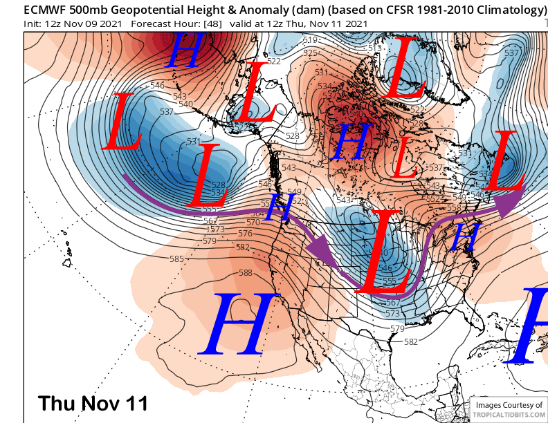
That means temperatures will rise into the low to middle 50s at Main over the weekend with mid-40s at McCoy and possibly low 40s up top. Snowmaking will likely not happen over the period.
Long Range (Days 5+):
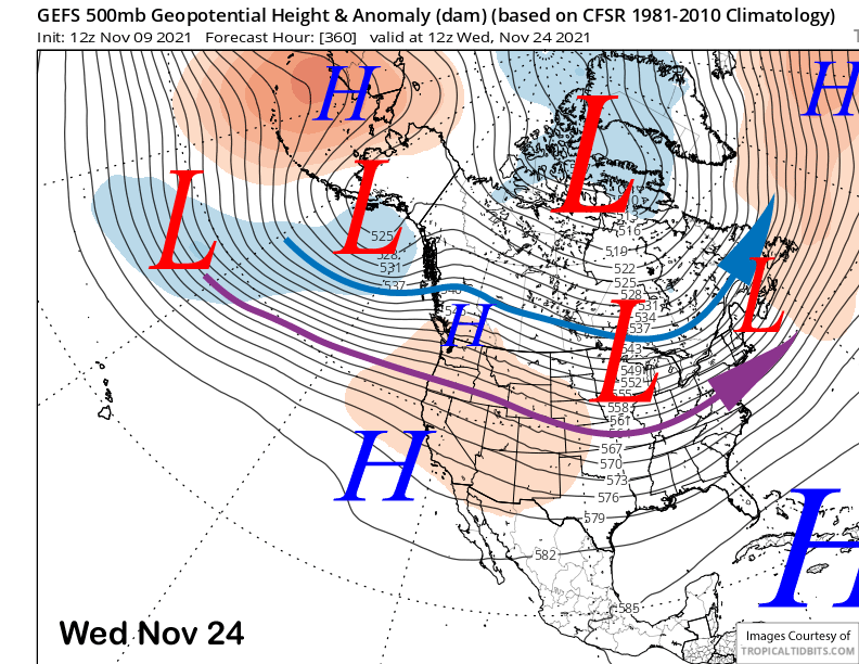
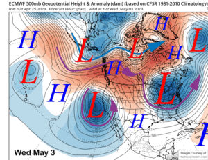
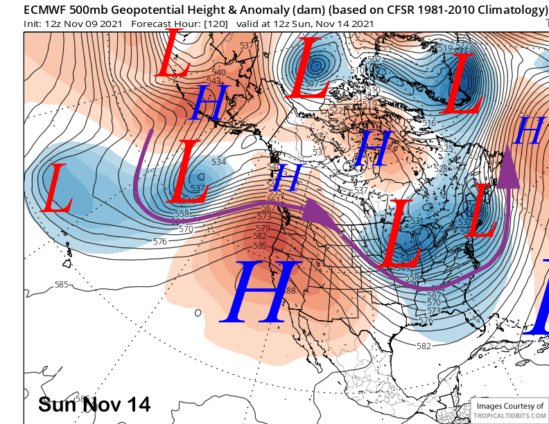
The longer-range guidance is still looking fairly dismal for any potential storminess. The models peak the high-pressure ridge in strength on Sunday (image below) with the dry and seasonably warm weather likely to continue Monday.
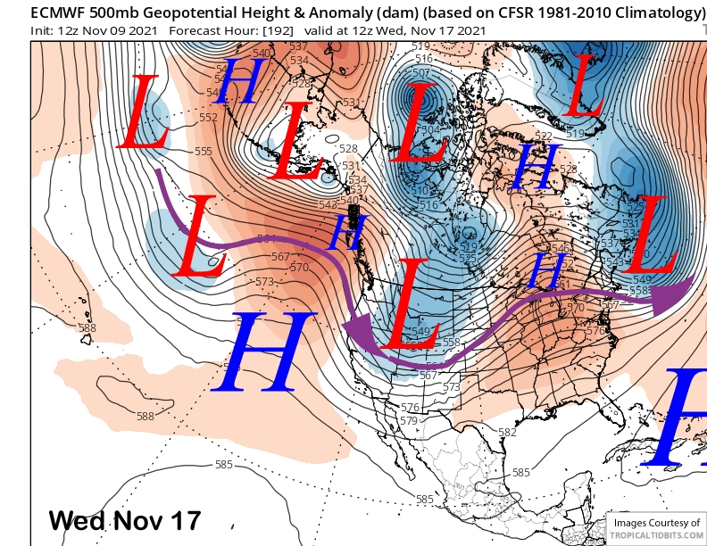
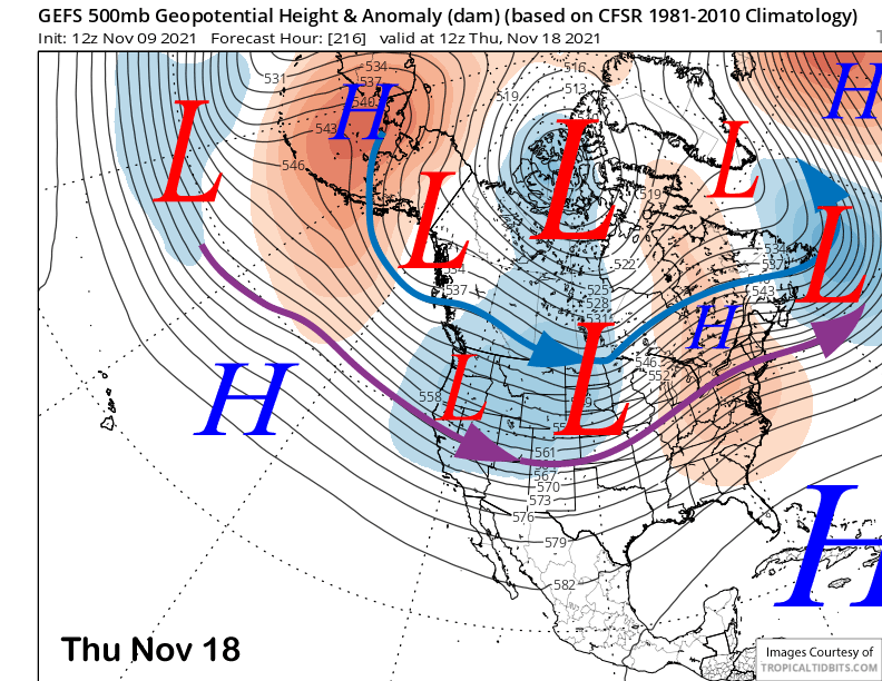
The ECM (image below) and Canadian models move an inside slider-type short wave through CA around Tuesday next week that would potentially lower temperatures a bit and maybe enough for night-time snowmaking. The GFS keeps the ridge in place through mid-week and has a potential slider for around Thursday or Friday next week.
The GFS ensemble supports the slider solution and also has that second system sliding into the state from the west around Thursday (image below). So maybe there could be some light snowfall end of next week. The ECM ensemble isn’t showing this solution at all and keeps dry weather in place.
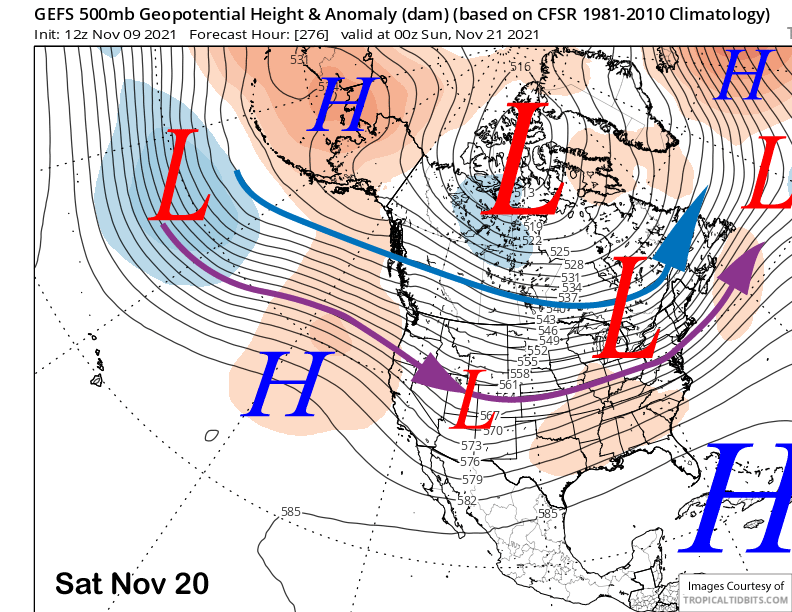
The GFS and ECM ensemble means both rebuild the ridge over the following weekend (image below) for more fair/dry weather. Hopefully, it won’t be too strong so at least some limited snow-making could happen.
The guidance generally keeps the ridge (image below) in place over the West Coast to start the Thanksgiving Holiday weekend for continued dry weather. A white Thanksgiving is not looking probable right now. The next chance for meaningful snowfall might not be until the end of the month or early December. WG