

January 6th @ 2 PM – The National Weather Service has a winter storm warning posted for Mammoth Mountain, Mammoth Lakes, and 395 down to Toms Place until 4 AM on Sunday.
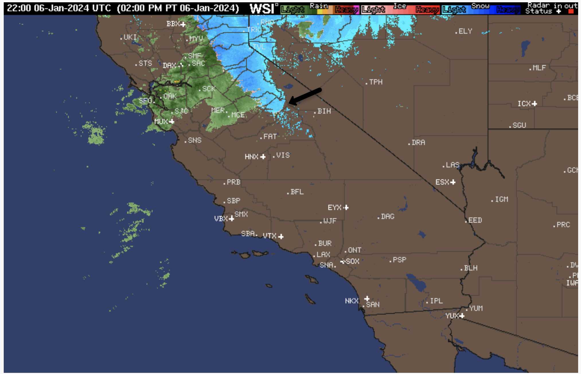
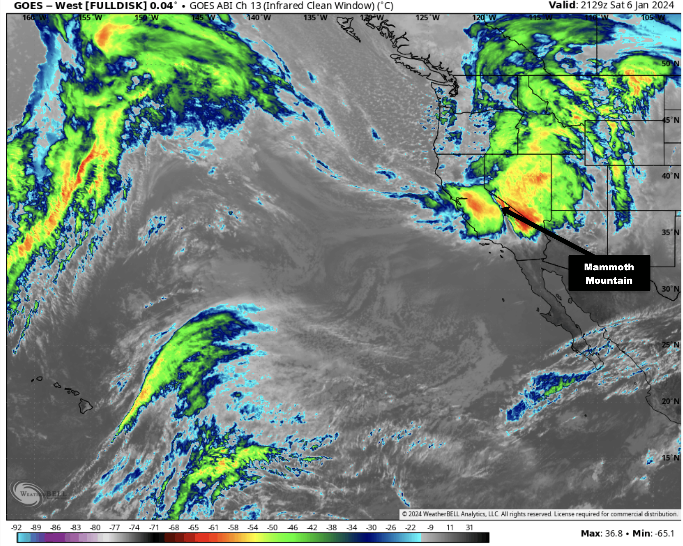
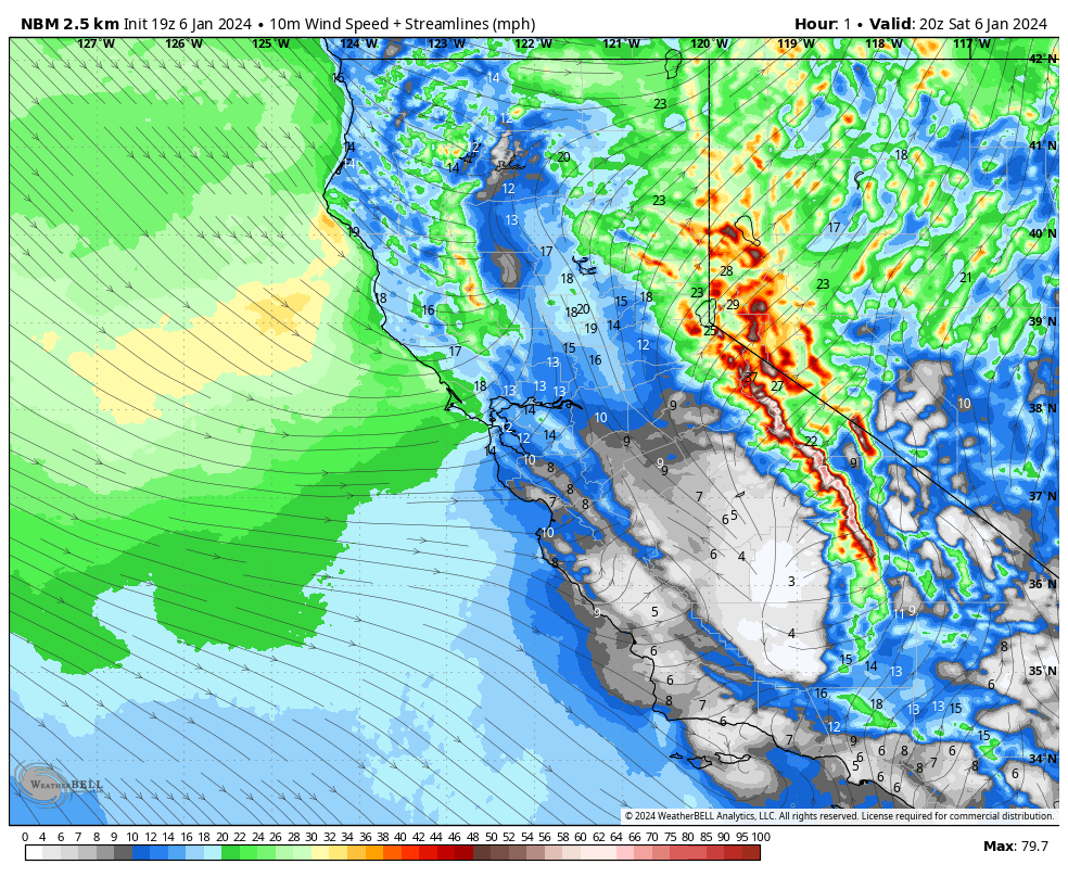
Currently, the local radar image shows the cold front with its line of snow just coming into the Mammoth area, with snow showers and very strong winds now showing on the Unbound Webcam.
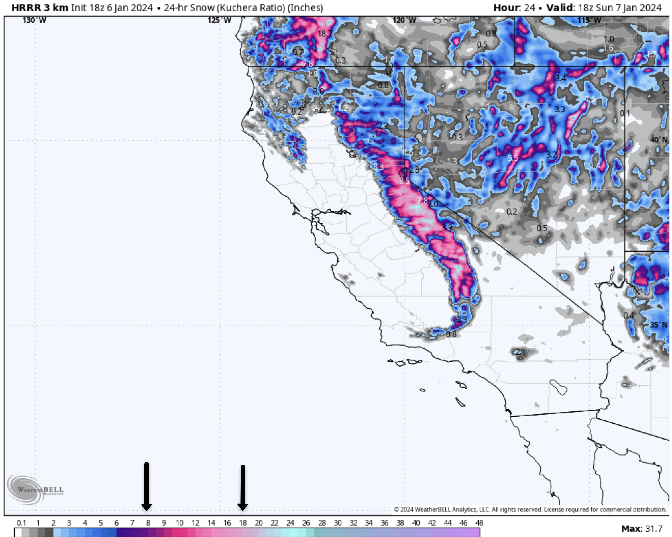
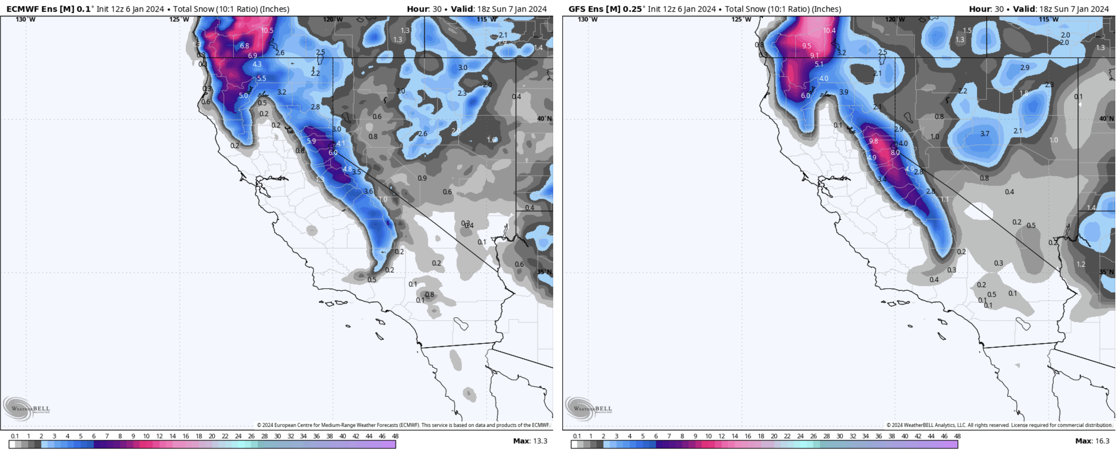
It appears Mammoth Mountain could pick up 8-18 inches of snow from about the Mill up to the top of the Mountain. The snow will be light and dry in areas that are protected from the wind.
Snow Ratios, once the front gets into the area, will be in the 12-1 to 14-1 range. Before that time, the strong winds will create fracking, and the snow ratios will be much lower.


More snowfall is on the way later next week and over the Martin Luther King Weekend coming up.
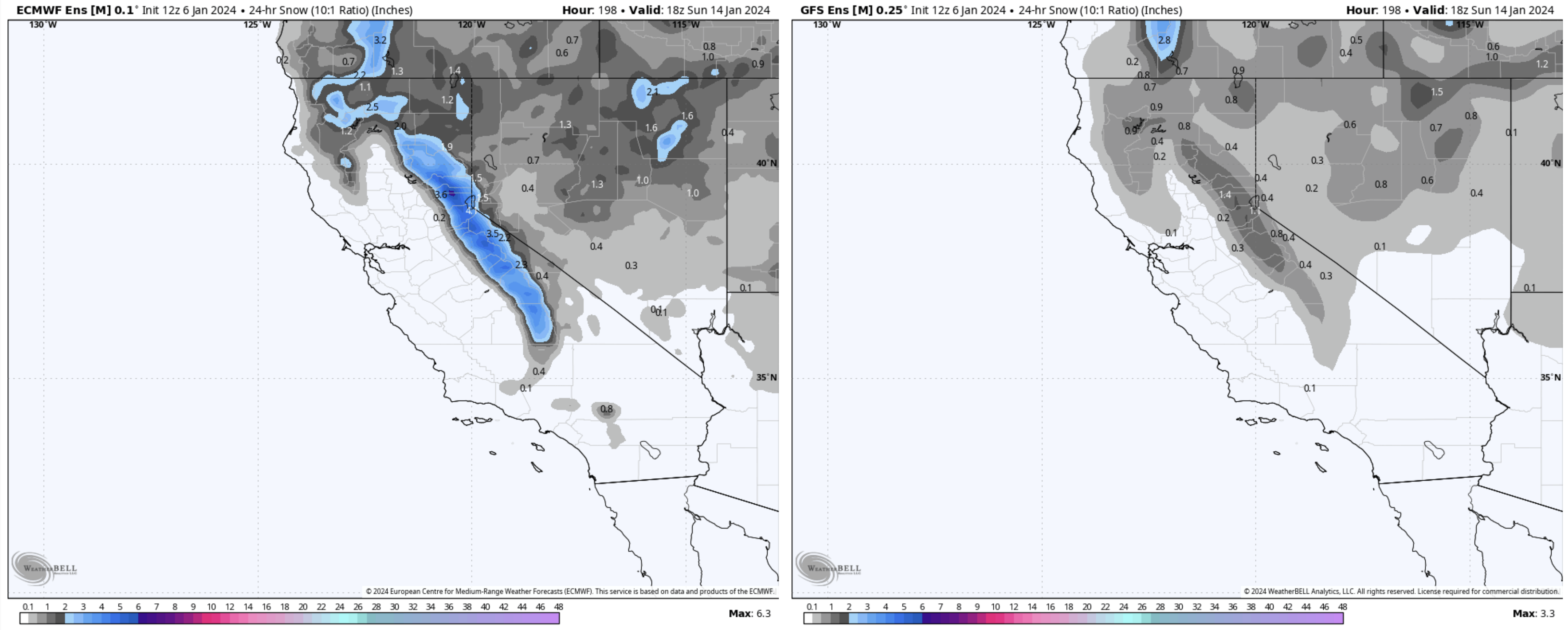
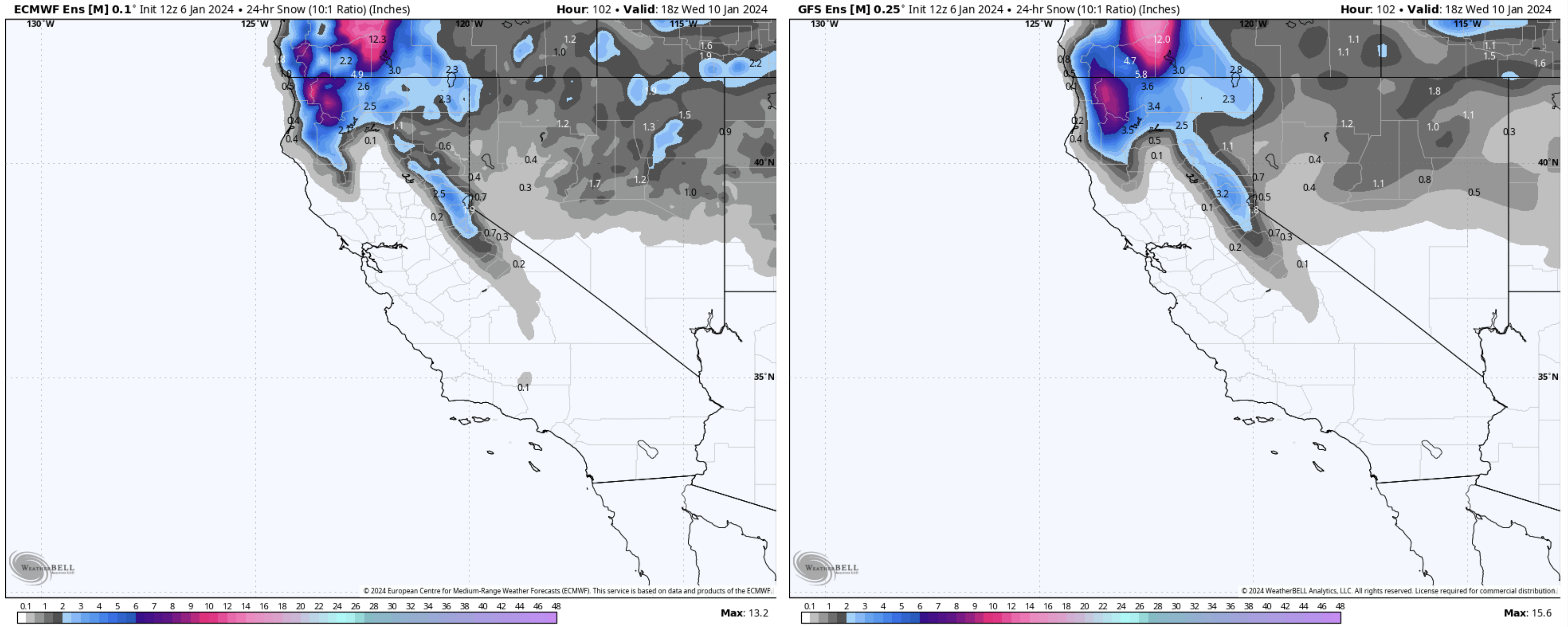
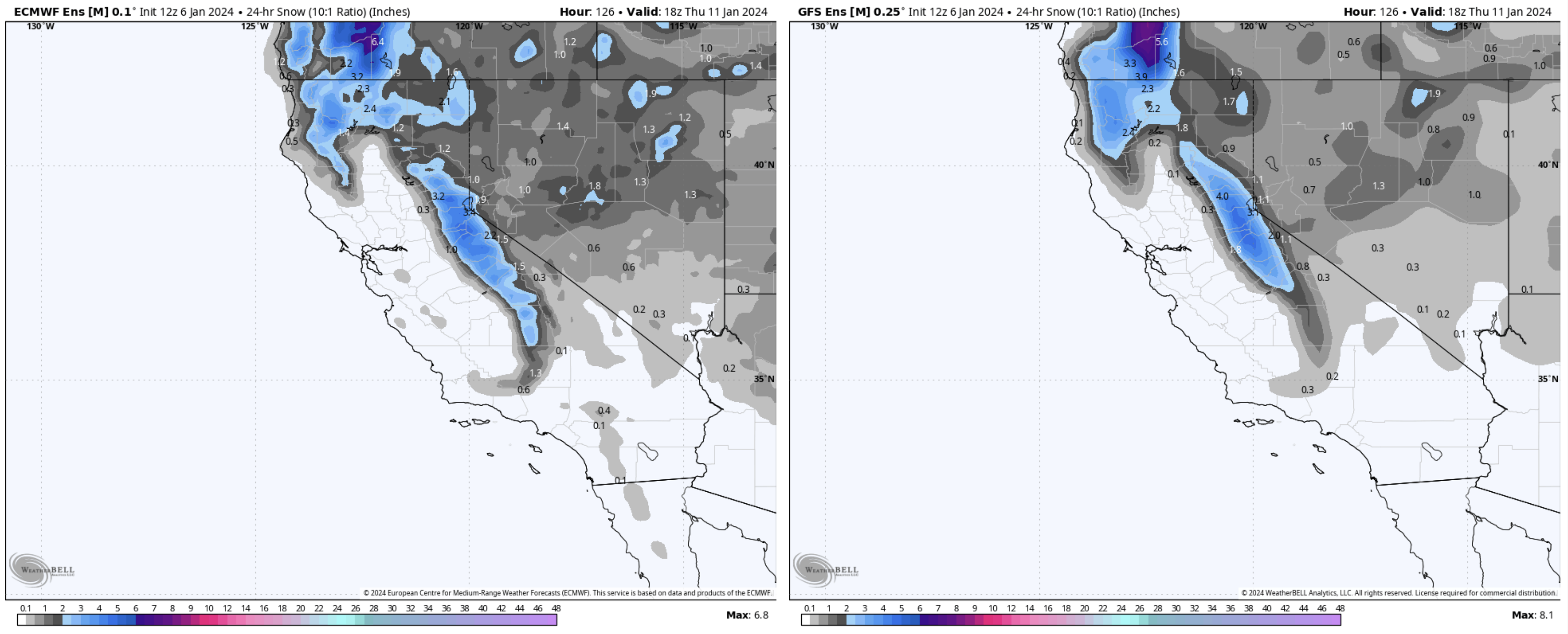
However are trusted EU model that went on a hyper spree the last couple days on the snowfall has now backed off today.
lol It’s now behaving like the hyper GFS operational model that so many people freakout over. What a year for model riders and weather watchers.
Seems like the only things you can trust this season is the Window Cast and a yard stick. 


Author – Steve Taylor – The Mammoth Snowman – Over the last 30+ years, Snowman has spent countless hours studying and learning about Mammoth Mountain Weather and Snow Conditions first hand. He has been skiing around the hill with marked ski poles since March of 1991 so he can measure the fresh snowfall amounts out on the hill.
Snowman started blogging this information back in 1990 on the old Mammoth BBS system, then the RSN Forums and then on to MammothSnowman.com in 2004 with Video & Photo Blog reports. (No YouTube back then). Facebook got added to the fold back in 2008 and then the Facebook Group in 2016.
Reports, videos, and photos from the website have been featured on both local TV Stations here in Mammoth and Bishop, along with KTLA, AP, Fox, ABC, CBS, and NBC News.
Click Here to Learn More About the People Who Make MammothSnowman.com a Reality


