

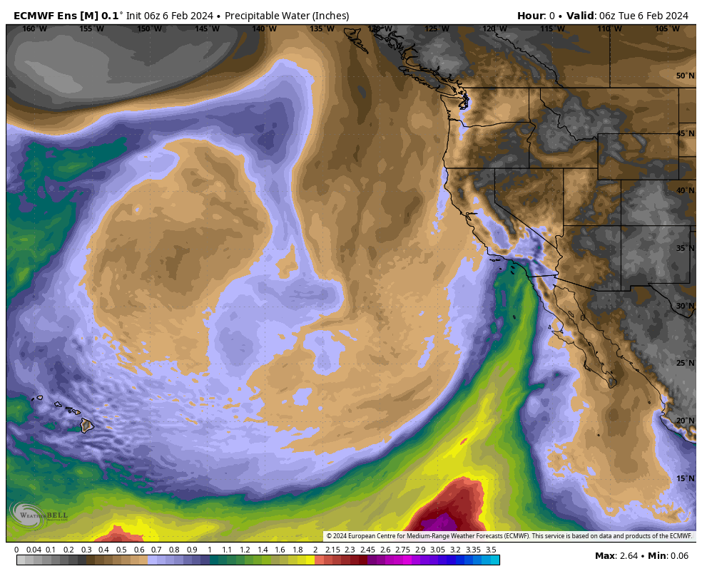
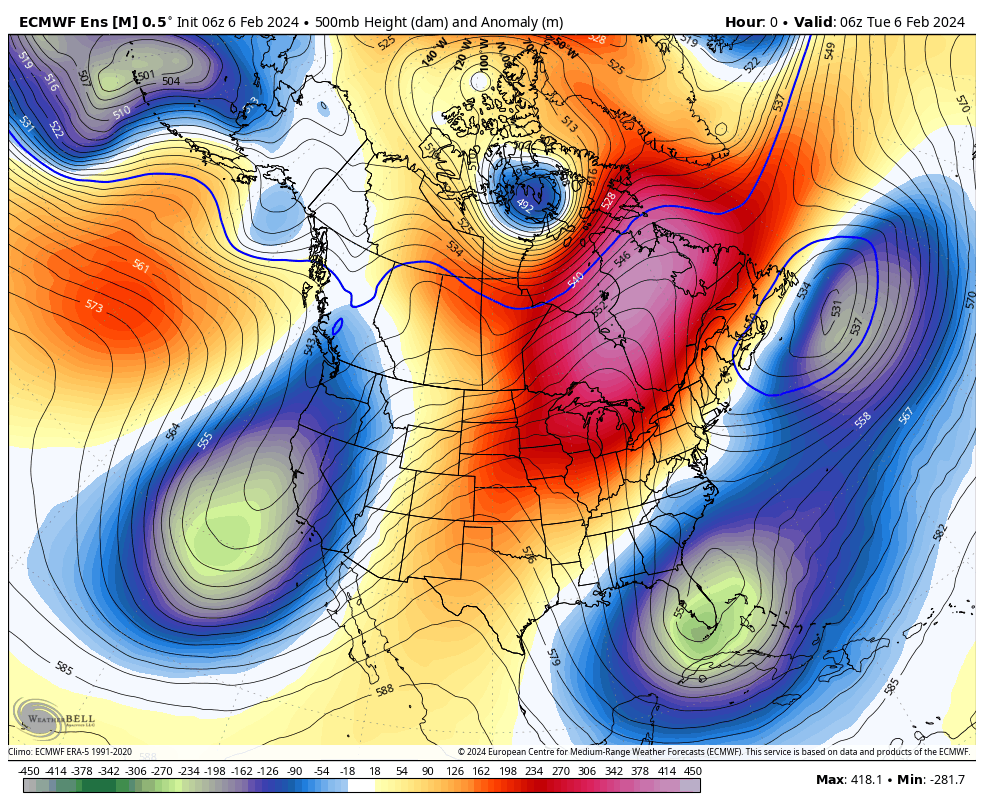
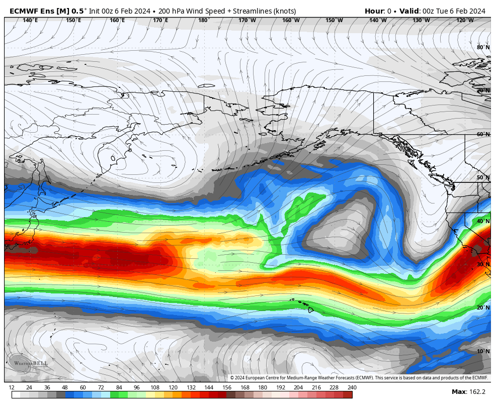
February 6th, 2024 @ 11 AM – Good morning; today’s weather is influenced by this very slow-moving storm system. Right now, Mammoth is north of the main AR band pounding areas to our south, so the snowfall is light to moderate at times, with breaks in the action.


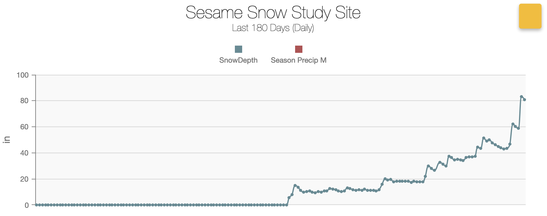
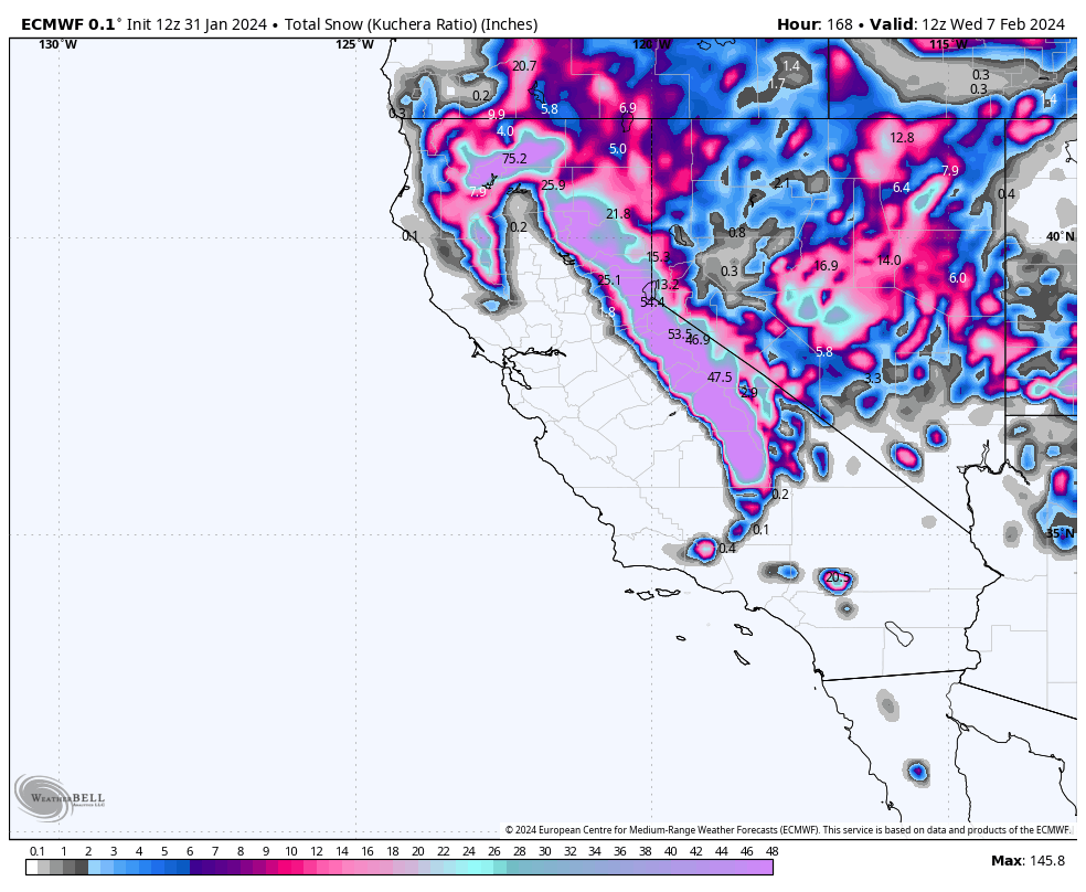
Last night, seven more inches of snow fell at the 9000-foot level. That brings the snowfall totals from this second storm up to 4 feet at the Main Lodge. Add in the 2 feet from late last week and that’s 6 feet of fresh in 7 days at the 9000 foot level. The base at the Snow Study Sites is now sitting at 80 inches.
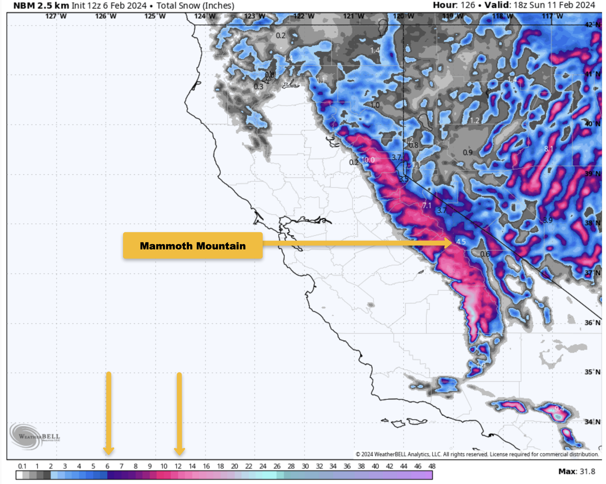
Over the next 48-72 hours, the snowfall will continue at times in the light to moderate range. Snowfall amounts average out in the forecast to be in the 3-5 inch range below the 9000-foot level with 6-10+ inches up to the top of Mammoth Mountain.
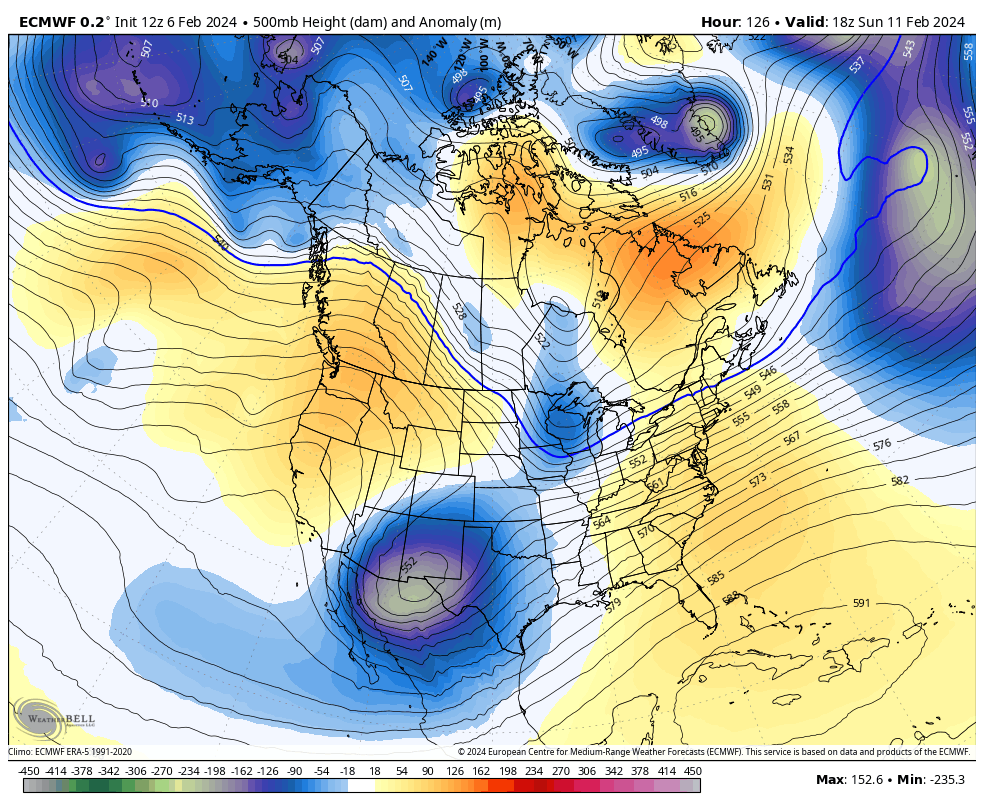
By next weekend, clearing looks to take place as high pressure will be the dominant weather maker by Sunday into the middle of next week. Temperatures will moderate a bit but still remain in the upper 20s to lower 30s from Main Lodge to the Top, with mid 30s down at Canyon Lodge.
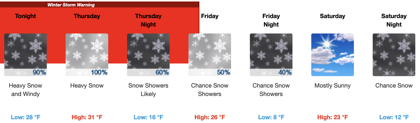
 If you’re heading out to the hill today, there will be cloudy skies with snowfall light to moderate at times, with a mid-day temperature around 25 at the Main Lodge after morning lows around 20. S to SW winds will be 5-10 MPH today, with 15-25 MPH winds over the mid and upper mountain.
On Wednesday, expect more pt cloudy skies to start the day with snow showers likely at times during the afternoon hours. Temperatures will be near 23 degrees with a Southwest wind of 10 to 15 mph, with gusts to 30 mph at Main Lodge with stronger winds over the top. Snow accumulation of 1 to 3 inches looks possible with snow levels down to 5500-6000 feet.


Author – Steve Taylor – The Mammoth Snowman – Over the last 30+ years, Snowman has spent countless hours studying and learning about Mammoth Mountain Weather and Snow Conditions first hand. He has been skiing around the hill with marked ski poles since March of 1991 so he can measure the fresh snowfall amounts out on the hill.
Snowman started blogging this information back in 1990 on the old Mammoth BBS system, then the RSN Forums and then on to MammothSnowman.com in 2004 with Video & Photo Blog reports. (No YouTube back then). Facebook got added to the fold back in 2008 and then the Facebook Group in 2016.
Reports, videos, and photos from the website have been featured on both local TV Stations here in Mammoth and Bishop, along with KTLA, AP, Fox, ABC, CBS, and NBC News.
Click Here to Learn More About the People Who Make MammothSnowman.com a Reality
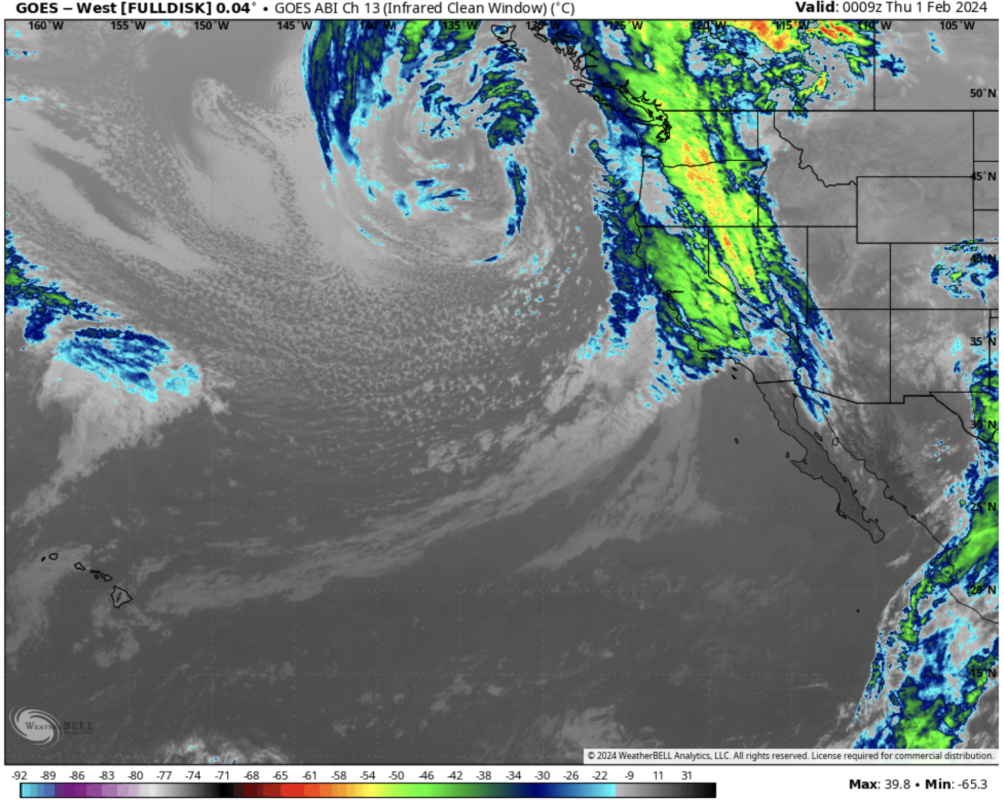
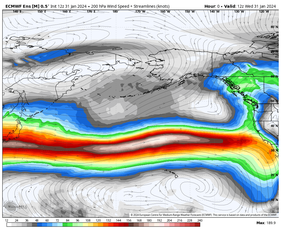
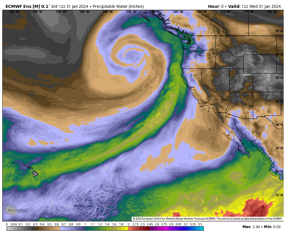
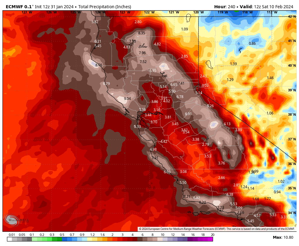
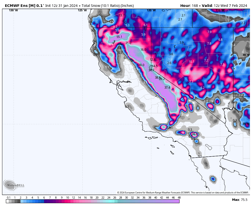
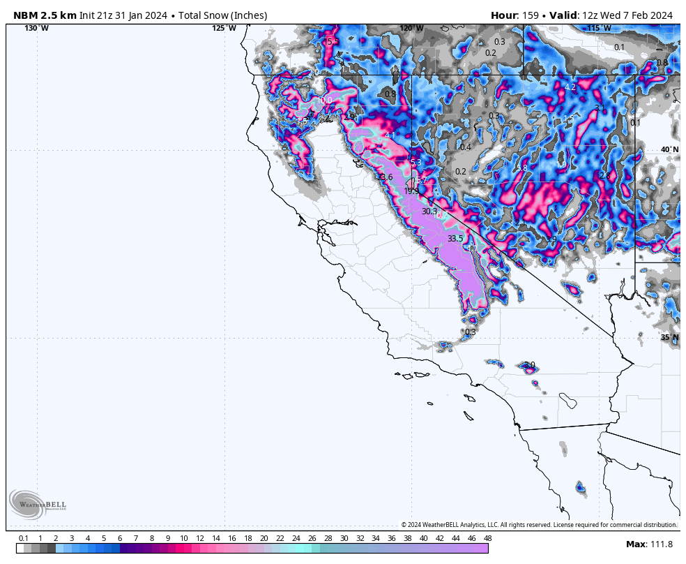
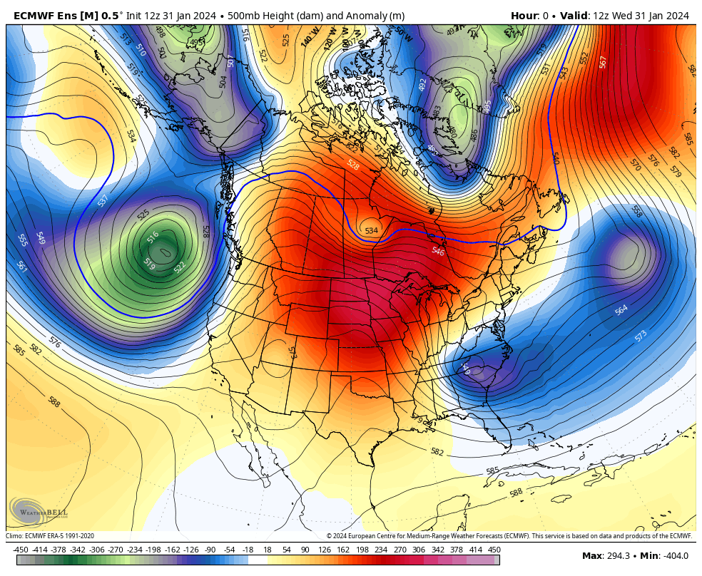
January 31st, 2024 @ 5 PM – Good evening; taking a look at the most current weather data, confidence is increasing that Mammoth Mountain will see a moderate storm system with 1-2 feet of new snow over the lower mountain and possibly 20-30 inches over the upper mountain by Friday evening.
Late tonight, snow levels will start around the 7000-7500-foot elevation. The snow levels will come down before sunrise to around the 6000-6500 foot level and then down to around 5500-6000 feet on Friday.
Over the weekend, there should be snow showers at times into early Sunday. By Sunday afternoon/evening, the next low-pressure system will start to affect the area, with more heavy snowfall for Mammoth Mountain looking likely into Tuesday evening.
That second storm system is starting to look like it could be a big-time snow producer, with heavy snow at times falling late Sunday into Tuesday afternoon. The heavy snowfall looks to be followed by snow-showery weather out to day 10.
If you plan on traveling to Mammoth on Thursday, expect a slower go from Toms Place to Mammoth. As of this evening, it’s looking like 395 from Tom Place to Mammoth could see 4-8 inches from this first storm system. Be prepared to chain up, slow down, and watch out for unprepared drivers.
The second system, if it comes in as shown on this evenings data, could usher in a brief shutdown of 395 for a period sometime during the Monday / Tuesday Time frame.
If you’re out on the hill on Thursday, expect to see 5-10 inches at sunrise from Wednesday night’s snowfall. During the hours the lifts are open, expect moderate to heavy snow at times, with 8 – 14 inches of possible new snowfall on Mammoth Mountain. Snowfall ratios on Thursday look to be in the 10-1 to 12-1 range.
It could be a decent rider of the storm day if we don’t get blown out. Winds as of now don’t look to be too bad, with a southwest wind at 25 to 30 mph decreasing to 20 to 25 mph in the afternoon with ma gusts in the 45-55 MPH range. That would allow crews to at least run chair 22 on Thursday for some Riders of the Storm action.
Snowman
Author – Steve Taylor – The Mammoth Snowman – Over the last 30+ years, Snowman has spent countless hours studying and learning about Mammoth Mountain Weather and Snow Conditions first hand. He has been skiing around the hill with marked ski poles since March of 1991 so he can measure the fresh snowfall amounts out on the hill.
Snowman started blogging this information back in 1990 on the old Mammoth BBS system, then the RSN Forums and then on to MammothSnowman.com in 2004 with Video & Photo Blog reports. (No YouTube back then). Facebook got added to the fold back in 2008 and then the Facebook Group in 2016.
Reports, videos, and photos from the website have been featured on both local TV Stations here in Mammoth and Bishop, along with KTLA, AP, Fox, ABC, CBS, and NBC News.
Click Here to Learn More About the People Who Make MammothSnowman.com a Reality


