

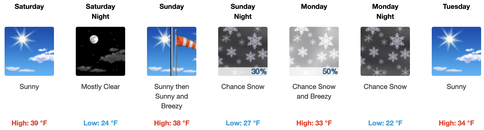
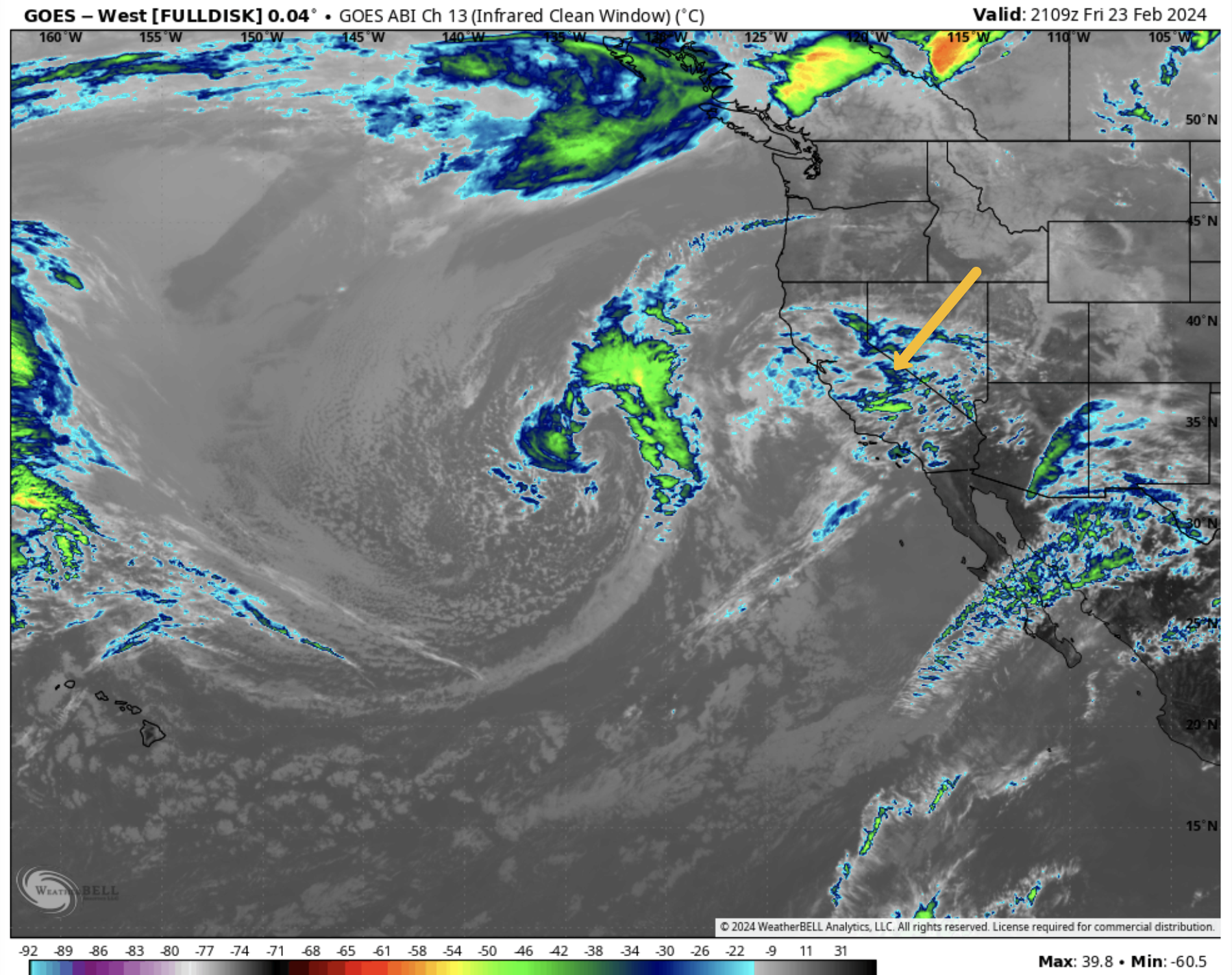
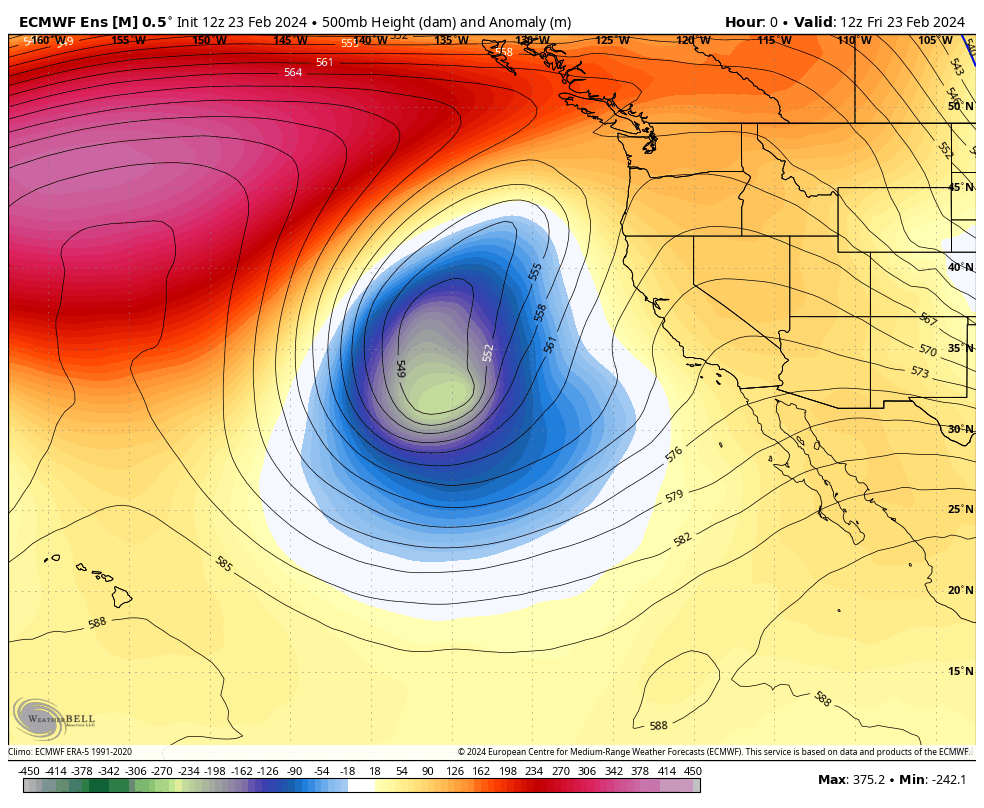
2-23-2024 @ 1 PM – A cut-off low is currently well off the California coast and is sending in the high clouds that are in the area today. As the COL drops southward, skies will clear over the weekend for more bluebird days.
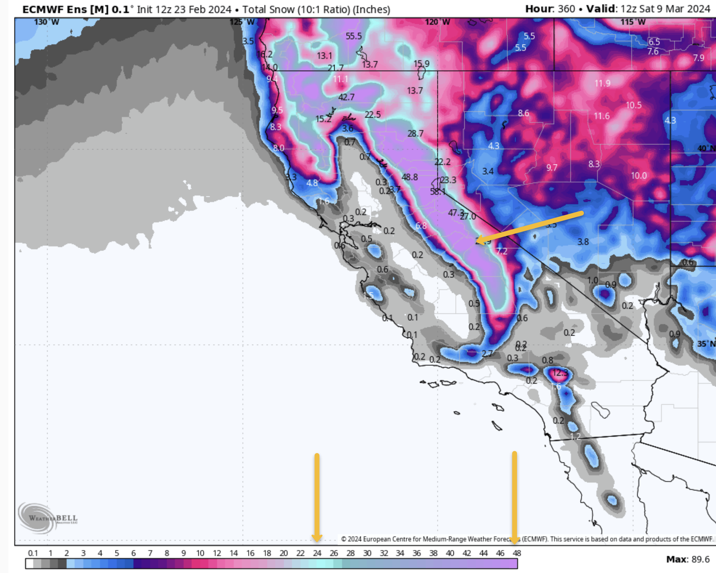
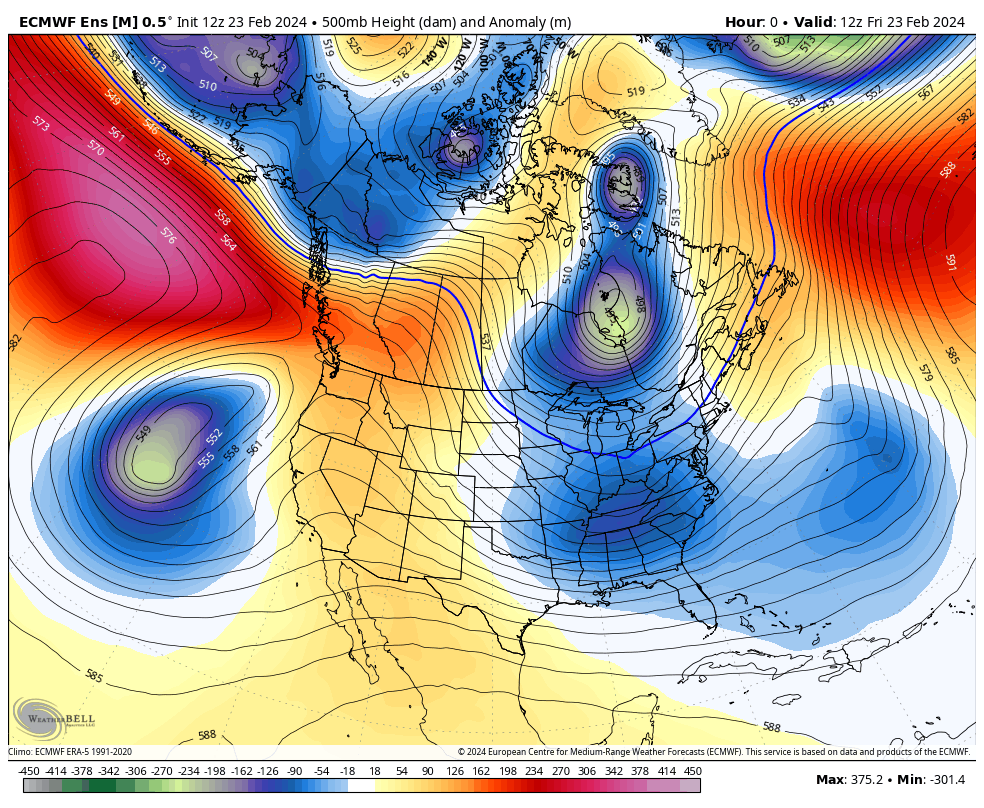
By late Sunday, the next low coming in will be an inside slider that will be able to pull in just enough moisture that there could be around 3-5 inches of snowfall on Monday. Along with the snow, there will be a big drop in temperatures down into the upper 20s to lower 30s.
Confidence is low in snowfall amounts as some of the models bring the low closer to the Sierra Crest, and that would increase the snowfall. For now, we are going with the ECM ENS, which has been right more than wrong this season with its lower snowfall forecasts.
The middle of next week looks to be a break before the next larger system starts to effect the area out on Day 8 next Friday. Winds should pick up around next Thursday for a nice wind-buff event.
That second low is deep and looks to have a decent hook-up with some sub-tropical moisture. Models show the 2nd low affects the area all the way out to day 11.
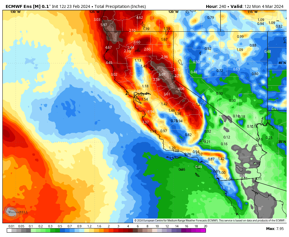
QPF for that time period is in the 2-4 inch range for Mammoth Mountain; however, QPF is sure to change since that is the fantasy outlook time period.
If you’re heading to the hill on Saturday or Sunday, look for mostly clear skies to return, with temperatures climbing into the upper 30s to the mid-40s with continued light winds.


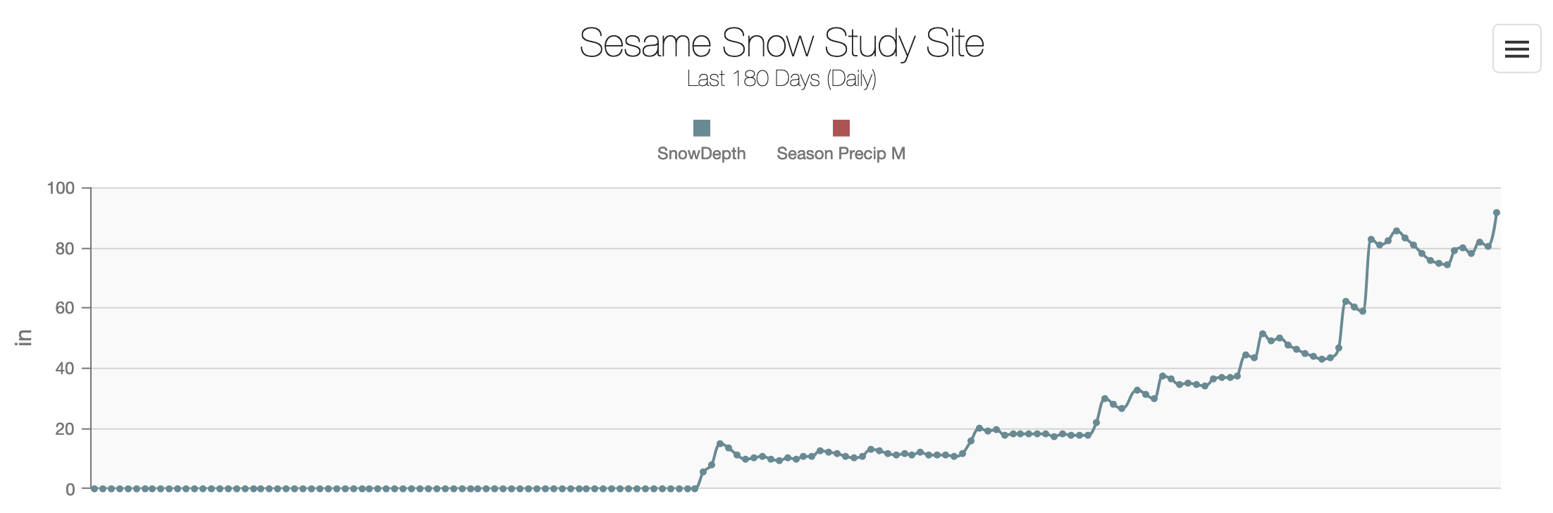
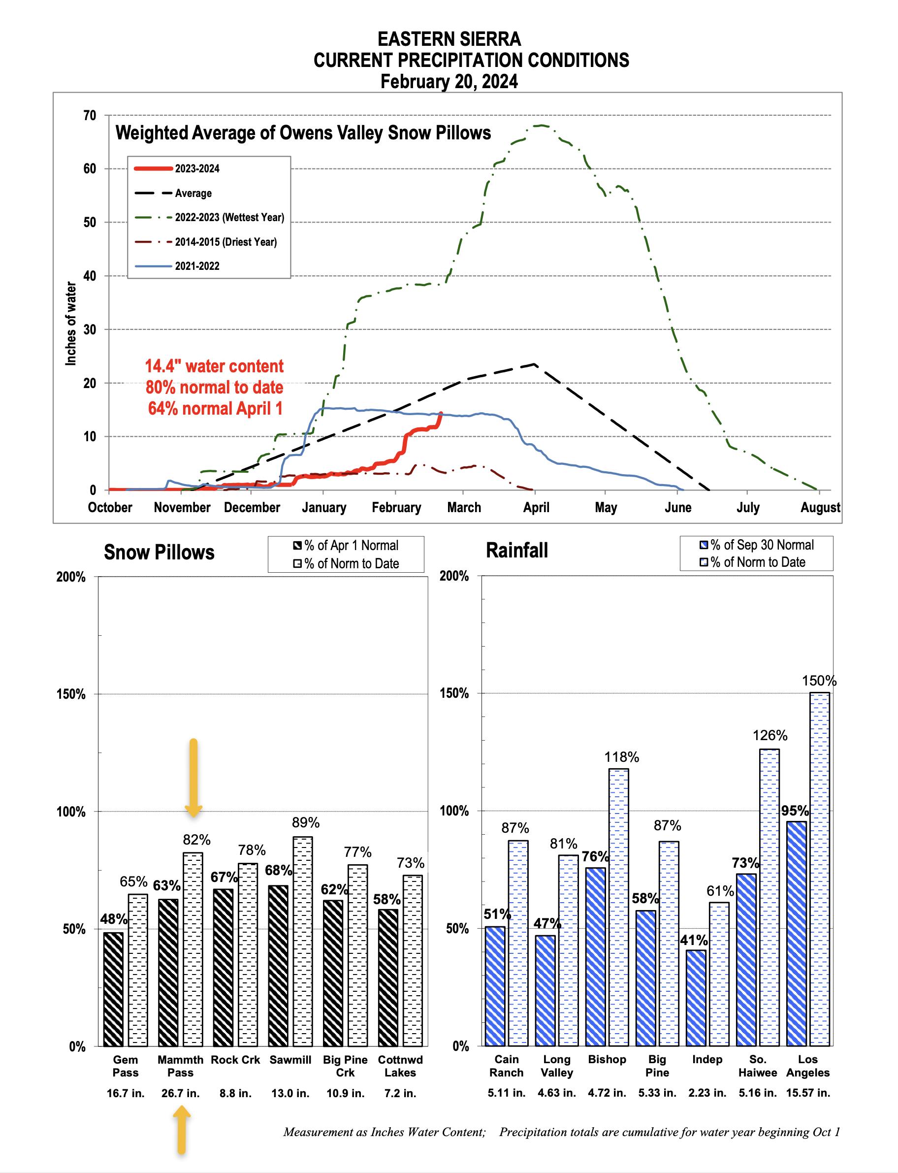
Snow Study Site & Eastern Sierra Snow Pillow
The seasonal snowfall for February at the Sesame Street Snow Study Site is around 119 inches this morning with a base of 90 inches. Total Precipitation this season is around 24.6 inches of water.
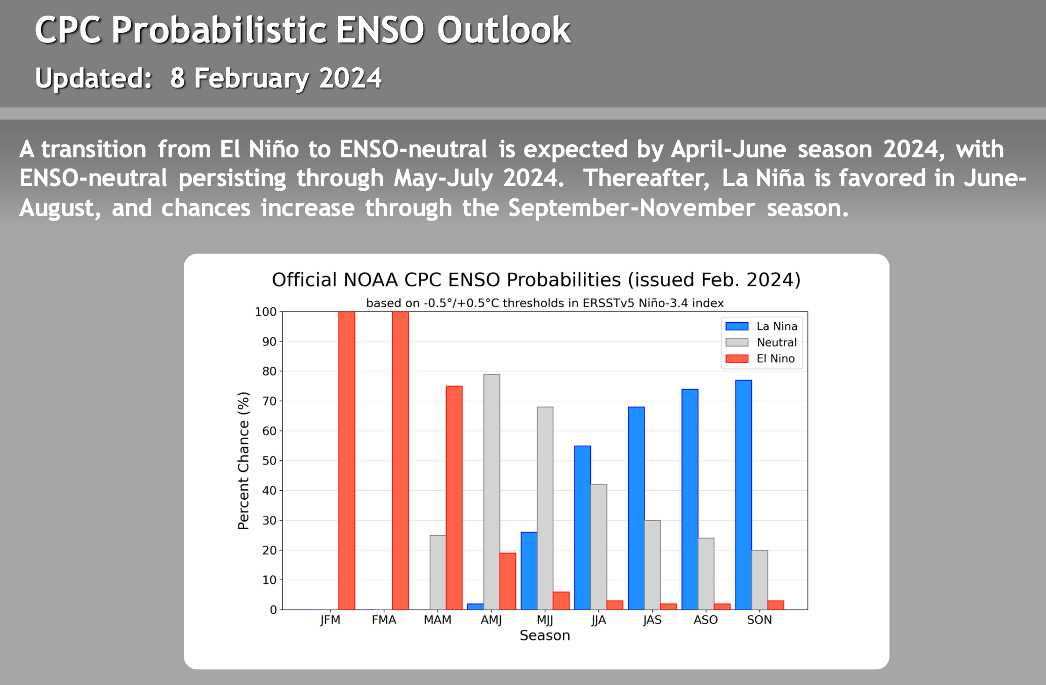
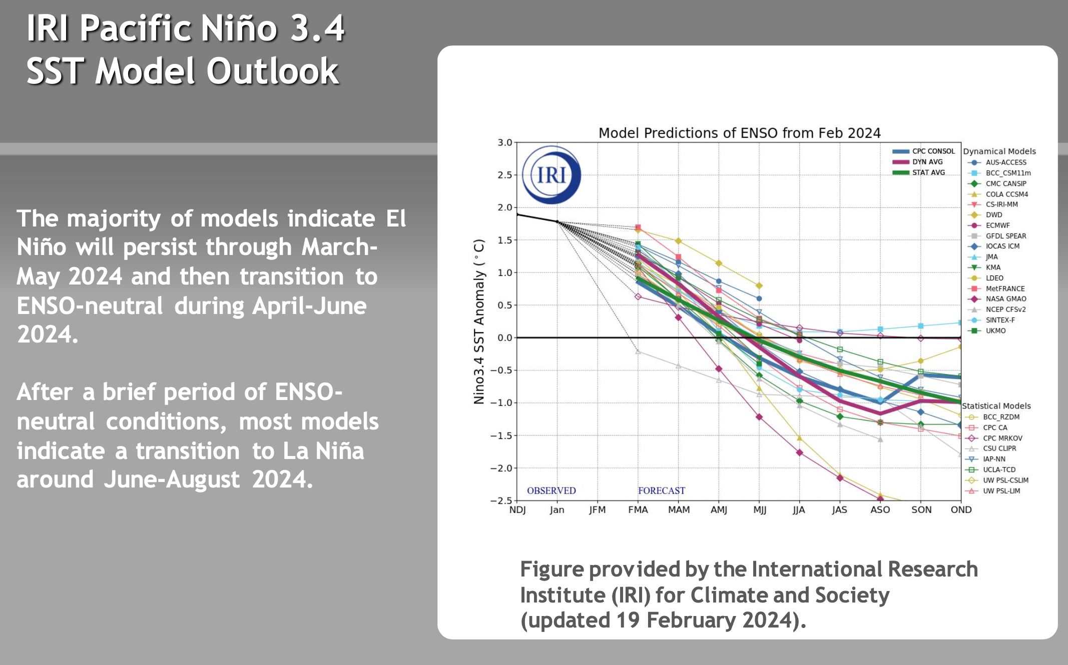
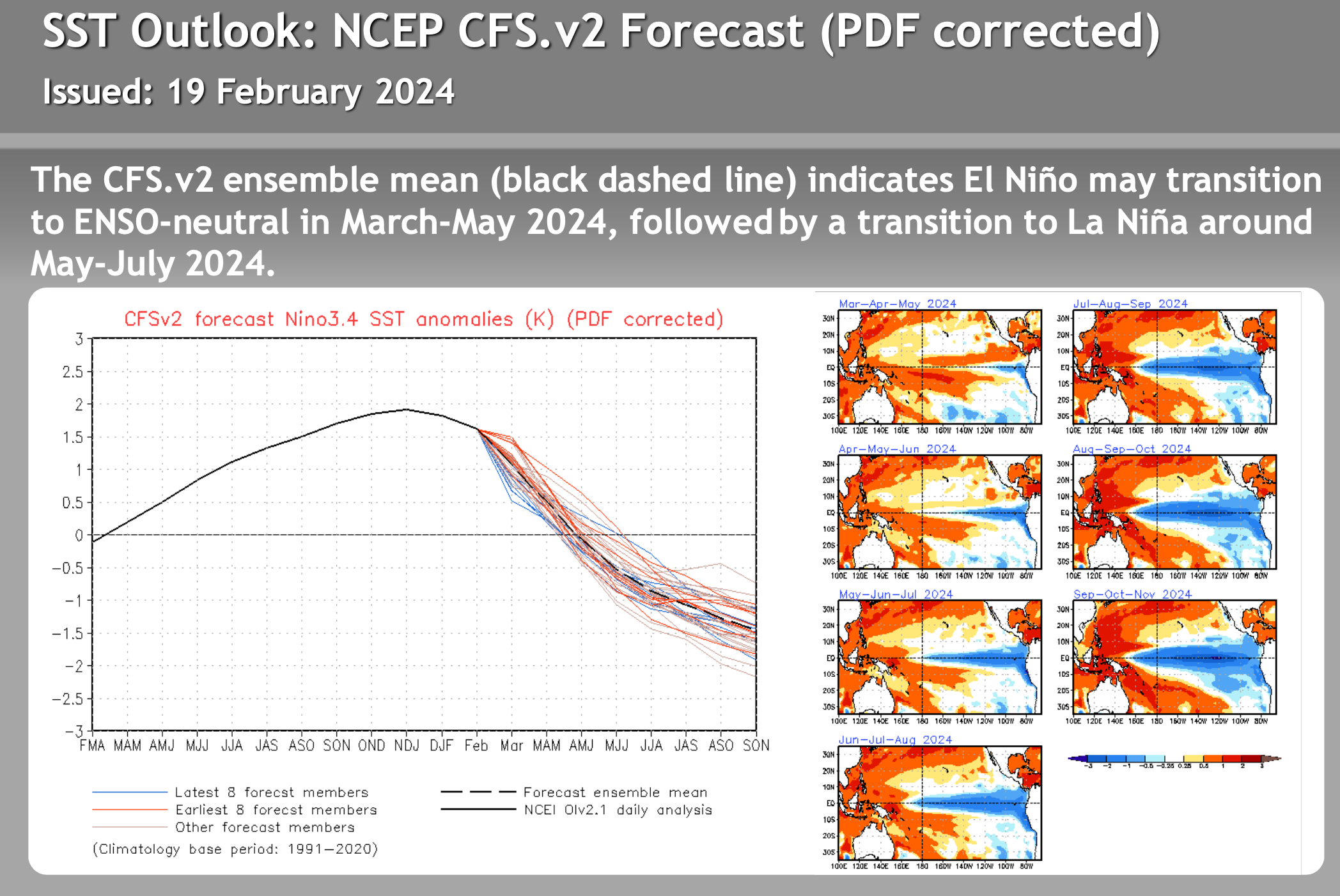
El Nino – La Nina – Neutral Watch


Author – Steve Taylor – The Mammoth Snowman – Over the last 30+ years, Snowman has spent countless hours studying and learning about Mammoth Mountain Weather and Snow Conditions first hand. He has been skiing around the hill with marked ski poles since March of 1991 so he can measure the fresh snowfall amounts out on the hill.
Snowman started blogging this information back in 1990 on the old Mammoth BBS system, then the RSN Forums and then on to MammothSnowman.com in 2004 with Video & Photo Blog reports. (No YouTube back then). Facebook got added to the fold back in 2008 and then the Facebook Group in 2016.
Reports, videos, and photos from the website have been featured on both local TV Stations here in Mammoth and Bishop, along with KTLA, AP, Fox, ABC, CBS, and NBC News.
Click Here to Learn More About the People Who Make MammothSnowman.com a Reality


