
Mammoth Weather Update for Sunday, July 25th, 2021
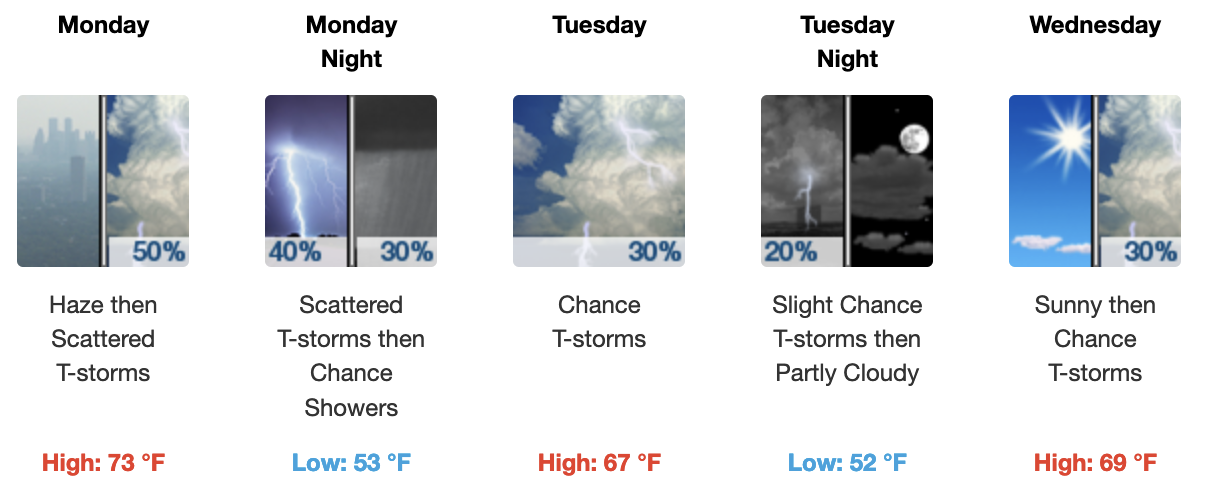
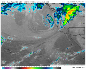
Synopsis: The monsoon is on its way back and we will see a 50% chance of thunderstorms starting today.
The thunderstorms will become a bit more numerous on Monday with heavy rain, hail, lightning, and strong outflow winds possible.
By Tuesday into Friday chances for t storms with being in the 30% range. There will be ample sun and heat these days allowing for some strong isolated storms to develop. Storms that do form will have heavy rain falling under them.
Temperatures will be typical for July with low 80s in Mammoth the next couple of days dropping into the mid-70s by Tuesday. Bishop will be near 100 today and then drop into the low 90s by Monday. Lows at night are perfect in the high country with the mid-50s expected.
Winds: Expect light winds the next couple of days unless you happen to get caught in a thunderstorm.
Smoke and haze: I would expect just light amounts at times until further notice. AQI levels have remained in the green zone for a week now for the higher elevation.
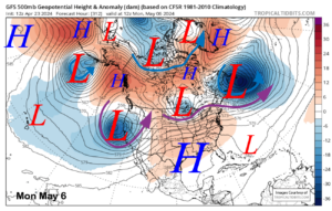
Extended Outlook: Looking out over the next 16 days I am still not seeing any excessive heat waves. Some of the models want to keep the T Storms going for the next week before they try to dry us out.
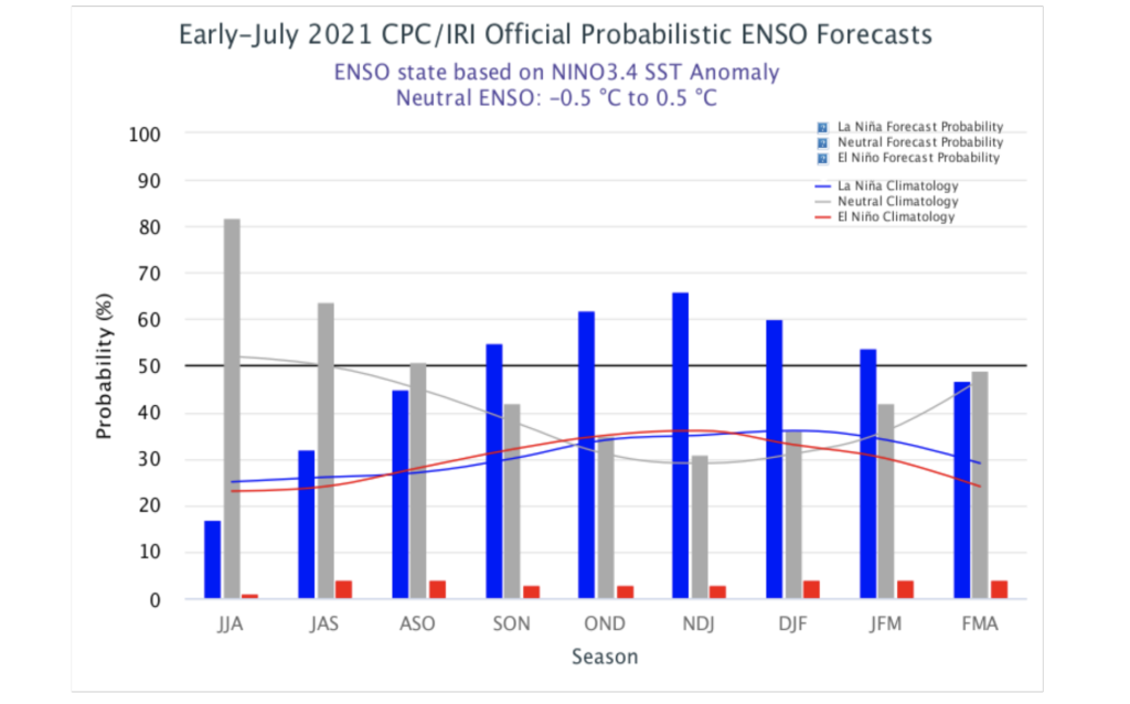
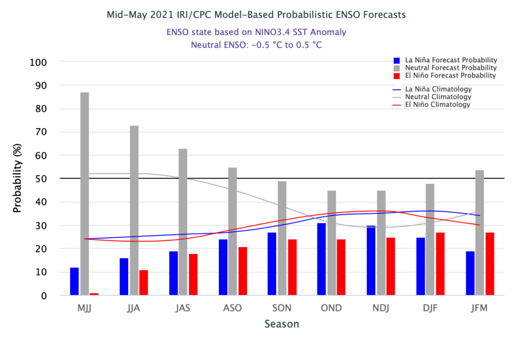
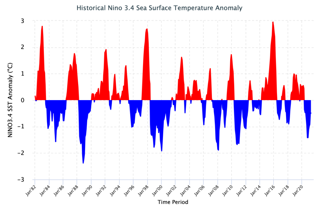
Looking out towards Fall and into the Winter months, it’s looking dry and warm to start. Models have moved from a neutral winter to forecasting a la Nina to set up again.
Kind of early to jump on how strong it could be. Mammoth and the central Sierra have done good with weak La Nina’s, not so bad with moderate ones but if it’s strong again expect a drier year.
Snowman PS I will have the images below updated by 10:10 AM this morning…
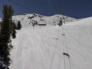
Mammoth Mountain Ski Patrol Current Conditions 7-25-2021

Forecast for the Mammoth Lakes Basin & Main Lodge @ 8900 feet
Forecast for Mammoth Lakes @ 8000 Feet

Forecast for Bishop @ 4200 feet 
HRRR High-Temperature Forecast 
HRRR 18 Hour Precipitation Forecast
HRRR Current Dew Point
HRRR Current Humidity Levels
Precipitable Water
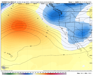
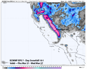
ECMWF EPS Ensemble going out 10 days / 240 hour

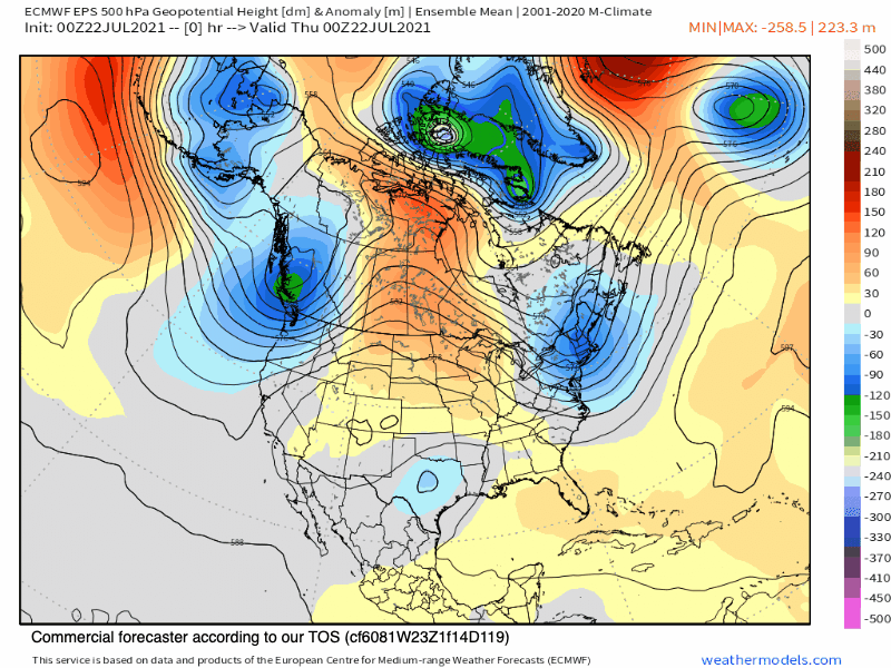
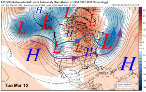
Temperature Anomaly Outlook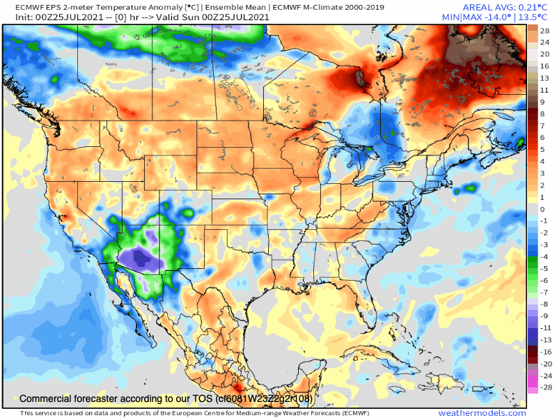
Precipitation Anomaly Outlook

___________________


")
Who Are We?
 Steve Taylor – Mammoth Snowman – Over the last 30+ years, Snowman has spent countless hours studying and learning about Mammoth Mountain Weather and Snow Conditions first hand. He has been skiing around the hill with marked ski poles since March of 1991 so he can measure the fresh snowfall amounts out on the hill.
Snowman started blogging this information back in 1990 on the old Mammoth BBS system, then the RSN Forums and then on to MammothSnowman.com in 2004 with Video & Photo Blog report. (No YouTube back then). Facebook got added to the fold back in 2008 and then the Facebook Group in 2016.
Reports, videos, and photos from the website have been featured on both local TV Stations here in Mammoth, along with AP, Fox, ABC, CBS, and NBC News.
 Ted Schlaepfer – Mammoth WeatherGuy – The Powder Forecast – Posted Tuesday and Fridays at 5 PM November into Mid May. These forecasts are now responsible for many people getting multiple powder days on Mammoth Mountain over the years.
Ted’s Bio: Ted has been a full-time Meteorologist (CCM) for the past 25+ years. He has always been fascinated with the weather,” skiing was just a natural extension of my love for snow and rain. I started skiing at age 5, first discovered Mammoth in 1979 as a youth, and have been a regular visitor since the late ’80s.”.
Here is the link to The WeatherGuys Powder Forecast Page.
Click Here to Learn More About the People Who Make MammothSnowman.com a Reality


