
Current Satellite View


Long Range Snowfall Outlook for mid-October into mid November
10-8-22 @ 7:33 AM – The long range fantasy outlook looks more encouraging with every ensemble run from both the EPS and the GEFS. Add in the Seasonal EPS run that came out a couple days ago and the card deck seem to be stacked in our favor for some much needed snowfall in November.
At this point we all need to beware that this is an OUTLOOK not a forecast. This will be a good test to see if this will be a season where the long range always looks good for snowfall and then it disappears in the sort range forecast period.
Personally I have got a good feeling about the upcoming season regarding the snow conditions for skiing and snowboard on Mammoth Mountain. Time will tell… 🙂
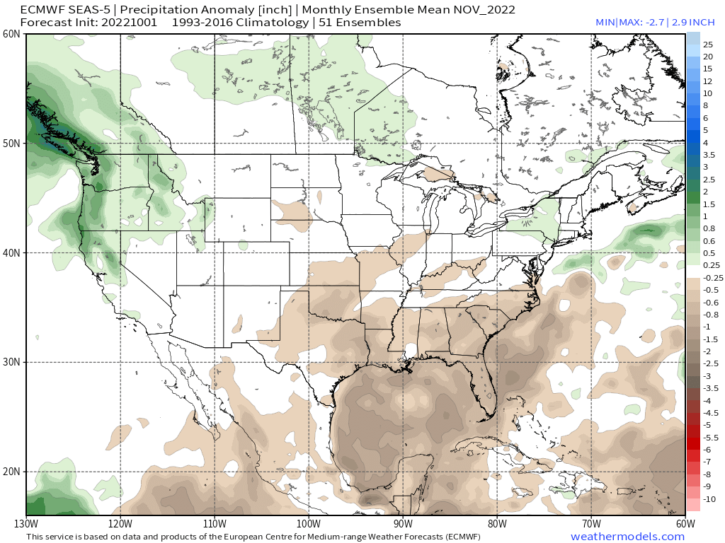
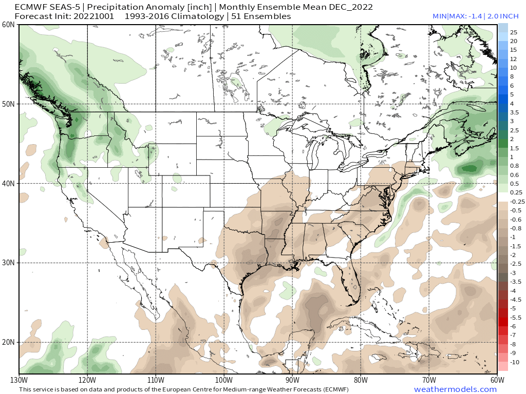
Here is the EPS Seasonal November Monthly Forecast and the forecast chart for the first 3 months of the season.

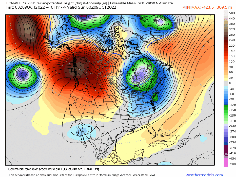
GEFS and EPS Long Range Data
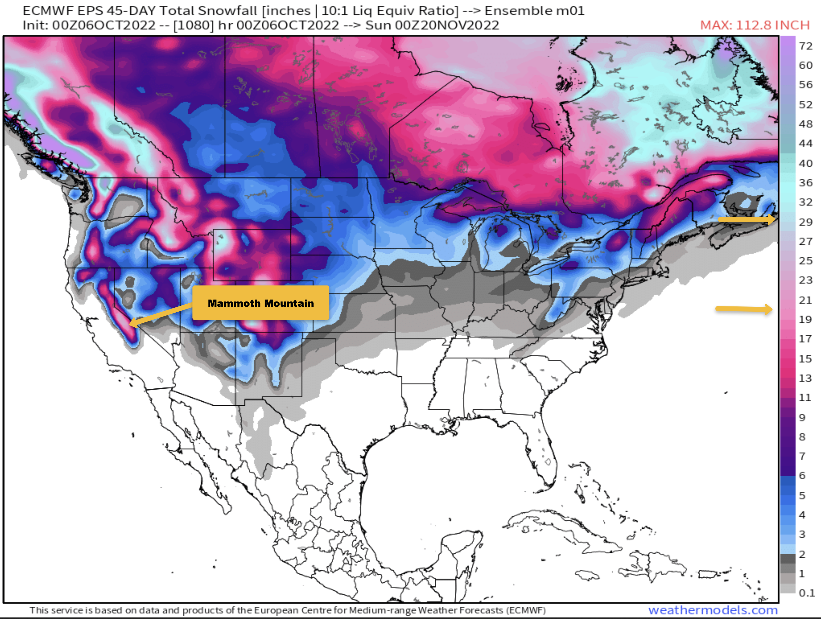
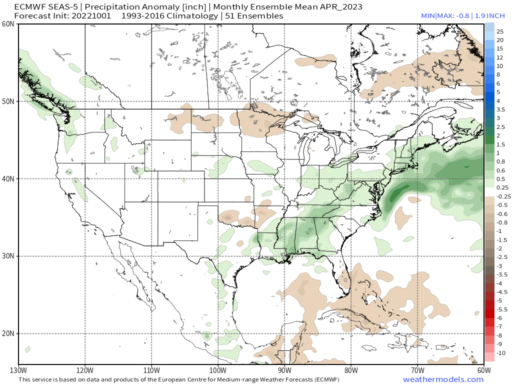
The EPS Ensemble C run (shown below) from 10-6 is starting to pick up on what the EPS Seasonal Model is showing for November. While you can’t forecast QPF out this far, the model is showing moderate amounts of snowfall in the outlook trend.
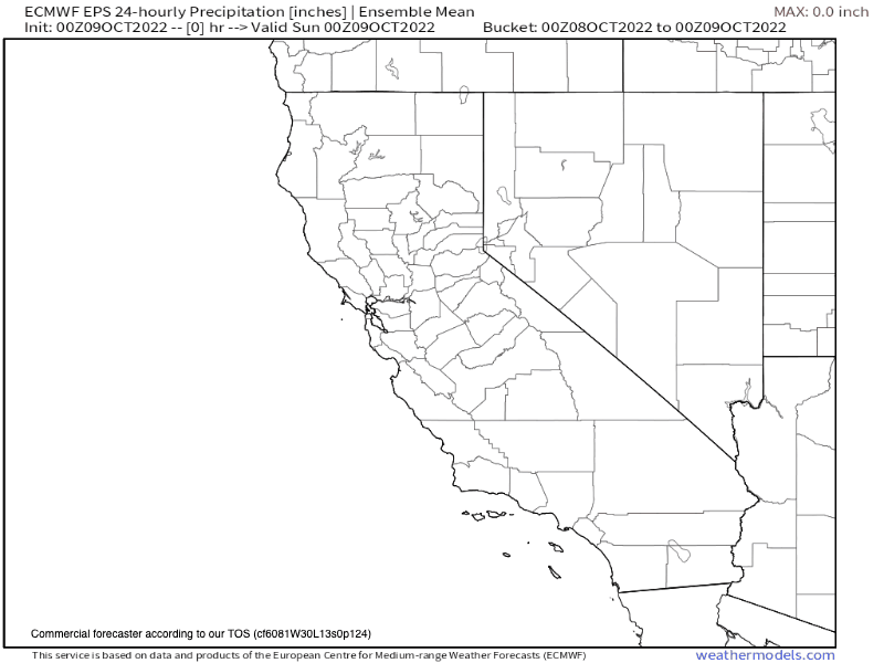
45 Day Snowfall Outlook – EPS 45 Precip
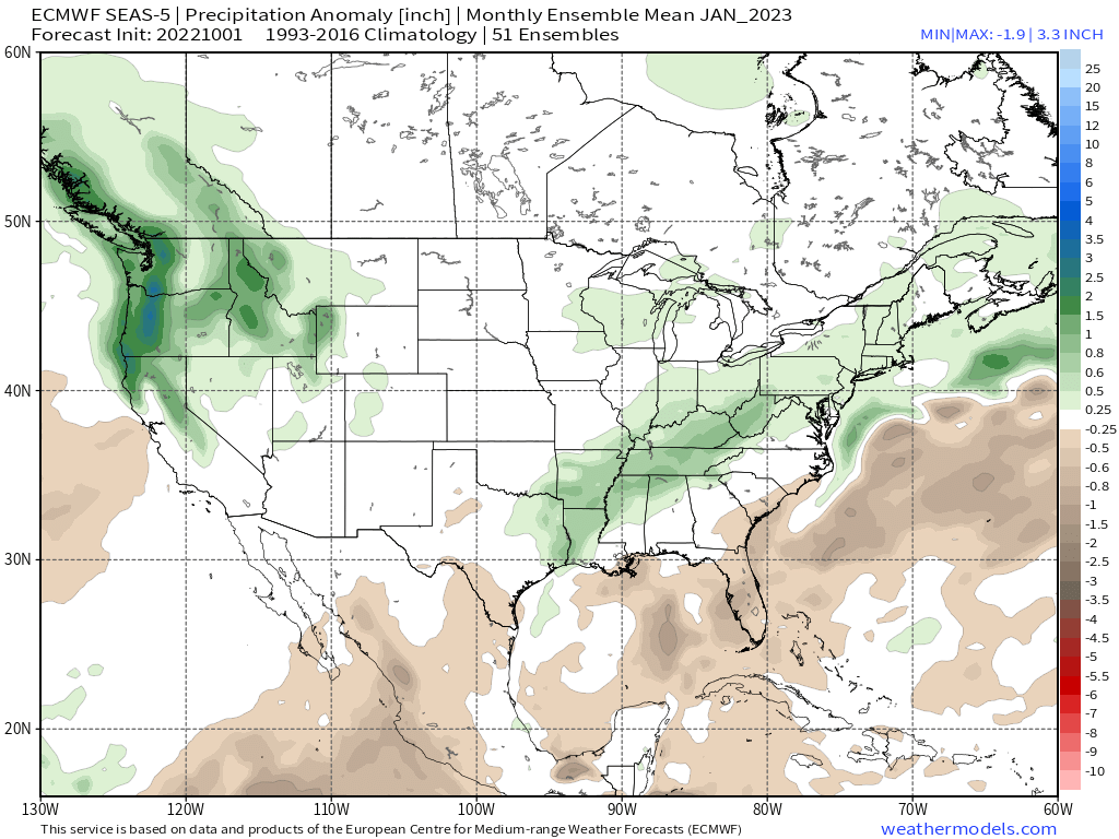
What’s really encouraging is the GEFS Ensembles going out just over 800 hours are also picking up on some decent snowfall for early November. At this point while confidence is low in any out come the trend is in our favor.
GEFS 800 Precip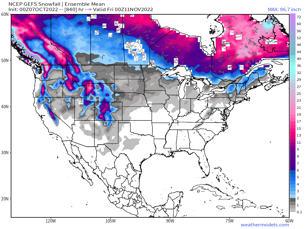 Both of these ensemble runs show an outcome that would allow top to bottom skiing possibly as early as mid November.
Let’s hope and pray for a November to Remember.
Now it’s the waiting game… Snowman


Who Are We?
 Steve Taylor – Mammoth Snowman – Over the last 30+ years, Snowman has spent countless hours studying and learning about Mammoth Mountain Weather and Snow Conditions first hand. He has been skiing around the hill with marked ski poles since March of 1991 so he can measure the fresh snowfall amounts out on the hill.
Snowman started blogging this information back in 1990 on the old Mammoth BBS system, then the RSN Forums and then on to MammothSnowman.com in 2004 with Video & Photo Blog report. (No YouTube back then). Facebook got added to the fold back in 2008 and then the Facebook Group in 2016.
Reports, videos, and photos from the website have been featured on both local TV Stations here in Mammoth, along with AP, Fox, ABC, CBS, and NBC News.
 Ted Schlaepfer – Mammoth WeatherGuy – The Powder Forecast – Posted Tuesday and Fridays at 5 PM November into Mid May. These forecasts are now responsible for many people getting multiple powder days on Mammoth Mountain over the years.
Ted’s Bio: Ted has been a full-time Meteorologist (CCM) for the past 25+ years. He has always been fascinated with the weather,” skiing was just a natural extension of my love for snow and rain. I started skiing at age 5, first discovered Mammoth in 1979 as a youth, and have been a regular visitor since the late ’80s.”.
Here is the link to The WeatherGuys Powder Forecast Page.
Click Here to Learn More About the People Who Make MammothSnowman.com a Reality


