Mammoth Mountain & Eastern Sierra Recreational Weather Forecast
Friday, October 8th, 2021 @ 5:51 AM
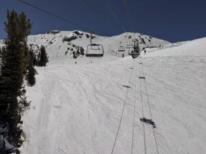
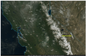
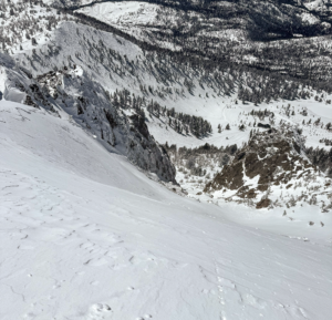
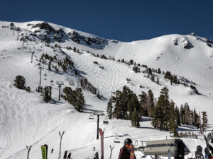
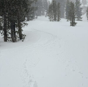
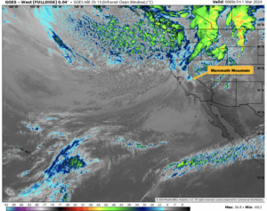
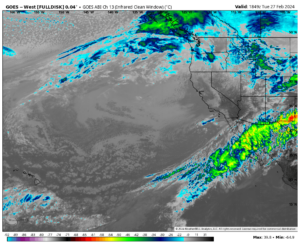
Weather Summary: we have a cut off low that has moved in during the overnight hours. There is already a dusting of fresh snow on the Mammoth Mountain webcams that is visible at 5 AM.
Looking at the latest HRRR model run for possible snowfall amounts today it has 2-3 inches for the Main Lodge area with 6-7 inches over the Top.
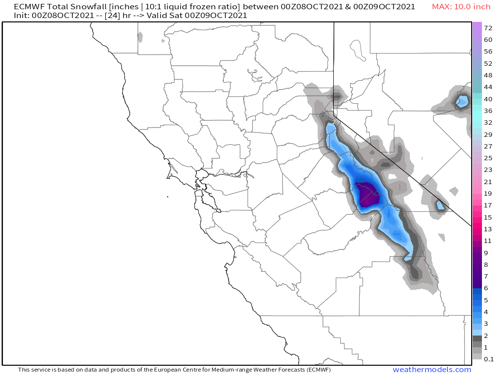
The EPS ensemble we use for our forecasts leading up to the a weather event is sticking with 3-4 inches. The GFS on last nights run also had a good 6-7 inches over the top.
All these models have some locations just a few miles north getting a foot. Will be interesting to see the final totals and compare that to what has been forecast for the last several days.
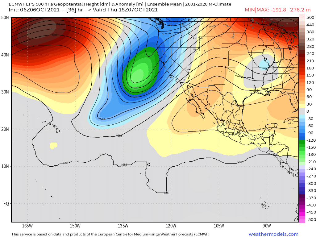
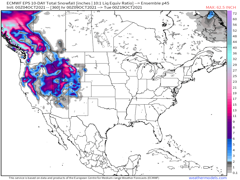
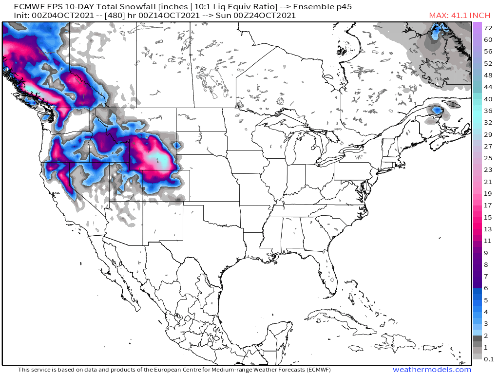
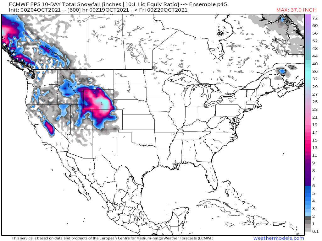
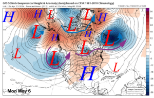
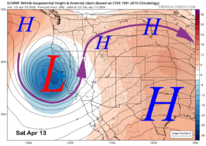
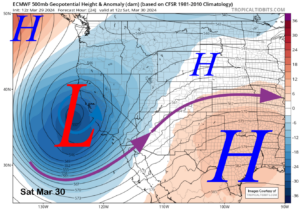
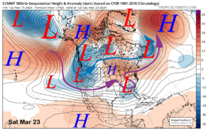
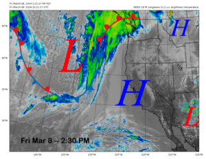
Here is the lastest EPS model run, you can the see the cut off low moving right into California.
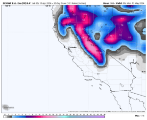
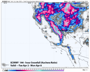
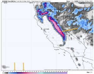
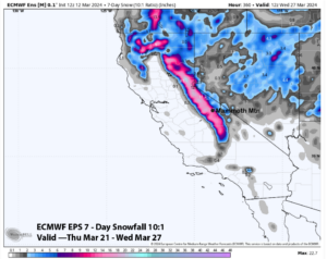
Here are the Snowfall Amounts as forecast at 5 AM today.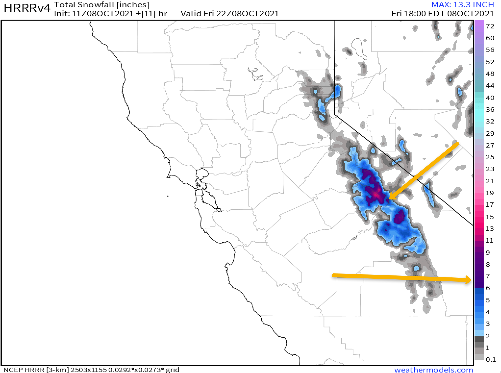

Checking the window cast there is snow and rain in the area at this time. The current snow level is around 8300 feet and is expected to come down to the Village soon. There is still moderate smoke being picked up on the AQI monitors, but I would expect all that bad air to clear out quickly this morning.
Taking a look at local conditions the last couple of days. Yesterday at the top of Mammoth Mountain there was a high of 39, the low this morning was 27. The peak wind gust over the last 24 hours was 45 MPH @ 4 AM out of the WSW. The snow study site is not looking accurate this AM , will take a look at those number after lunch today and what we can come up with.
In Mammoth Lakes, the temperature peaked at 57 degrees on Thursday with a low of 31.8 degrees this morning. Winds in town have been out of the WNW with peak gusts of 15 MPH at 4 AM this morning.
Down in Bishop on Tuesday, there was a temperature of 77 degrees with a low of 43 degrees this morning.
Precipitation and Snowfall: Snowfall amounts for today are forecast in the 1-3 inch range from 8000 feet to the 9000 foot level with 3-4 inches possible above 9000 feet and possibly 5-7 inches over the top of Mammoth Mountain and along the Sierra Crest.
Temperatures: Updating
Winds: Southwest wind 10 to 15 mph, with gusts as high as 30 mph with high gusts over the higher elevations and ridgetops.
Here are the links to the local NWS Forecasts for Main Lodge & the Mammoth Lakes Basin, Mammoth Lakes, June Lake, Crowley Lake, and Bishop.
Fire and Smoke Forecast:

10-6-21 @ 7:08 AM The Weather Story
Two weather systems are forecast to affect Eastern Sierra weather over the next week. The first system will start to effect us today with a shift and increase in the winds. Those winds will start to blow out all the smoke in the area.
On Thursday and more likely on Friday the higher elevations above 7500 – 8000 feet will get snow showers and their first real accumulated dusting of snow for the season. Not looking for much more then 1-3 inches of snow as of this mornings update.
The second system is dropping in over land and is not forecast to bring much more then a dusting of snow to an inch at best. If there is a course change there could possibly be more snow early next week. The main effects will be colder air from that system.
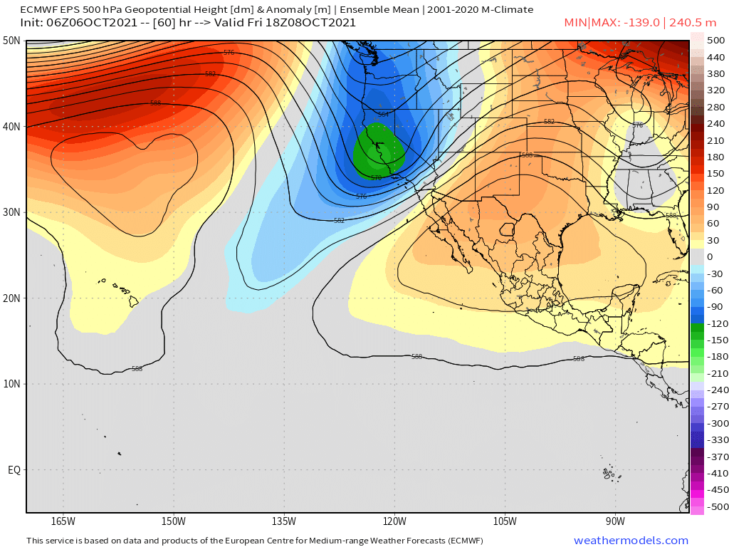
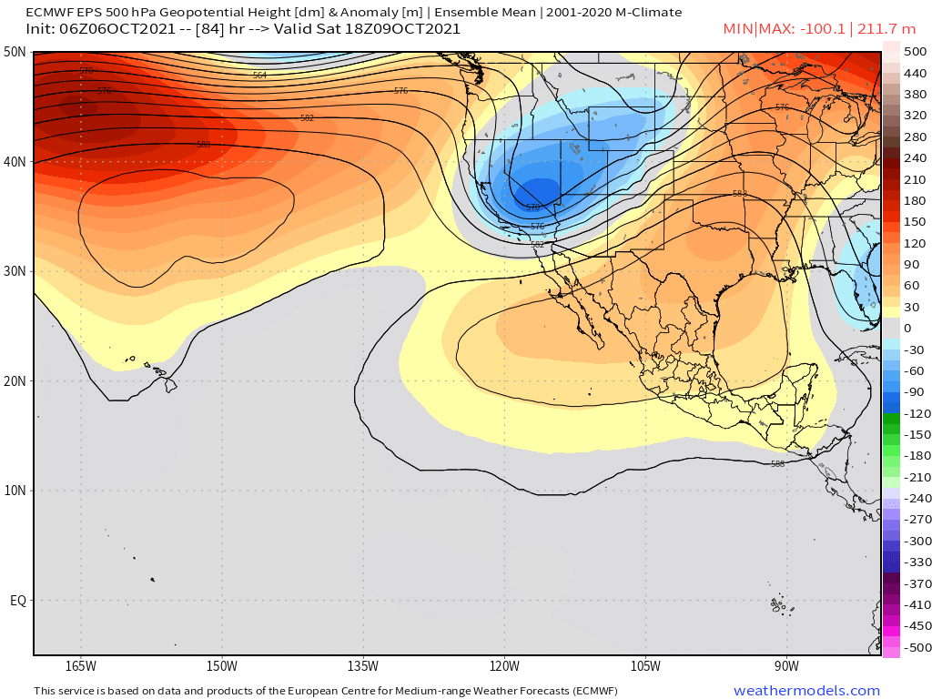
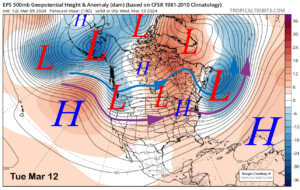
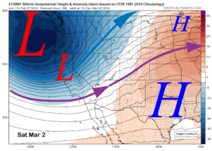
In the gif below you can see the whole process of lows 1 and 2 over the next 7 days.
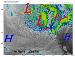
Taking a closer look at the next week. The first system is a cut-off low that is forecast to pinch off from the main low hitting the Pacific North West at this time. You can see that cut-off low pinch of and form on the gif below.
The cut-off low will work its way inland Thursday into late Friday. The best chance for accumulating snowfall from the first system will be Friday as the colder air has moved in along with some convective activity going on during the day.
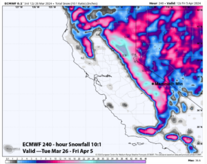
Snowfall amounts will be in the 1-2+ inch range for the higher elevations with the snow a heavy wet slush.
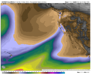
QPF amounts are in the .10-.30 range with a chance for a bit higher amounts. This is a cut-off low so it can be the weather man’s woe tricking us and doing what it wants and not what we forecast.
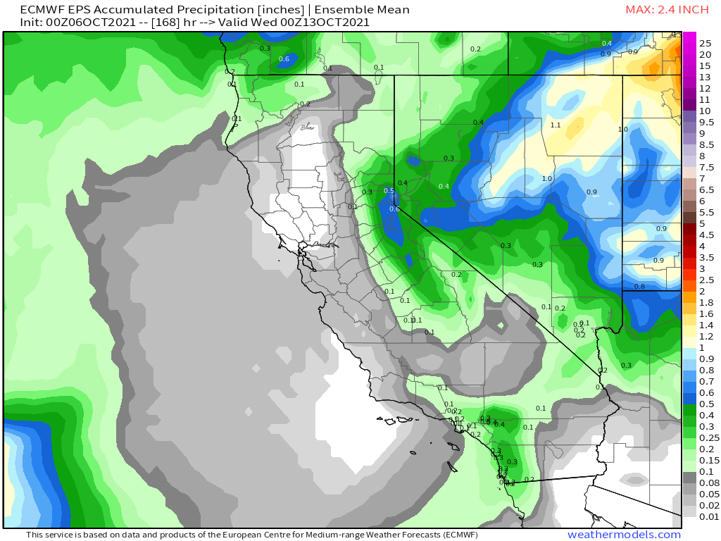
Here are the snowfall amounts that are foretasted on the EPS Ensemble Mean. The Mammoth Mountain Summit is right on the first blue line. That’s right at 2 inches of snow with most of it from the first system moving in. Don’t be surprised if there is more snowfall then the couple inches in the forecast.

Over the weekend the low will move to our east on Saturday and there will be a north to northeast flow in the area and that will keep the Eastern Sierra nice, clear and cool.
Looks like a good chilly weekend to take in some Fall Colors with some snow on the local area peaks. Look for higher elevation leaf burn with the snow and freezing temperatures above 9000 feet.
There will be a slight warm-up in the area on Sunday a head of the next system coming in.
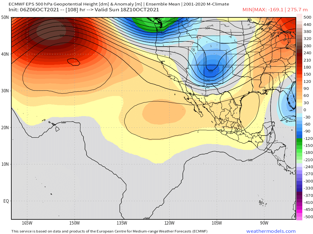
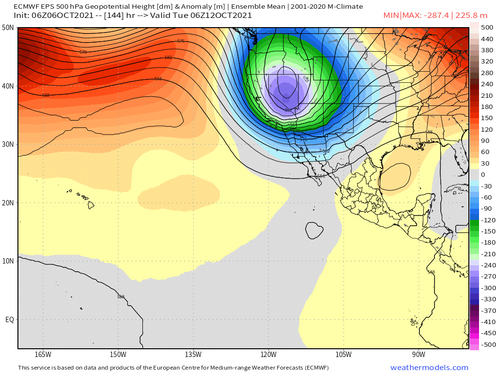
The second low drops down into the area with a path from the direct north, overland. That is a dry but very cold pattern. Not expecting much snowfall over a dusting with that one.

Tuesday is a long ways off so be aware that this lows path is going to change a bit over the next several days. Snowman
Going to stay nice and cool for the next 10 days and beyond. Soon there will be temperature section set up in here so You can take a daily look at the Snowmaking opportunities for the Mammoth Mountain Ski Area. 


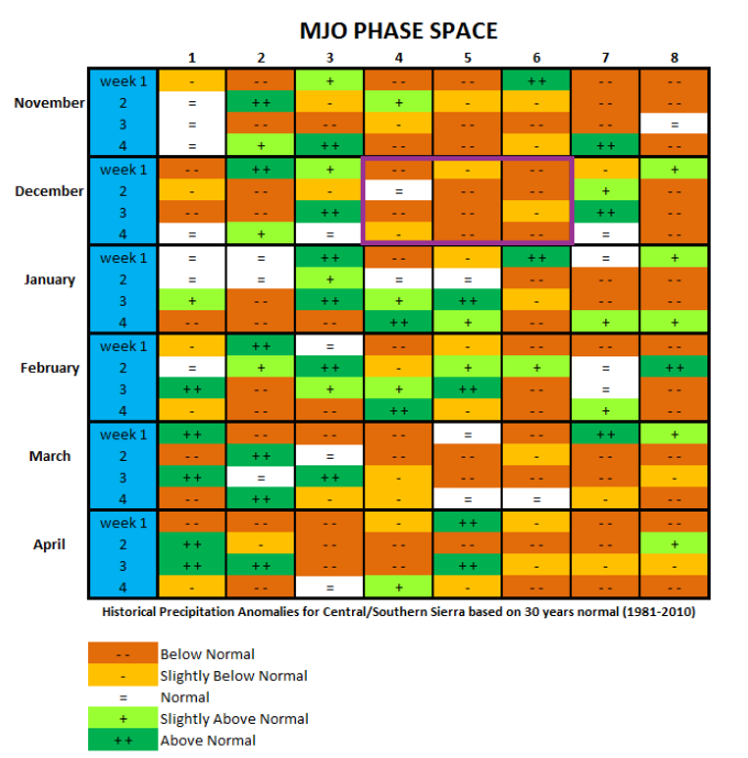
Fantasy Long Range Weather Outlook
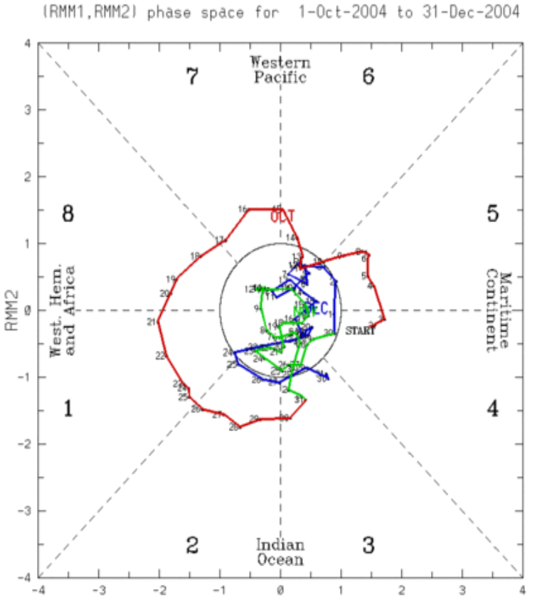
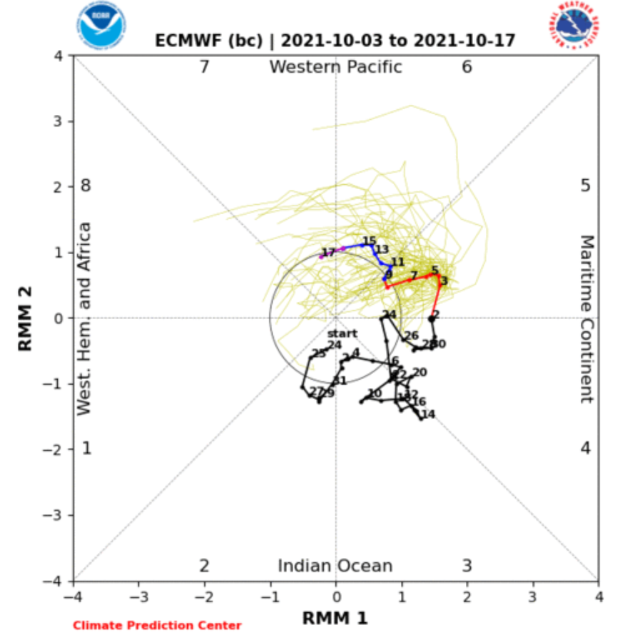
Back in October 2004 we had on of the greatest early season starts ever. The Weatherguy sent me the Mojo images back from 2004 this week and compared them to this year at this time. Let’s hope this years pattern delivers some decent snowfall after mid October like that seasons storms did. We all could use a decent early season base to get started this season. Turns get everyone smiling. 🙂
 |
 |


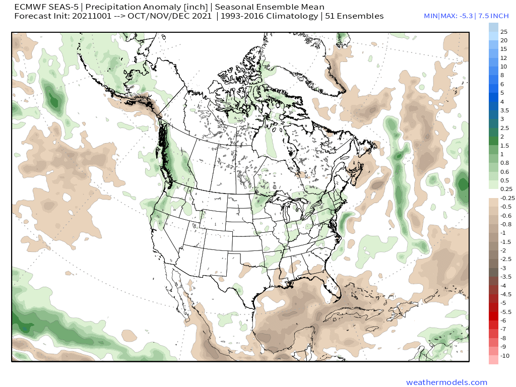
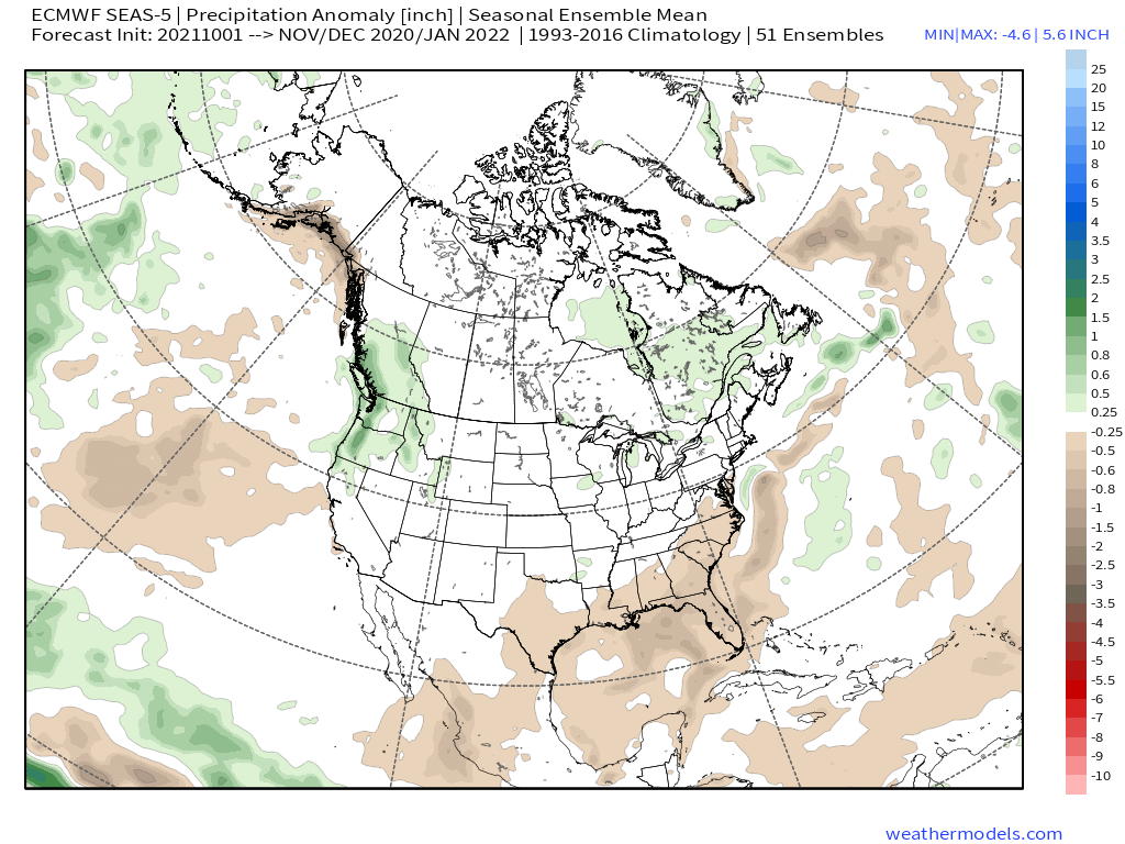
ECMWF Seasonal Ensemble Mean – Monthly Update from 10-1-2021


")

")
")
")
")
Who Are We?
 Steve Taylor – Mammoth Snowman – Over the last 30+ years, Snowman has spent countless hours studying and learning about Mammoth Mountain Weather and Snow Conditions first hand. He has been skiing around the hill with marked ski poles since March of 1991 so he can measure the fresh snowfall amounts out on the hill.
Snowman started blogging this information back in 1990 on the old Mammoth BBS system, then the RSN Forums and then on to MammothSnowman.com in 2004 with Video & Photo Blog report. (No YouTube back then). Facebook got added to the fold back in 2008 and then the Facebook Group in 2016.
Reports, videos, and photos from the website have been featured on both local TV Stations here in Mammoth, along with AP, Fox, ABC, CBS, and NBC News.
 Ted Schlaepfer – Mammoth WeatherGuy – The Powder Forecast – Posted Tuesday and Fridays at 5 PM November into Mid May. These forecasts are now responsible for many people getting multiple powder days on Mammoth Mountain over the years.
Ted’s Bio: Ted has been a full-time Meteorologist (CCM) for the past 25+ years. He has always been fascinated with the weather,” skiing was just a natural extension of my love for snow and rain. I started skiing at age 5, first discovered Mammoth in 1979 as a youth, and have been a regular visitor since the late ’80s.”.
Here is the link to The WeatherGuys Powder Forecast Page.
Click Here to Learn More About the People Who Make MammothSnowman.com a Reality


