Mammoth Mountain Recreational Weather & Travel Forecast
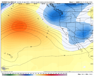
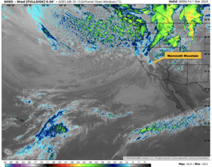
Mammoth Mountain Recreational Weather & Travel Forecast April 26th, 2024 @ 10 AM – Snow Showers are in the area this morning as a weak

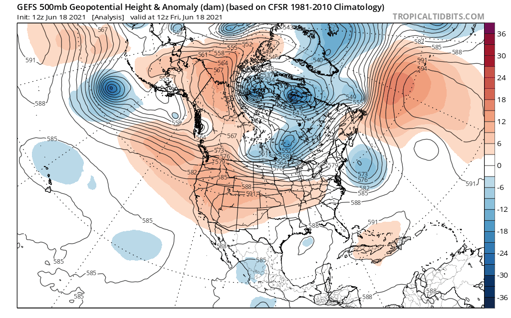
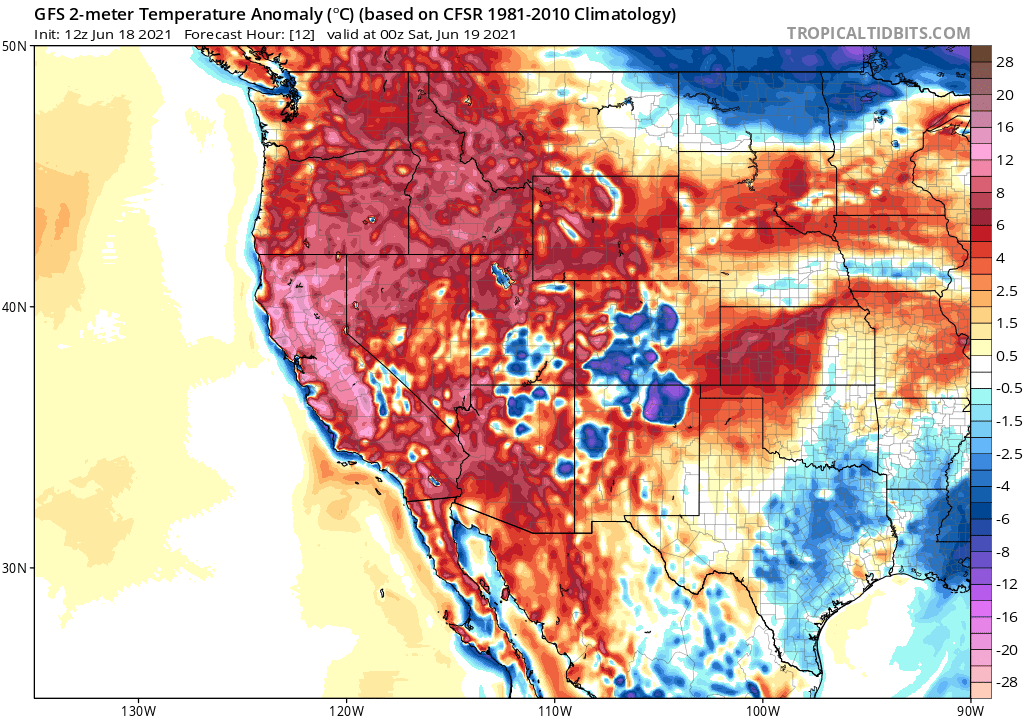
Friday, June 18th, 2021 @ 5 PM Hello everyone, I hope you had a great week and were able to stay cool.
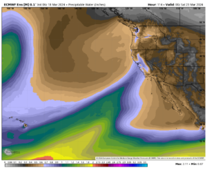
Taking a look at the window cast, we have pt cloudy skies with the t-storms building across the entire Eastern Sierra.
Highs at this point are still near record levels, from Mammoth to Bishop. Dew Points are up in the 40s and it feels hot and muggy.
Yesterday I was up at the Main Lodge around 11 AM and I was thinking wow it’s hot for the 9000-foot level.
I would expect highs at main in the high 60s in late June but it was 80 all the way up to the minaret vista.
They’re where some build-ups on Thursday along with a few showers but it was pretty limited.
Parts of Bishop had a good t storm with some light to moderate showers. The streets even got wet for a bit of time yesterday around 3 PM.
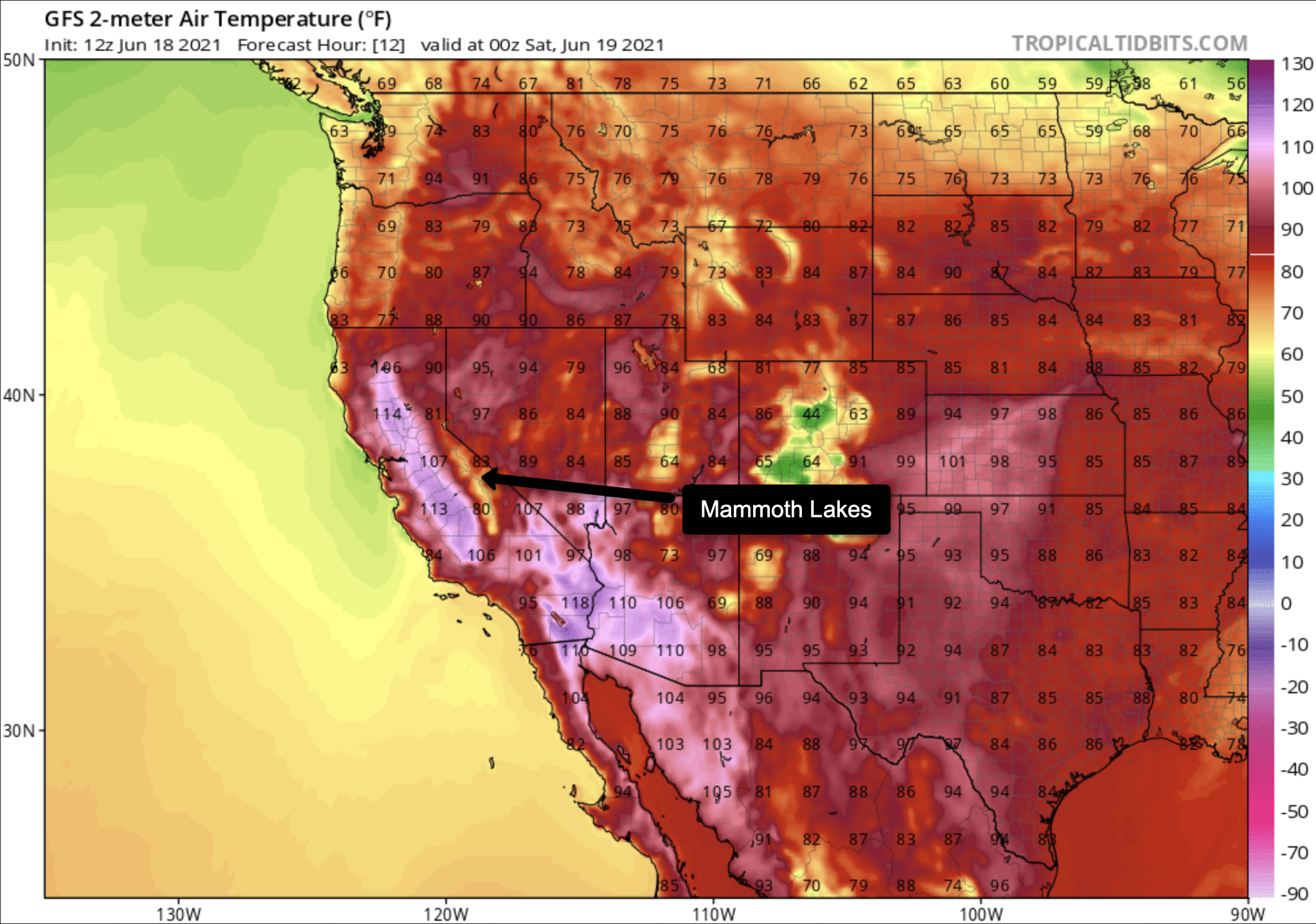
Highs this week have been in the mid to upper 80s in Mammoth Lakes with Bishop in Downtown up to 106 on Tuesday and Wednesday.
The cloud cover on Thursday kept the high down in the mid-90s.
Taking a look around the area this Friday afternoon up at the top of Mammoth Mountain it’s a cool 65 with west winds at 22 MPH gusting to 51 MPH.
Down at Main Lodge, the temperature is 75 with Mammoth Lakes at 78, Crowley Lake at 82, and Bishop at 99.


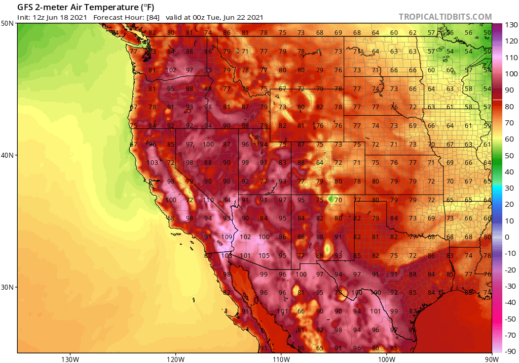
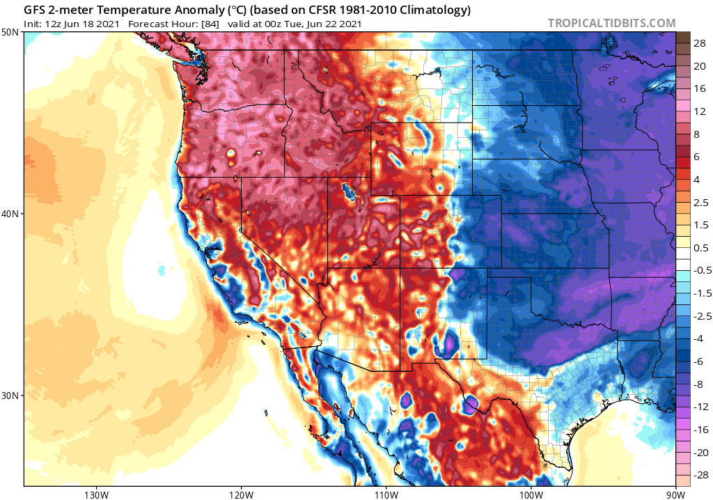
Hot temperatures continue through the weekend with a few record highs possible across the region. Heat impacts are likely across many of the lower valleys of western Nevada. Isolated thunderstorms are possible the rest of this afternoon and evening mainly east of US Highway 395 and south of Interstate 80. The heat should ease slightly next week with breezy winds possible early on in the week.
DISCUSSION…
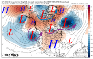
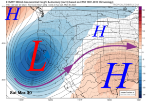
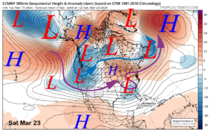
Only minor changes were made to the forecast as the weather pattern is at a mostly steady state at this time with the Four Corners high remaining in place through at least Monday.
The main story continues to be the current heatwave affecting our region. The ridge of high pressure centered over the Four Corners region continues to bring strong subsidence to eastern California and western Nevada.
Temperatures will stay hot through Monday with afternoon highs in the upper 90s to low 100s along with the lower valley floors of western Nevada. In the Sierra, temperatures each afternoon will mainly be in the 80s, with lower valleys reaching near 90degrees.
Due to the lingering high temperatures, we have extended the Heat Advisory until Sunday evening. Heat health impacts are likely especially for those outdoors for extended periods and for sensitive groups. Definitely have a good hydration strategy and try to get outdoor activities done early in the day.
Mammoth Lakes Forested Temperatures at 8000 Feet

Bishop Forecast Temperatures at 4200 Feet

Summary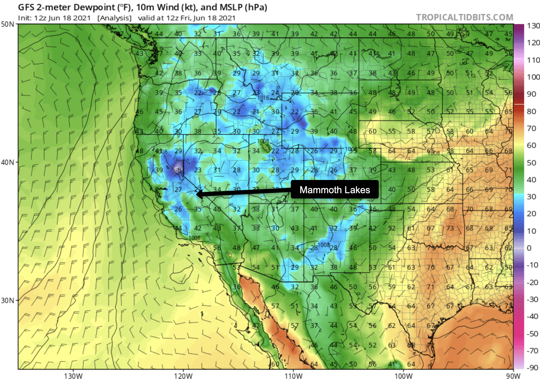
Summary
Summary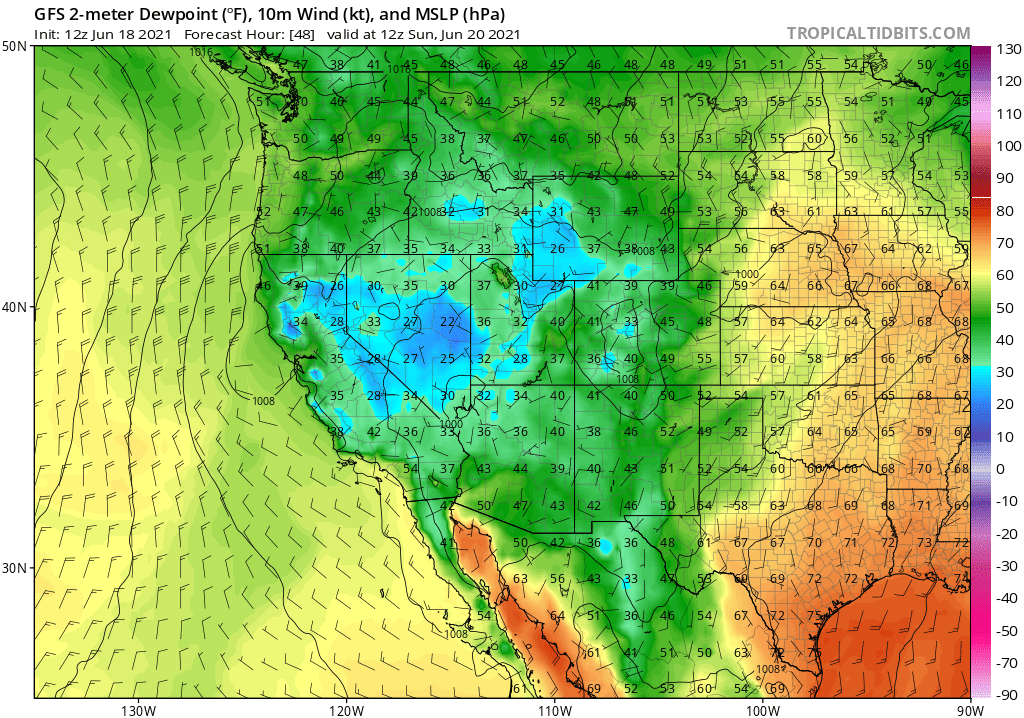
Summary
Air Quality and Fire Weather Watch
So far the air quality is perfect from Mammoth Lakes down to Bishop and in all the backcountry areas above us.
Currently under fire restrictions, the Town of Mammoth Lakes and the Inyo National Forest.
There are no Campfires, BBQs or Smoking allowed now out in the open. Even if you have a fire permit, it is not valid again this season.

___________________


..


")

Mammoth Mountain Recreational Weather & Travel Forecast April 26th, 2024 @ 10 AM – Snow Showers are in the area this morning as a weak
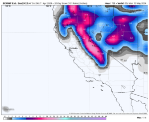
Powder Forecast – Tuesday, April 23rd, 2024 Ted Schlaepfer CCM—- Mammoth Mountain WeatherGuy Snowfall forecasts are valid at the Sesame snow course (Main Lodge) for
Powder Forecast – Tuesday, April 16th, 2024 Ted Schlaepfer CCM —- Mammoth Mountain WeatherGuy Snowfall forecasts are valid at the Sesame snow course (Main Lodge)
Mammoth Mountain Recreational Weather & Travel Forecast Friday, April 12th, 2024 @ 8 AM – Good morning. Today is looking spring-like, with cloudy skies in
Mammoth Mountain Recreational Weather & Travel Forecast 4-10-2024 @ 8 AM – Good morning; the roller coaster of Mammoth spring weather is upon us now.
Powder Forecast – Tuesday, April 9th, 2024 Ted Schlaepfer CCM —- Mammoth Mountain WeatherGuy Snowfall forecasts are valid at the Sesame snow course (Main Lodge)
Latest News …………………………………………………………………..4-7-24 @ 7:30 AM… Sunny Skies with Mid Winter Conditions… Spring Expected by Mid Week… Mammoth has a base of Ski Ya Later
Mammoth Mountain Recreational Weather & Travel Forecast 4-7-2024 @ 9:25 AM – Good morning; the roller coaster of Mammoth spring weather is upon us now.
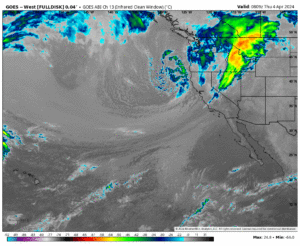
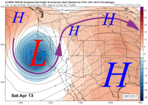
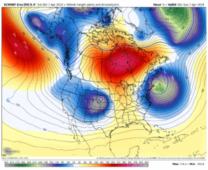
Mammoth Mountain Recreational Weather & Travel Forecast 4-4-2024 @ 11 AM – Good morning; a deep cold low-pressure system has moved into the area at
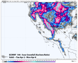
Powder Forecast – Tuesday, April 2nd, 2024 Ted Schlaepfer CCM—- Mammoth Mountain WeatherGuy Snowfall forecasts are valid at the Sesame snow course (Main Lodge) for
Powder Forecast – Friday, March 29th, 2024 Ted Schlaepfer CCM —- Mammoth Mountain WeatherGuy Snowfall forecasts are valid at the Sesame snow course (Main Lodge)
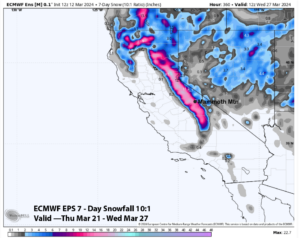
Mammoth Mountain Recreational Weather & Travel Forecast 3-29-2024 @ 10 AM — Good morning. The next winter low-pressure system is moving into the Mammoth Mountain
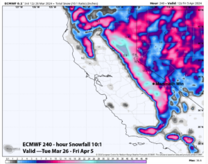
Powder Forecast –Tuesday, March 26th, 2024 Ted Schlaepfer CCM —- Mammoth Mountain WeatherGuy Snowfall forecasts are valid at the Sesame snow course (Main Lodge) for
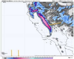
Mammoth Mountain Weather Forecast & Discussion 3-20-2024 @ 9:30 AM – If you’re heading out on Mammoth Mountain today, expect clear skies with light west-to-southwest
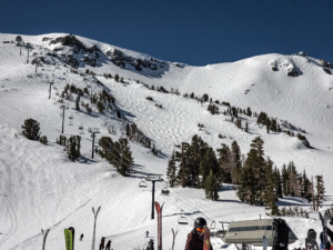
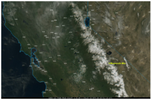
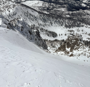
Mammoth Mountain Photos – March 10th – 19th, 2024 3-10-24 – Philippes 3-19-24 – Face of 3 – Photo from The Snowman 3-19-24 – View
Mammoth Mountain Weather Forecast & Discussion Mammoth Mountain Recreational Weather & Travel Forecast 3-18-2024 @ 9:30 AM – If you’re heading out on Mammoth Mountain
Powder Forecast – Friday, March 15th, 2024 Ted Schlaepfer CCM —- Mammoth Mountain WeatherGuy No updates next week; the next update is on 3/26 Snowfall
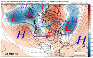
Powder Forecast – Tuesday, March 12th, 2024 Ted Schlaepfer CCM —- Mammoth Mountain WeatherGuy **Snowfall forecast confidence ranges from very low (1) to very high
Powder Forecast – Friday, March 8th, 2024 Ted Schlaepfer CCM —- Mammoth Mountain WeatherGuy Sesame Snow Course **Snowfall forecast confidence ranges from very low (1)
Powder Forecast –Tuesday, March 5th, 2024 Ted Schlaepfer CCM —- Mammoth Mountain WeatherGuy Snowfall forecasts are valid at the Sesame snow course (Main Lodge) for
Latest News …………………………………………………………………..3-2-24 @ 5:30 AM…Estimated New Snowfall is at 28-37 Inches with Heavy Snowfall & Blizzard Conditions… The BLIZZARD WARNING IS IN EFFECT TO
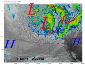
Powder Forecast – Friday, March 1st, 2024 Ted Schlaepfer CCM —- Mammoth Mountain WeatherGuy Snowfall forecasts are valid at the Sesame snow course (Main Lodge)
Mammoth Mountain Weather Forecast & Discussion Mammoth Mountain Recreational Weather and Travel Forecast BLIZZARD WARNING IN EFFECT FROM 4 PM THURSDAY TO 10 AM PST
Mammoth Mountain Weather Forecast & Discussion Mammoth Mountain Recreational Weather and Travel Forecast BLIZZARD WARNING IN EFFECT FROM 4 PM THURSDAY TO 10 AM PST
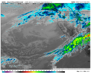
Powder Forecast – Tuesday, February 27th, 2024 Ted Schlaepfer CCM —- Mammoth Mountain WeatherGuy Snowfall forecasts are valid at the Sesame snow course (Main Lodge)
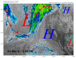
Mammoth Mountain Weather Forecast & Discussion Mammoth Mountain Recreational Weather and Travel Forecast February 26th, 2024 @ 2:30 PM – If you’re heading to the
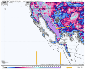
Mammoth Mountain Weather Forecast & Discussion February 25th, 2024, at 9 AM – Good morning; here is what you can expect this week for the


")
Who Are We?
 Steve Taylor – Mammoth Snowman – Over the last 30+ years, Snowman has spent countless hours studying and learning about Mammoth Mountain Weather and Snow Conditions first hand. He has been skiing around the hill with marked ski poles since March of 1991 so he can measure the fresh snowfall amounts out on the hill.
Snowman started blogging this information back in 1990 on the old Mammoth BBS system, then the RSN Forums and then on to MammothSnowman.com in 2004 with Video & Photo Blog report. (No YouTube back then). Facebook got added to the fold back in 2008 and then the Facebook Group in 2016.
Reports, videos, and photos from the website have been featured on both local TV Stations here in Mammoth, along with AP, Fox, ABC, CBS, and NBC News.
 Ted Schlaepfer – Mammoth WeatherGuy – The Powder Forecast – Posted Tuesday and Fridays at 5 PM November into Mid May. These forecasts are now responsible for many people getting multiple powder days on Mammoth Mountain over the years.
Ted’s Bio: Ted has been a full-time Meteorologist (CCM) for the past 25+ years. He has always been fascinated with the weather,” skiing was just a natural extension of my love for snow and rain. I started skiing at age 5, first discovered Mammoth in 1979 as a youth, and have been a regular visitor since the late ’80s.”.
Here is the link to The WeatherGuys Powder Forecast Page.
Click Here to Learn More About the People Who Make MammothSnowman.com a Reality


