
Mammoth Lakes and Eastern Sierra Weather for Tuesday, September 7th, 2021 @ 12:33 PM
With Labor Day behind us, everyone wants to know two things.
When will we get our first real taste of Fall, and when will we see the first dusting of snow this Season?
Looking at all the weather models, the 7, 10, and 16-day outlooks show that we are going to get more Summertime.
It will be warm today and again on Thursday then look for a rapid cool down on Friday into the weekend.
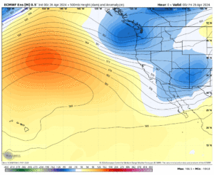
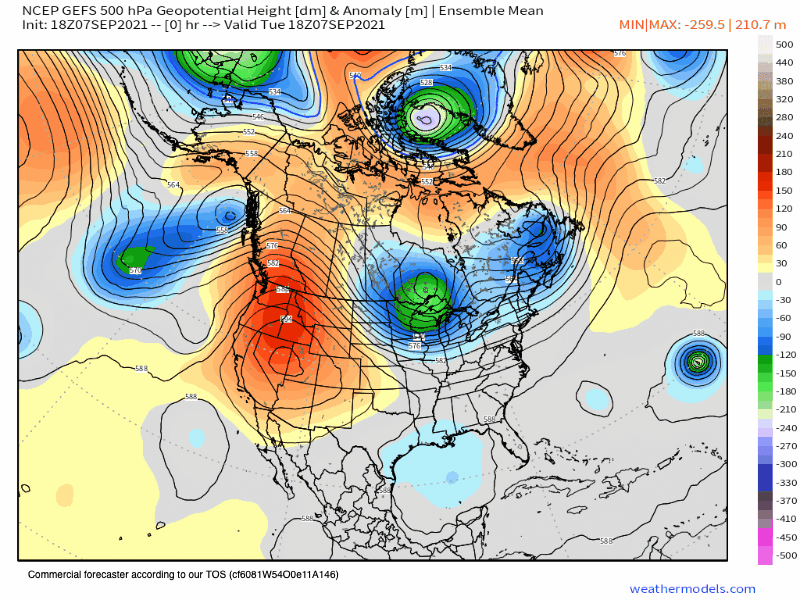
Weather Synopsis… The big ridge of high pressure that is pumping up these warm days with lower elevation heat will start its move to the east over the next couple of days.
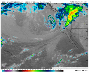
That will open the door to some very limited moisture leading to a 10-20% chance of a few
Thunder Storms going off. This could result in some dry lightning strikes over the Sierra.
As the high leaves the area it’s going to be replaced by a short-lived weak trough off the west coast.
This setup will be quickly followed by more high pressure in the area leading to just above average highs this time of year.
As of now, this pattern looks like it will be with us over the next 2+ weeks, and then let’s hope for signs of the annual first dusting of snow and some cooler weather.
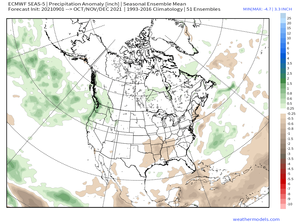
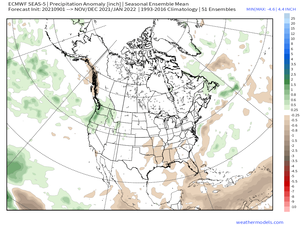
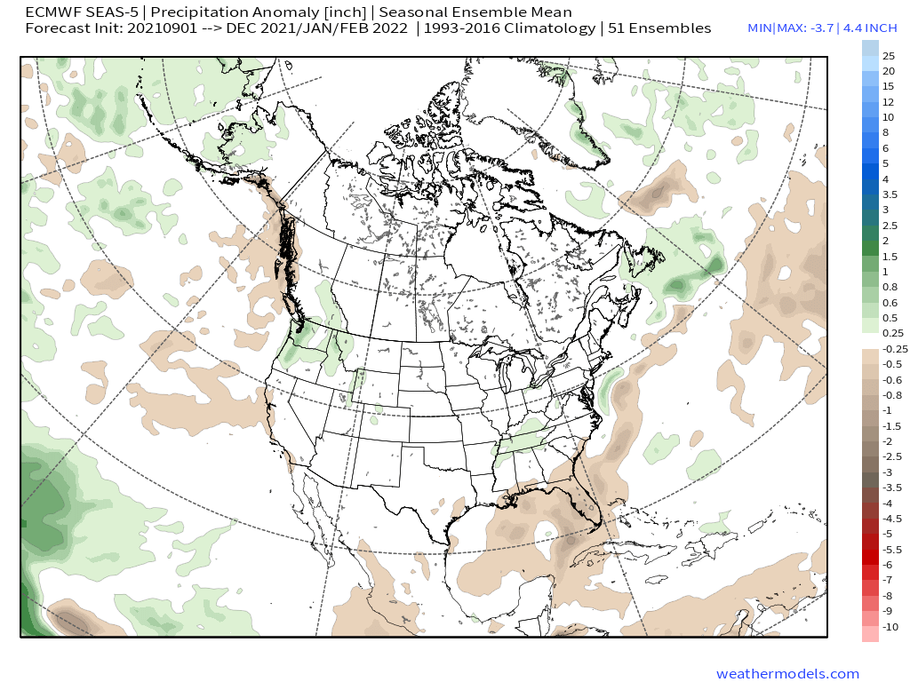
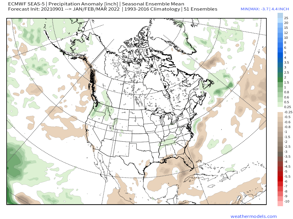
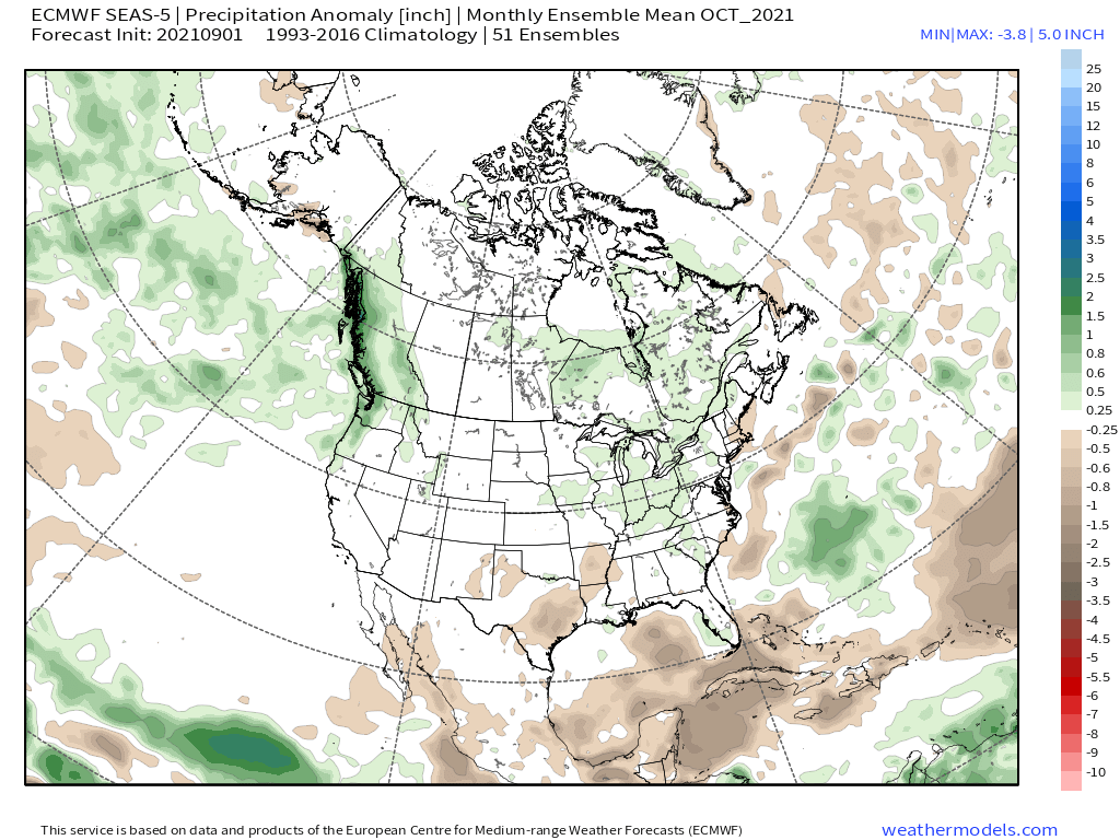
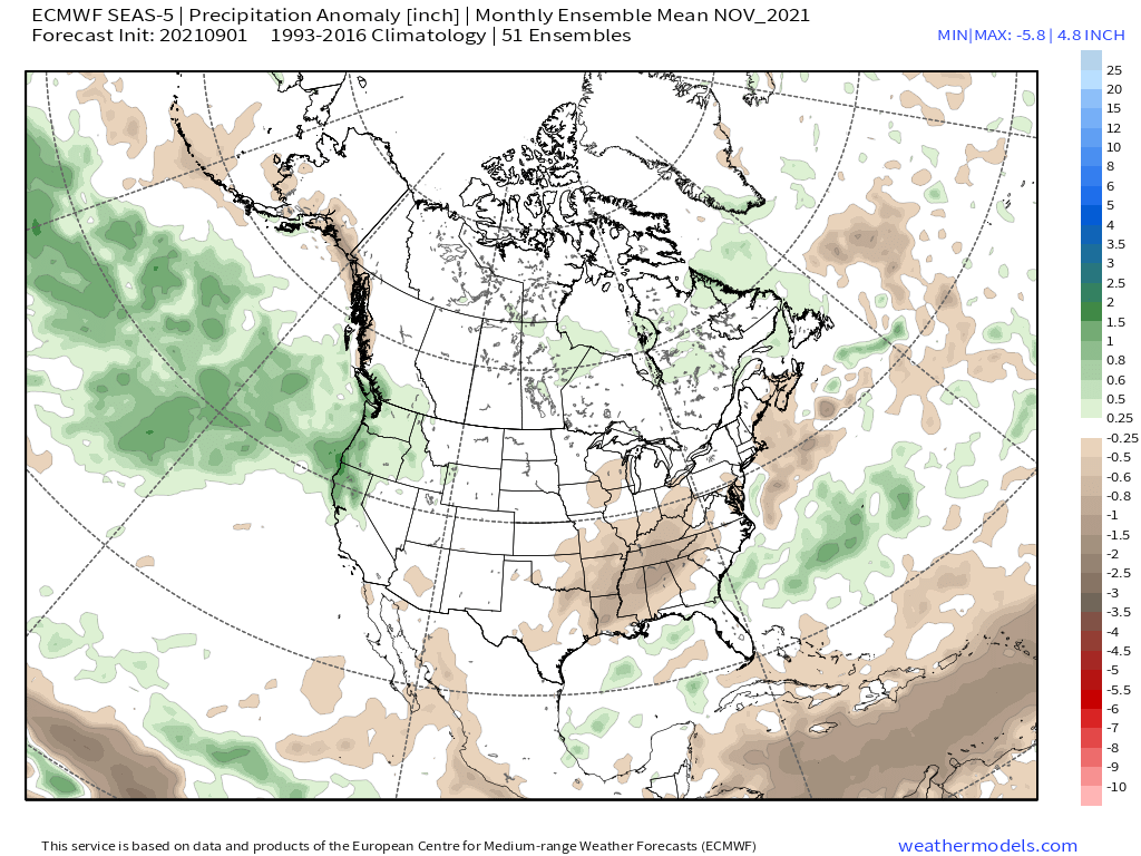
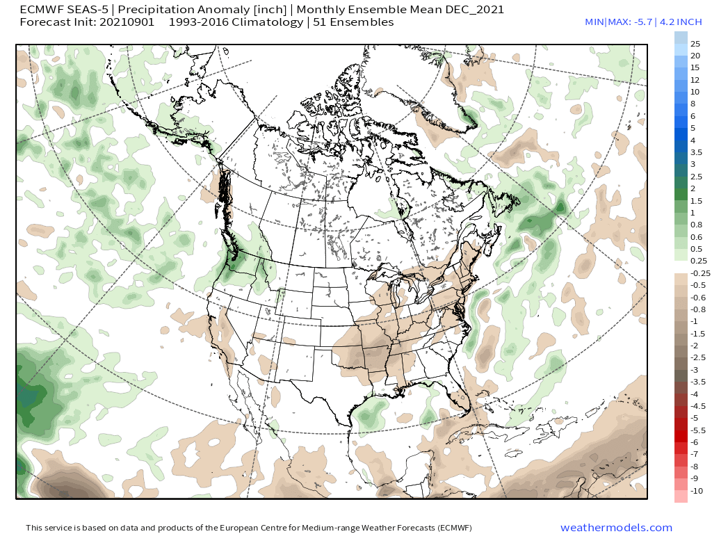
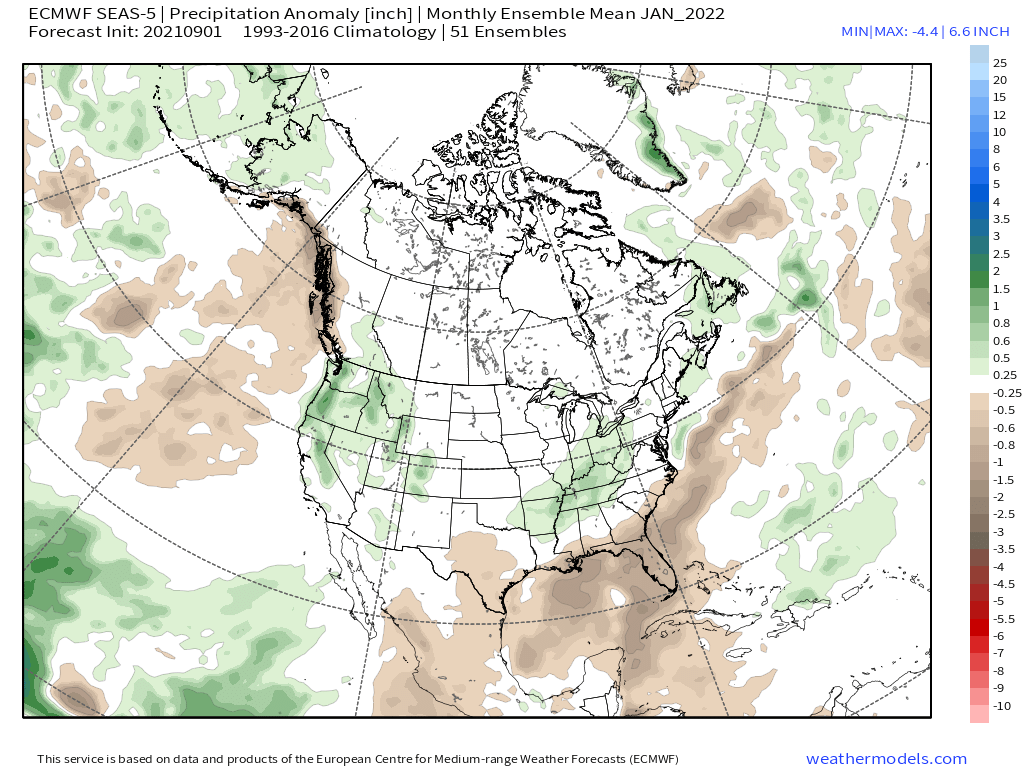
Also to note: The New ECMWF Long range charts got released on the 5th, I have posted the outlooks for the October – January time frame down the page. They sure look better than what a lot of people are expecting to see.
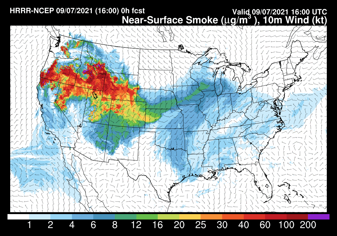
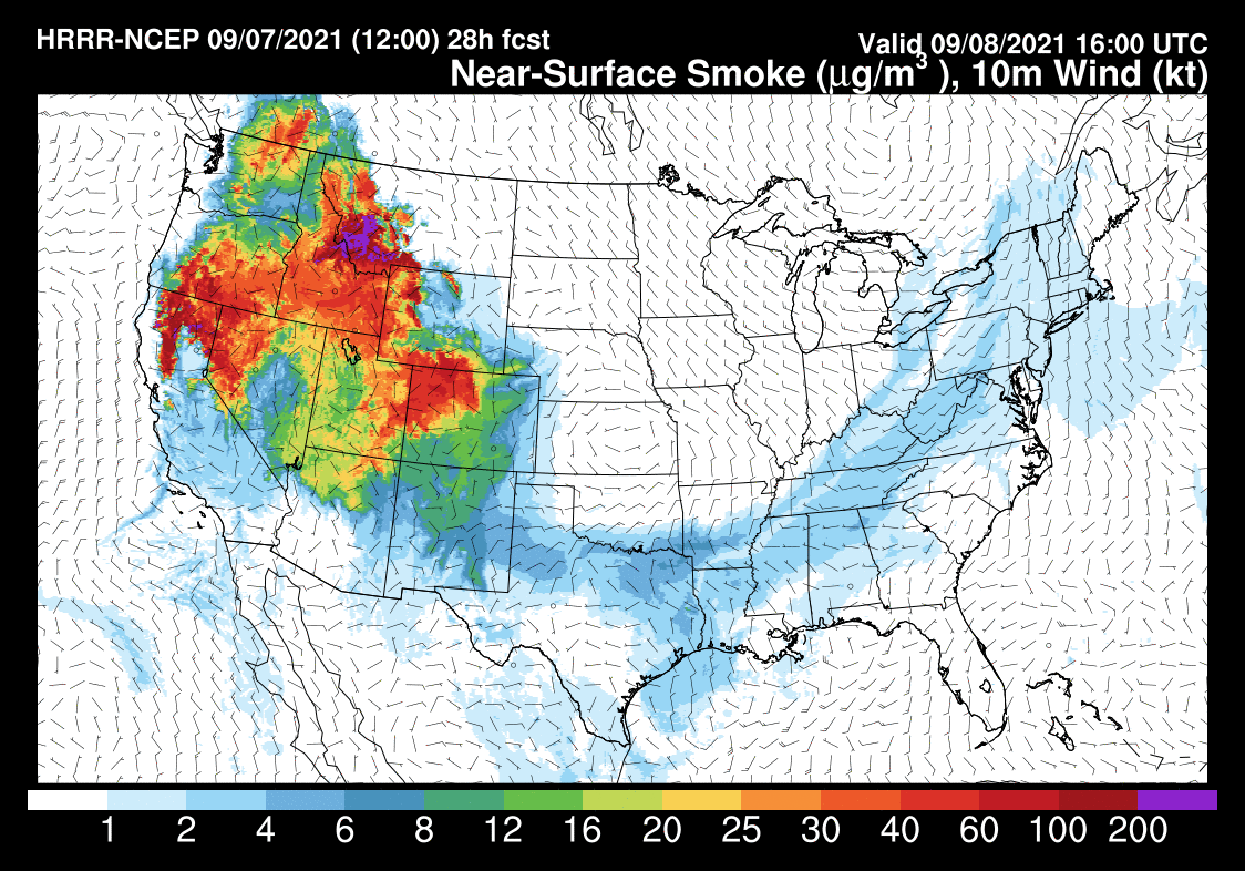
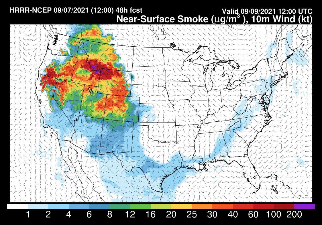
Smoke and Haze Update: As the west to southwest wind flow has weakened a bit there has been an increase in haze and the local air quality has suffered just a bit.
I would expect days like today to be with us more often than not the next few weeks. As long as we don’t have any new fire starts, the air quality will remain. Much better than it was at this time last year when the creek fire was burning just to our west.
 Temperatures:
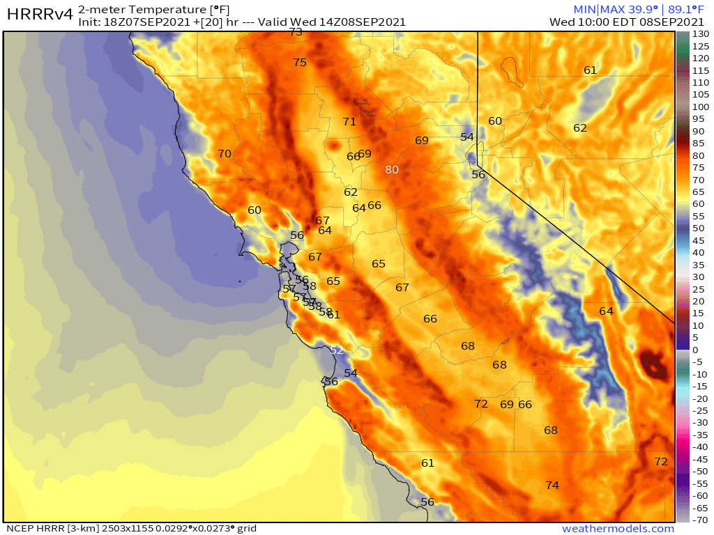
Mammoth will be into the low to mid-80s today with Bishop into the low 100s during the later afternoon hours.
Once we get to Friday the forecast is calling for at least a 7-10 degree drop in high temperatures. Nighttime lows are cooling off into the mid to upper 40s for the high country and into the mid to upper 50s in the Bishop and Round Valley areas.
Winds: West to South West winds will be the rule at 5-15 MPH in the lower elevation with 10-20 MPH and gust up to 30 MPH over the higher ridge of the Eastern Sierra. Once we get the thunderstorms into the area there could be much stronger wind gusts in the areas where storms form.
Here are the links to the local NWS Forecasts for Main Lodge & the Mammoth Lakes Basin, Mammoth Lakes, June Lake, Crowley Lake, and Bishop.
Extended Outlook: Looking out towards the early Fall season we can expect to start to see insider sliders show up by late September into early October. Many a year there will also be the first dusting of snow later in the month of September.
I am watching daily and will post when we have something to talk about. I do promises not to jump on the hype train here with false expectations.
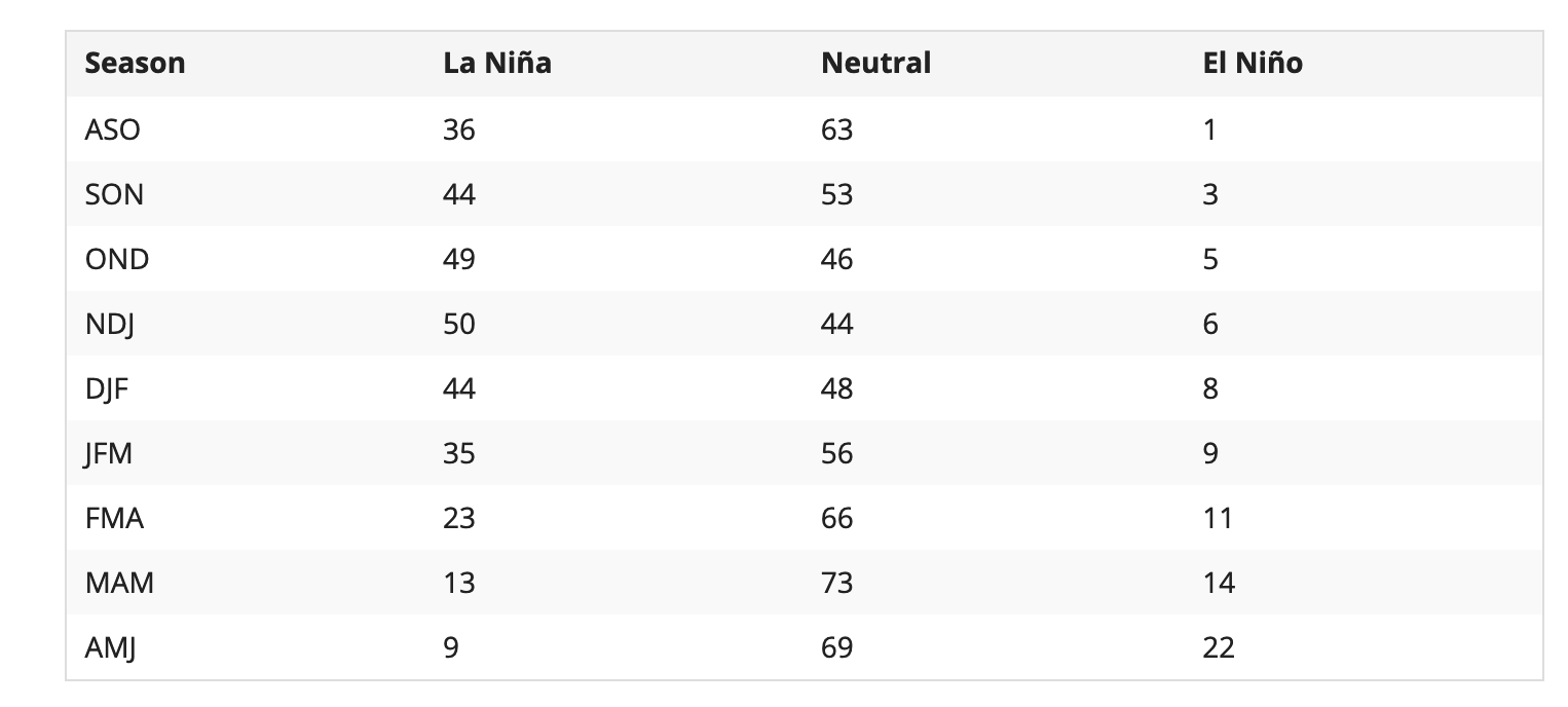
For the upcoming Winter, more than half of the extended models have us in a neutral ENSO state, with some showing a weak La Nina. As of now, I expect the chances of an average snowfall winter are much greater than a 3rd year of exponential drought. 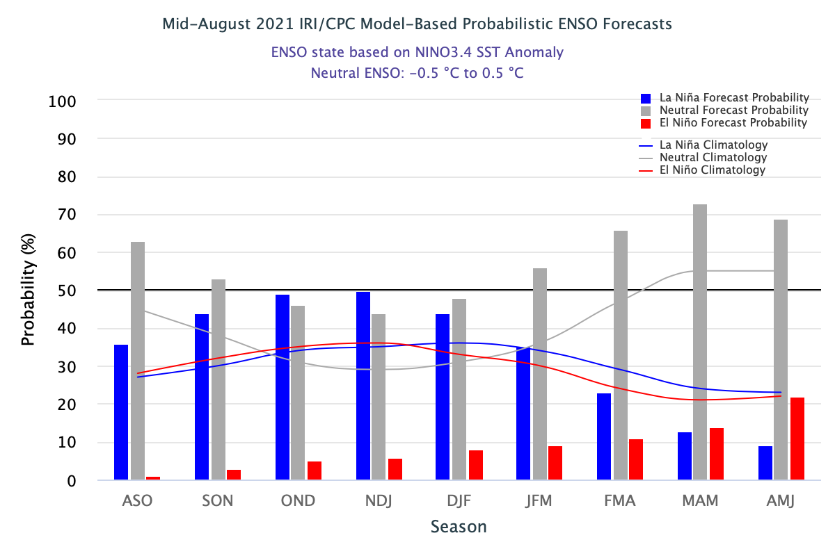


HRRR Temperature Forecast 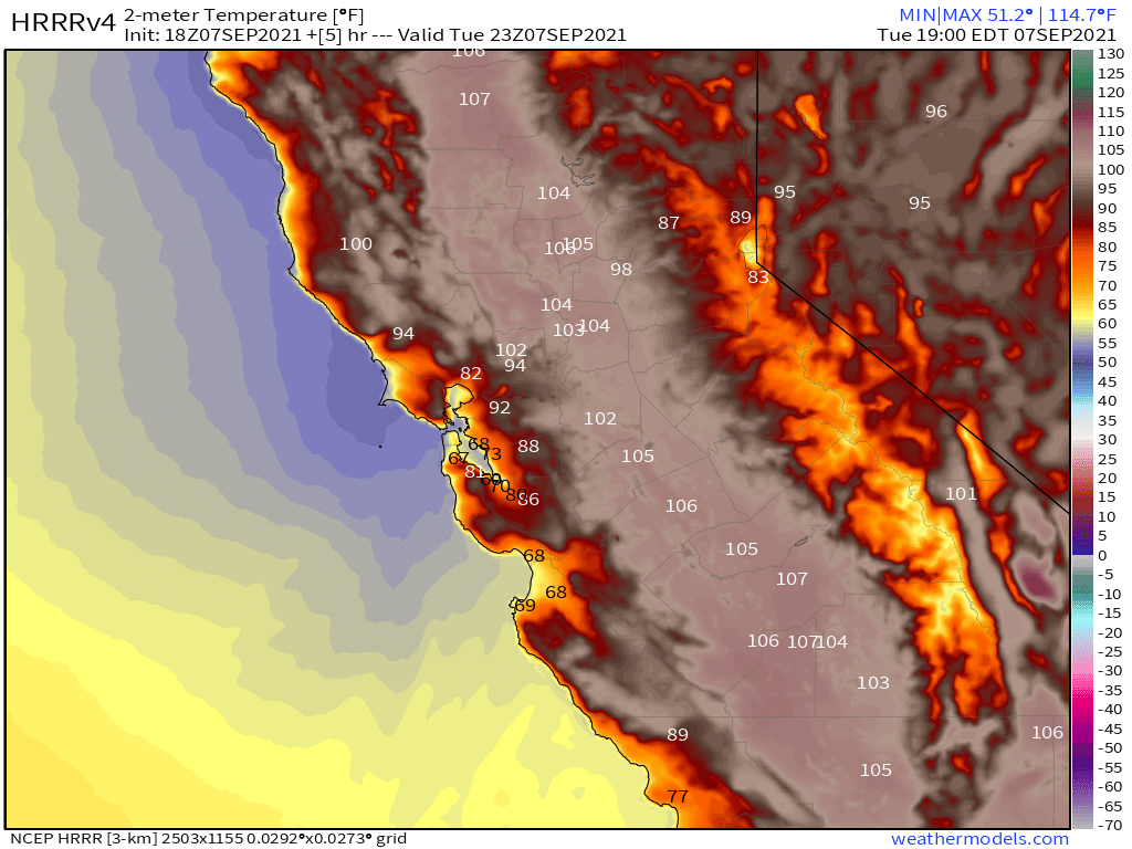

HRRR Precipitation Forecast 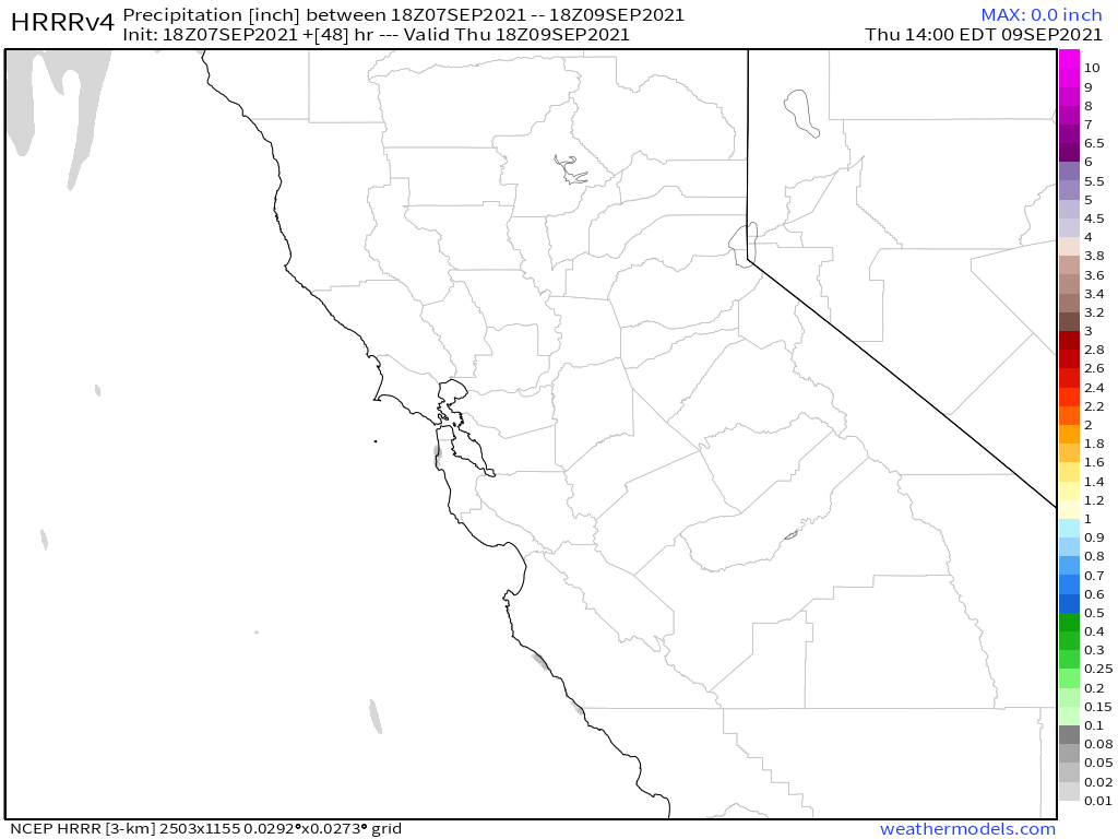
HRRR Current Dew Point
HRRR Current Humidity Levels 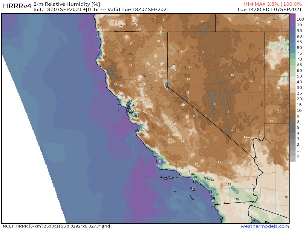
GEFS Ensemble going out 10 days / 240 hour
ECMWF EPS Ensemble going out 10 days / 240 hour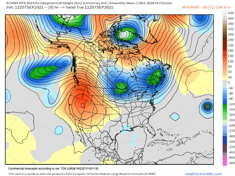
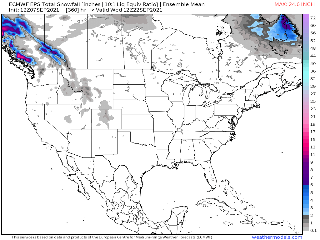
ECMWF EPS Accumulated Snowfall
GFS Accumulated Snowfall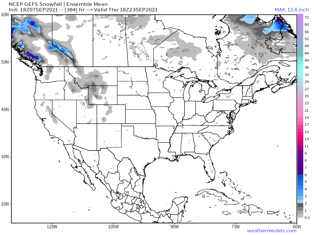
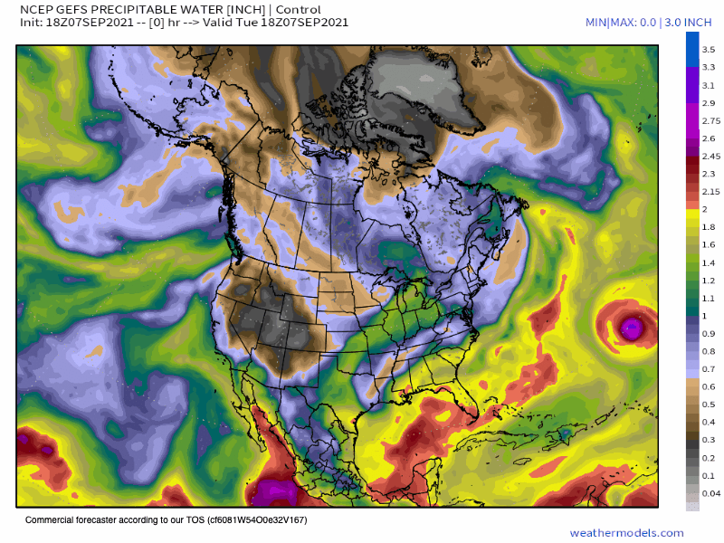
Precipitable Water
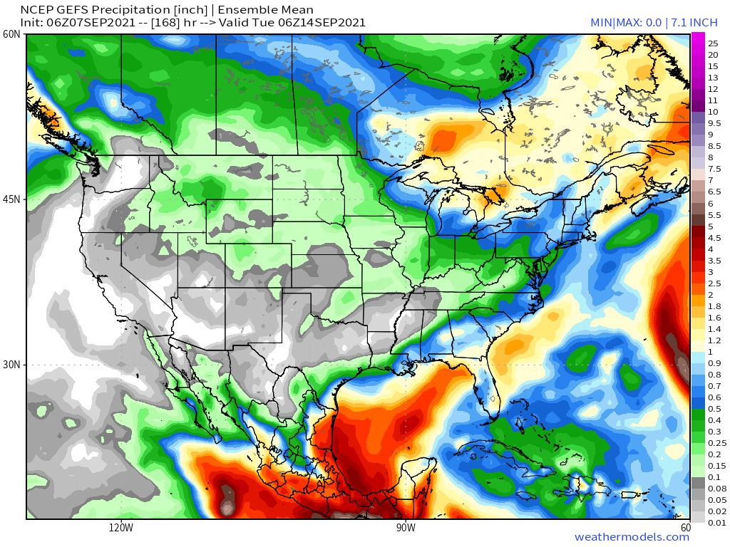
GEFS Accumulated Precipitation
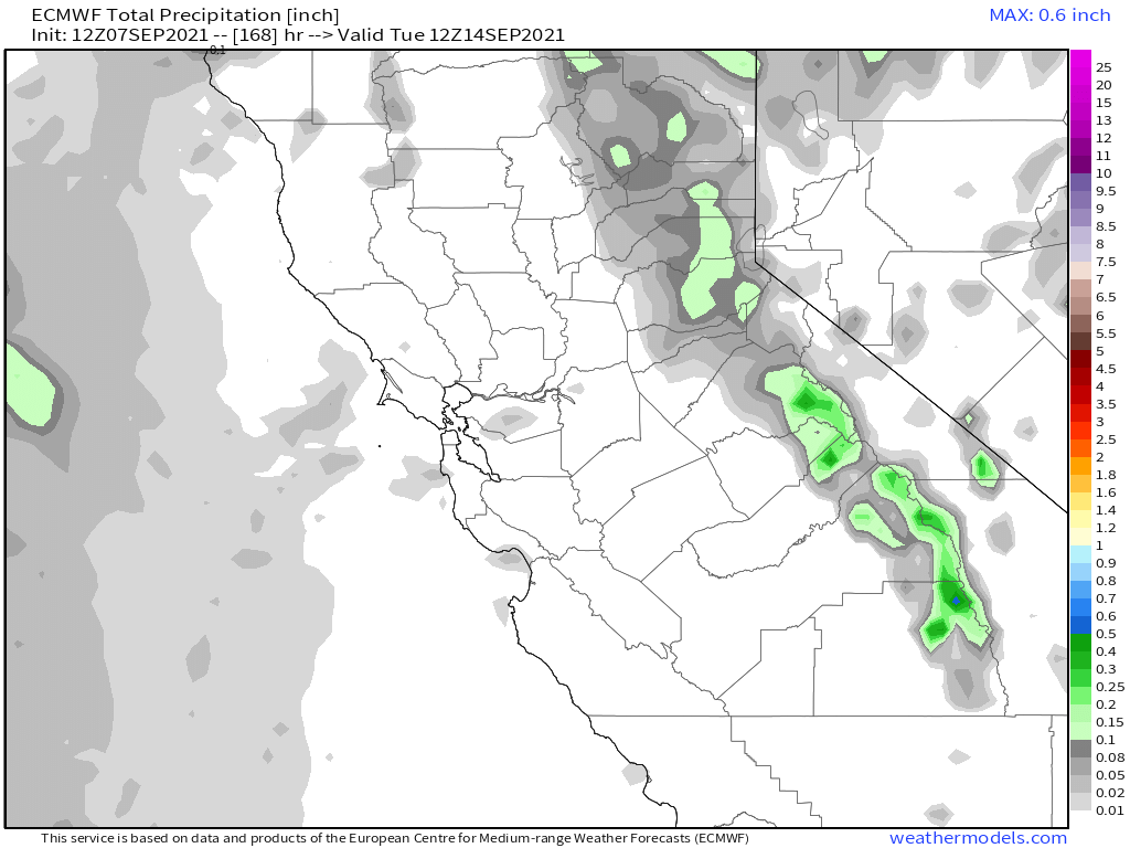
ECMWF EPS Accumulated Precipitation
Long Range Outlooks from the ECMWF
Who Are We?
 Steve Taylor – Mammoth Snowman – Over the last 30+ years, Snowman has spent countless hours studying and learning about Mammoth Mountain Weather and Snow Conditions first hand. He has been skiing around the hill with marked ski poles since March of 1991 so he can measure the fresh snowfall amounts out on the hill.
Snowman started blogging this information back in 1990 on the old Mammoth BBS system, then the RSN Forums and then on to MammothSnowman.com in 2004 with Video & Photo Blog report. (No YouTube back then). Facebook got added to the fold back in 2008 and then the Facebook Group in 2016.
Reports, videos, and photos from the website have been featured on both local TV Stations here in Mammoth, along with AP, Fox, ABC, CBS, and NBC News.
 Ted Schlaepfer – Mammoth WeatherGuy – The Powder Forecast – Posted Tuesday and Fridays at 5 PM November into Mid May. These forecasts are now responsible for many people getting multiple powder days on Mammoth Mountain over the years.
Ted’s Bio: Ted has been a full-time Meteorologist (CCM) for the past 25+ years. He has always been fascinated with the weather,” skiing was just a natural extension of my love for snow and rain. I started skiing at age 5, first discovered Mammoth in 1979 as a youth, and have been a regular visitor since the late ’80s.”.
Here is the link to The WeatherGuys Powder Forecast Page.
Click Here to Learn More About the People Who Make MammothSnowman.com a Reality


