Mammoth Mountain & Eastern Sierra Recreational Weather Forecast
10-22-21 3:32 PM Storm Update
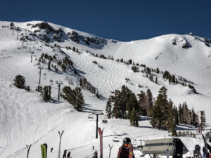
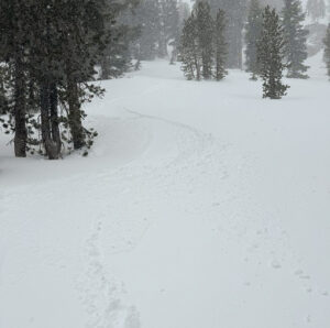
Good Friday afternoon, it’s a nice Fall day here in the Eastern Sierra.
Look for a chance of very light rain or snow to continue at times into early Saturday.
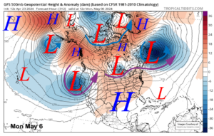
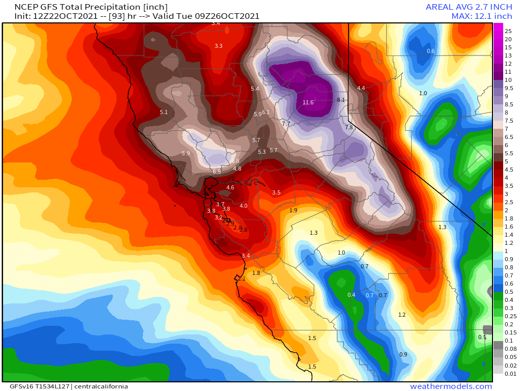
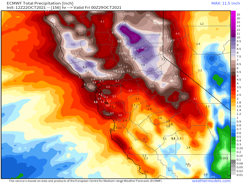
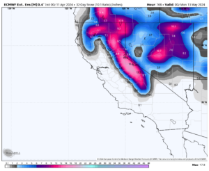
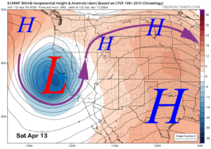
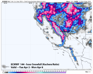
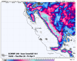
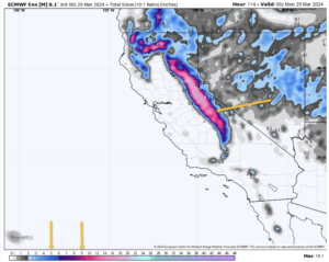
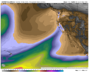
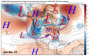
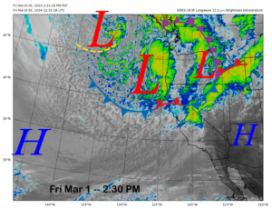
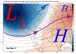
Looking at the details of the upcoming storm that is forecasted for Sunday and Monday. The AR band is still on track to pound Mammoth Mountain with a ton of moisture. Snow levels will be high above 9000 then up to 10,000+ before they come down to 9000 and then down to 8000 near the end.
Below that elevation, it looks like all areas of the Eastern Sierra should get rain including Bishop by Monday.
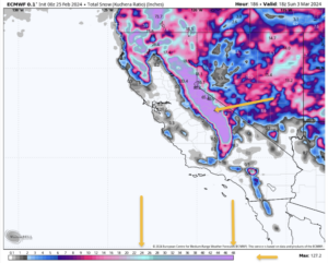
The snow that falls in the higher elevations will be heavy wet snow in the 5:1 range to start. By Monday AM snow levels come down and areas above 9000 feet should be around the 8:1 snowfall ratio.
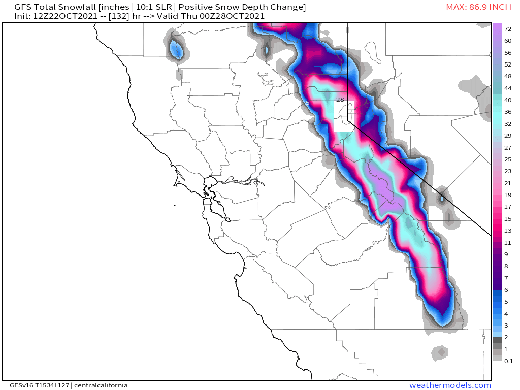
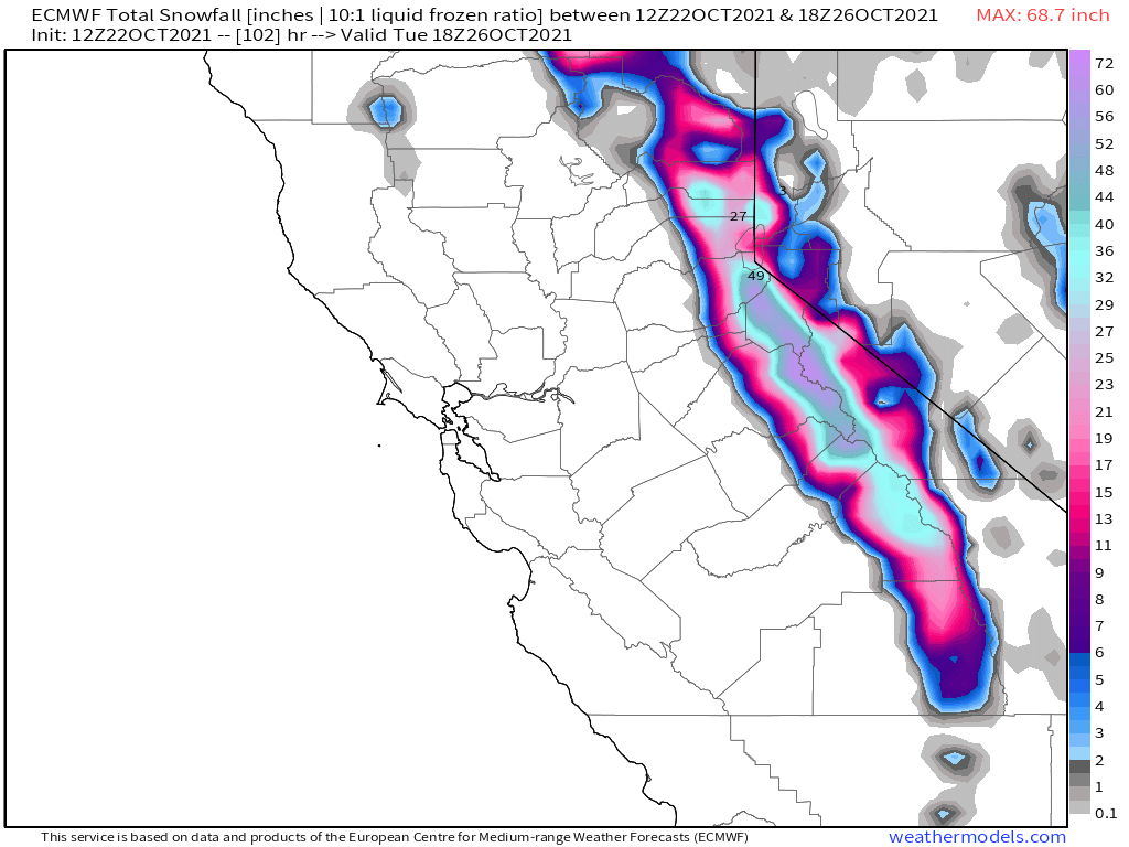
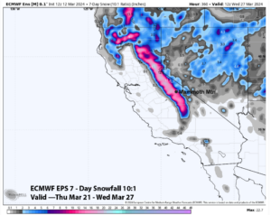
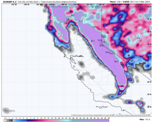
Looking at all my tools and confirming with the NWS, these are the snowfall numbers that might be expected by Monday afternoon. Canyon Lodge 3-7 inches, Main Lodge 8-12, MC Coy Station 12-24+, Top of Mammoth Mountain 36-48.
I will update these numbers again on Saturday morning and again early on Sunday. Have not heard from WeatherGuy today, will post anything he sends over to me.
The snow ratios will be low so the snow that we get will be perfect base building snow to help get the season get started.
Snow levels and how much snow really does end up falling at Main Lodge will all depend on how fast the snow levels come down.
As of this post, it’s looking like that will happen within a couple of hours of the midnight Sunday night time frame. That might bode well for the Main Lodge area and getting some good amounts of base snow.
Just remember folks this is just a forecast, never count on inches of snowfall before they fall on the ground or you end up disappointed.
Been playing this chasing fresh snow game in the area for 40 years now and I have learned to expect the unexpected more times than not. Nothing better than 6 inches of fresh in the forecast and you wake up to 18 inches of fresh snow.
I am working on updating everything below but wanted to get this up ASAP…. now back to the rest of the update for today…:)
 ______
10/2-/21 Here is the forecast for Thursday into Saturday.
Temperatures: On Thursday highs at the Main Lodge and in the Mammoth Lakes Basin will be in the upper 40s to low 50s. Then low 40s through the weekend. Night times lows will be in the low to mid-30s tonight through the weekend.
For Mammoth Lakes, highs will be in the upper 50s Thursday and then low 50s into Sunday. Nighttime lows will be in the low to mid-30s through the weekend.
Down in Round Valley and the Bishop areas highs will be in the upper 60s to low 70s through next weekend, lows will be back into the 40s each night.
Winds: Expect southwest to west winds 15 to 25 mph, with gusts as high as 40 mph over the higher elevations. 
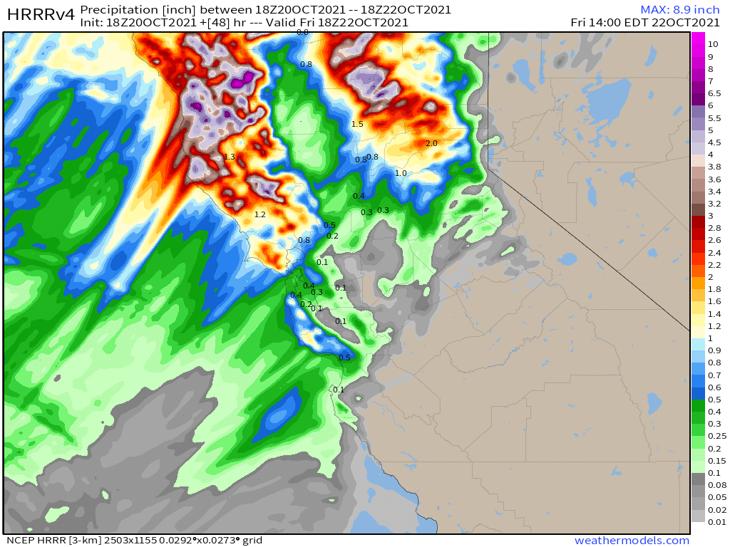
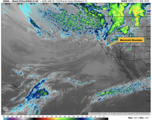
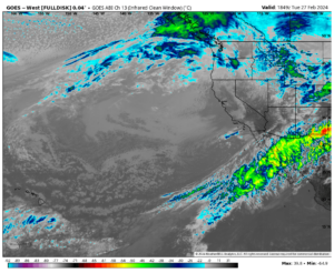
48 Hour Precipitation & Snowfall Forecast: Thru Friday afternoon Mammoth Mountain will be south of the main precipitation. As of now expect there could be a chance of showers later on Friday just after the forecast below expires.
Snowmaking: All the cold air is gone for now so now snowmaking for a bit. They had a great run for mid October. Will be watching for the next round of cold air to invade the area.

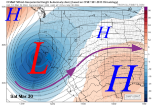
From NWS Reno Disclaimer: In the past, we have seen great model agreement days out only to see significant changes as the event nears with the emergence of finer-scale details.
This is especially true of atmospheric rivers as a shift of 50-100 miles in the core of the moisture feed (still quite possible) can affect precipitation amounts and higher elevation snowfall dramatically.


Who Are We?
 Steve Taylor – Mammoth Snowman – Over the last 30+ years, Snowman has spent countless hours studying and learning about Mammoth Mountain Weather and Snow Conditions first hand. He has been skiing around the hill with marked ski poles since March of 1991 so he can measure the fresh snowfall amounts out on the hill.
Snowman started blogging this information back in 1990 on the old Mammoth BBS system, then the RSN Forums and then on to MammothSnowman.com in 2004 with Video & Photo Blog report. (No YouTube back then). Facebook got added to the fold back in 2008 and then the Facebook Group in 2016.
Reports, videos, and photos from the website have been featured on both local TV Stations here in Mammoth, along with AP, Fox, ABC, CBS, and NBC News.
 Ted Schlaepfer – Mammoth WeatherGuy – The Powder Forecast – Posted Tuesday and Fridays at 5 PM November into Mid May. These forecasts are now responsible for many people getting multiple powder days on Mammoth Mountain over the years.
Ted’s Bio: Ted has been a full-time Meteorologist (CCM) for the past 25+ years. He has always been fascinated with the weather,” skiing was just a natural extension of my love for snow and rain. I started skiing at age 5, first discovered Mammoth in 1979 as a youth, and have been a regular visitor since the late ’80s.”.
Here is the link to The WeatherGuys Powder Forecast Page.
Click Here to Learn More About the People Who Make MammothSnowman.com a Reality


