Mammoth Mountain & Eastern Sierra Recreational Weather Forecast
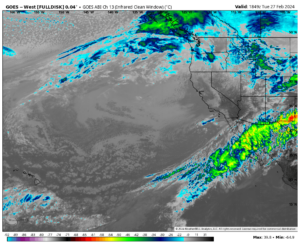
10-25-21 @ 1:25 PM Mammoth Mountain and the Eastern Sierra are now on the backside of the main AR band that has been the news the last several days.
Snow levels last night took hours longer to drop than we had anticipated. Seem the front almost came to a halt before it ever hit Mammoth and then once it did it hit the area the band sped up and has now exited. One thing is for sure the land is sure loving the recharge from all this rain.
Looking at the storm numbers, last night at the 9000-foot level there was 7 inches of rainfall before the snowline came down below Main Lodge. The water content in that snow is 1.77. The latter half fell at about 10:1 with the initial 2-3 inches at 1:2 / 1:3.
As for snowfall, the numbers have been spot on for the low side of what was forecast at Main Lodge. Looking at the snow study site is confusing, it’s showing the base has gone up more than the new snow. From what I can tell they have 14 new inches at Main Lodge.
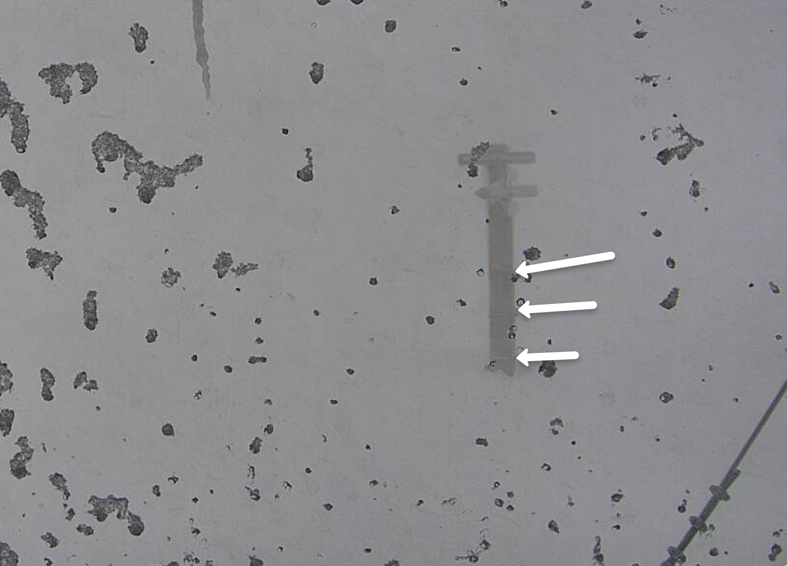
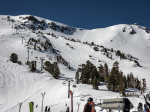
Looking at the webcam at the top you can see the 3 metal bands on the Mammoth Sign. Each band is 4 feet apart and the first one is 4 feet off the ground. In that image below my guess would be 3 to 3 1/2 feet of snow.
The thing is, I did not check the sign before the storm so no idea how much was there when all this started.
I did just check in with Ski Patrol and they have not been to the top yet to make a call on the snowfall yet.
Trying to check with the guy on top but so far no word. So let’s just assume we picked up at least 2-3 feet of the base with a bit of soft on top.
Hopefully, when patrol gets out there they find 4-5 feet. I will let you know when I hear for sure, remember don’t buy into the hype.
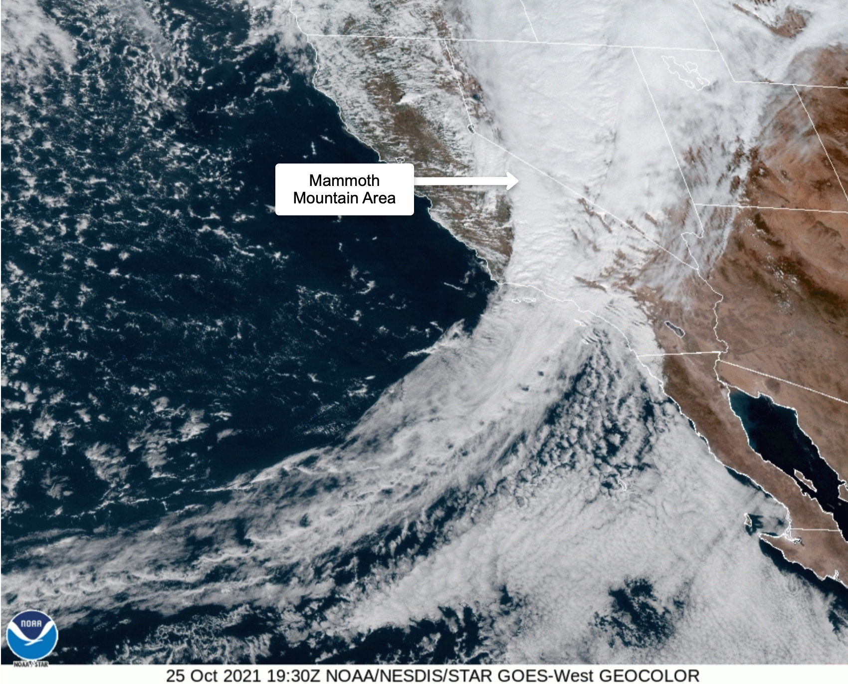
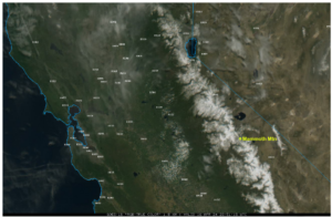
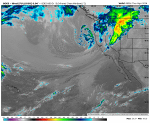
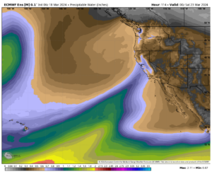
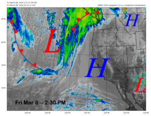
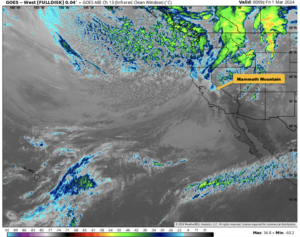
 Here is the current satellite view of the Western States. Mammoth Mountain is pointed out for you.
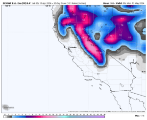
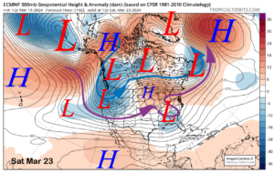
 Radar shows the main AR band has moved past the area.
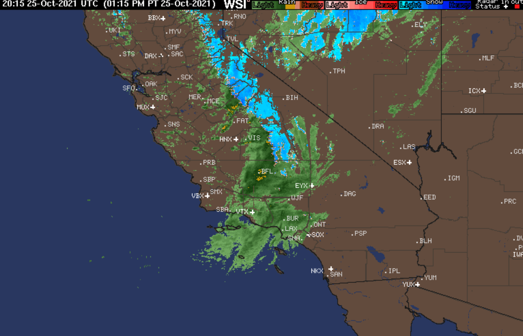
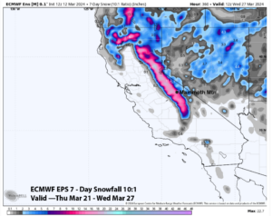
Just a few more inches in the forecast before this system is over.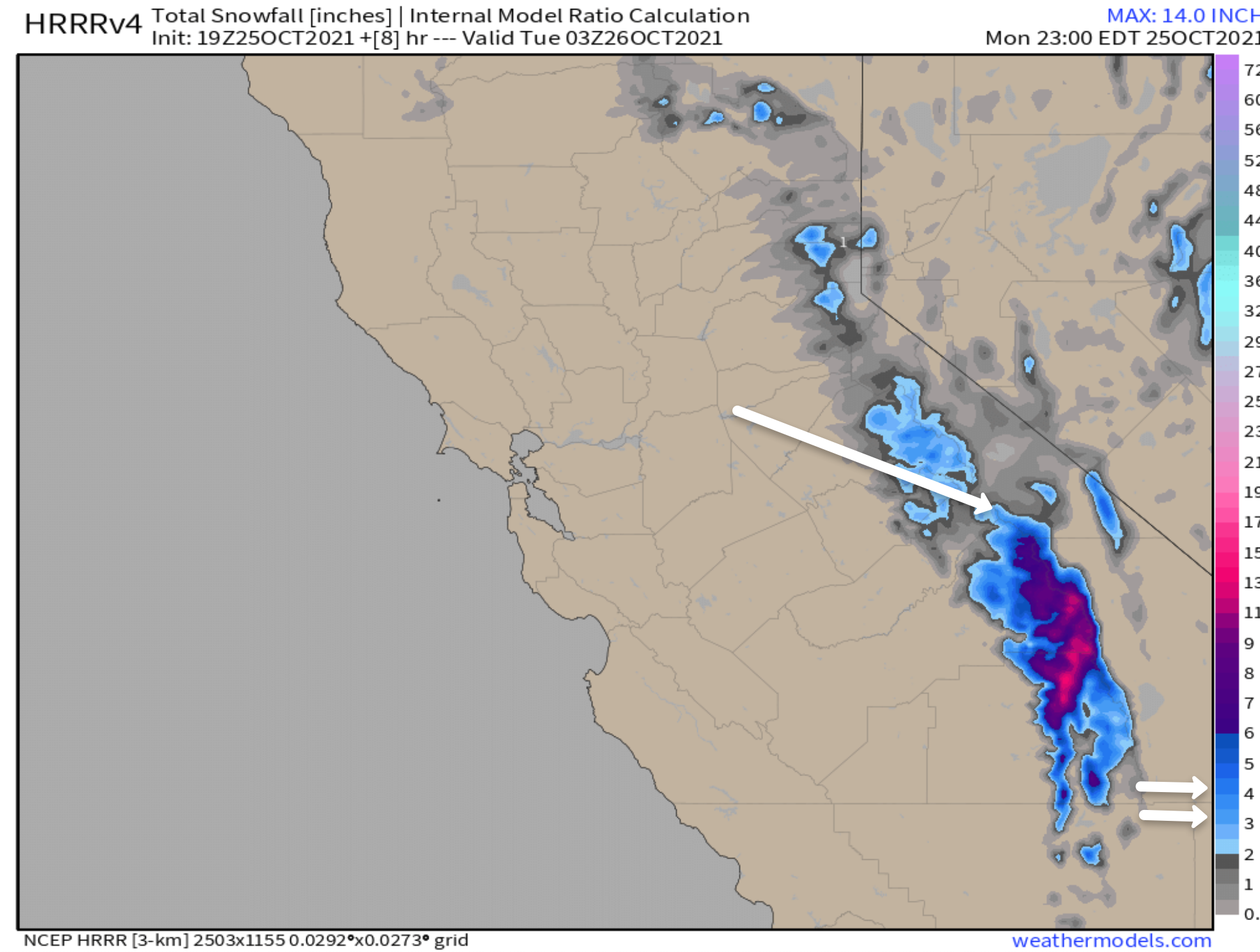
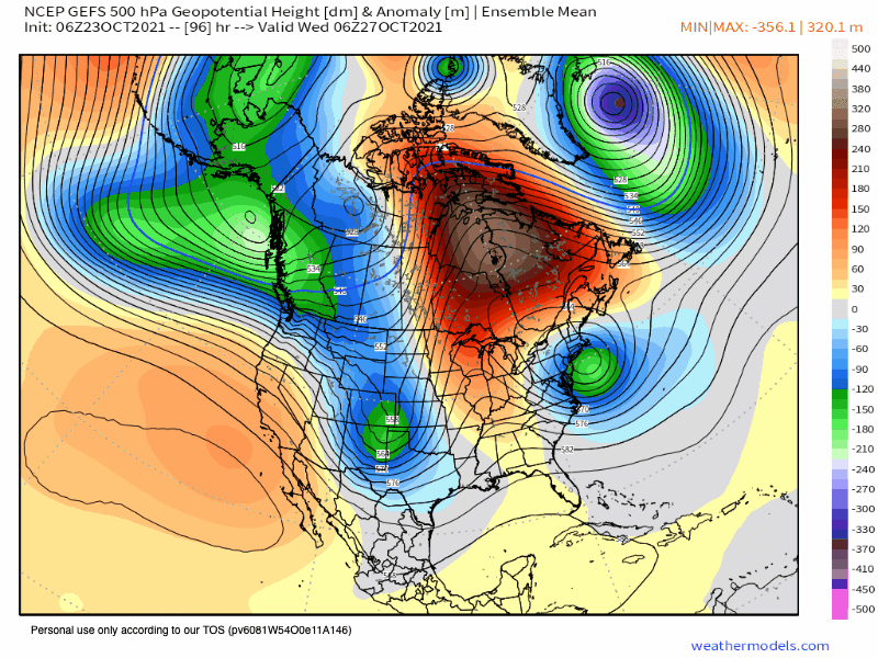
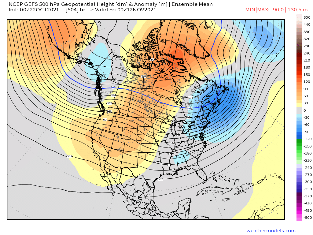
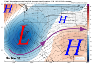
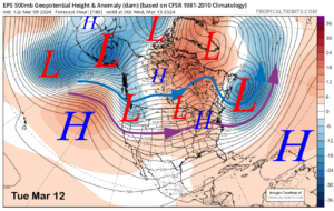
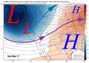
We go from a nice deep low back over to high-pressure ridging by mid-week. 
This upcoming week will be highlighted by warm and dry conditions. We are out of the October storm cycle now and on to a new pattern. Look for a change in about 21 days.
Temperatures: For Tuesday highs at the Main Lodge and in the Mammoth Lakes Basin will be in the mid 30s. Highs will come up into the mid 40s on Wednesday and remain there thru next weekend.
Nighttime lows will be in around 19 tonight and then upper 20s to low 30s into the weekend.
For Mammoth Lakes, highs will be in the mid 40s Tuesday and into the low to mid 50s Wednesday into the weekend. Lows will be in the upper teens tonight and then lower 30s into the weekend.
Down in the Round Valley and the Bishop areas highs will be in the lows 60s Tuesday and then upper 60s to the low 70s through the weekend, lows will be back into the 40s each night.
Winds: Expect West to Southwest winds 10 to 15 mph with gust as high as 25 mph over the higher elevations over the next few days.
Precipitation & Snowfall Forecast: Nothing in sight at this time.
Snowmaking: They are cranking the system up Monday into early Tuesday for what looks like a great run. The rest of the week conditions to make snow will be limited.
October is hit and miss with snowmaking, most years it’s to warm with no snow on the ground to help the cause so they wait till November.


10-23-21 @ 7:24 AM A warming and dry trend moves in this Wednesday and will be with us thru the 10 day period.


Fantasy Long Range Weather Outlook
10-23-2021 9 AM – We just had a fantasy forecast come thru, the last 21 days were picked by the EPS model back in September. Looks to be warm and dry for a bit now.
The Fantasy outlook period is starting to look interesting after we get past the ridging that is forecast to develop later this week.
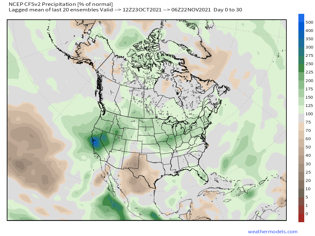
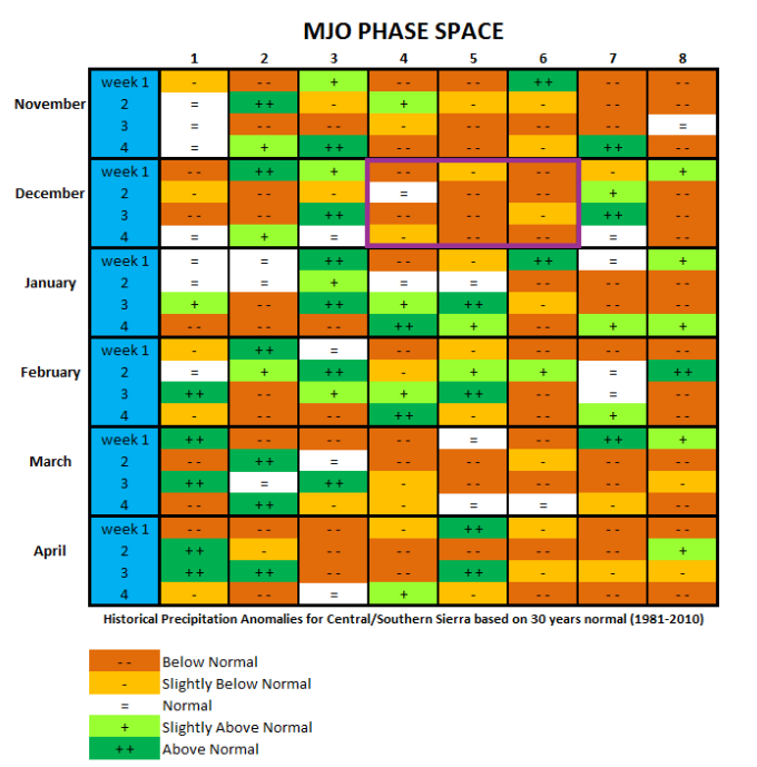
The EU models want to get us cold with some snow in the way off outlook as well. Not a big fan of CFS, but that model has above-normal snowfall for November.
**Right now I am looking to upgrade to Weather Bell again so we can post all the long long-range images for your enjoyment.
As I get more monthly subscribers to the website we can add more of these paid subscriptions that offer better forecast images.
If you can, please consider supporting this website, the time and images here are worth the money spent.

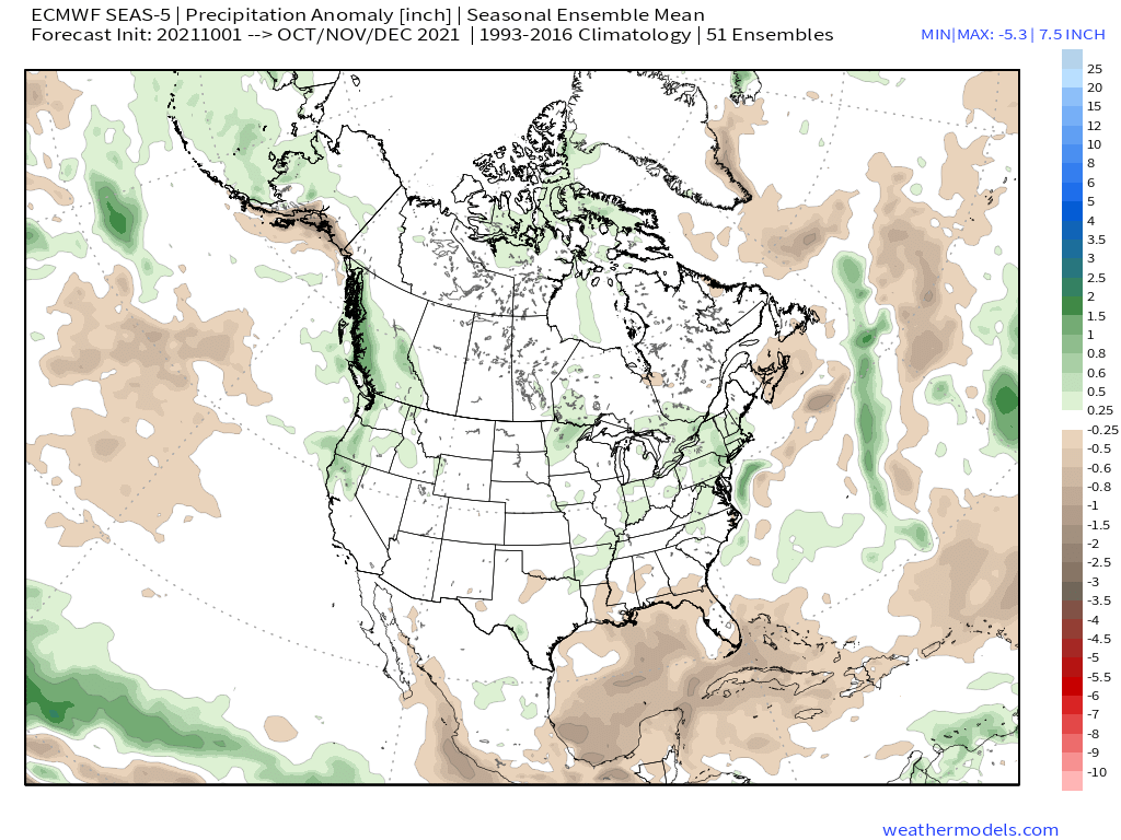
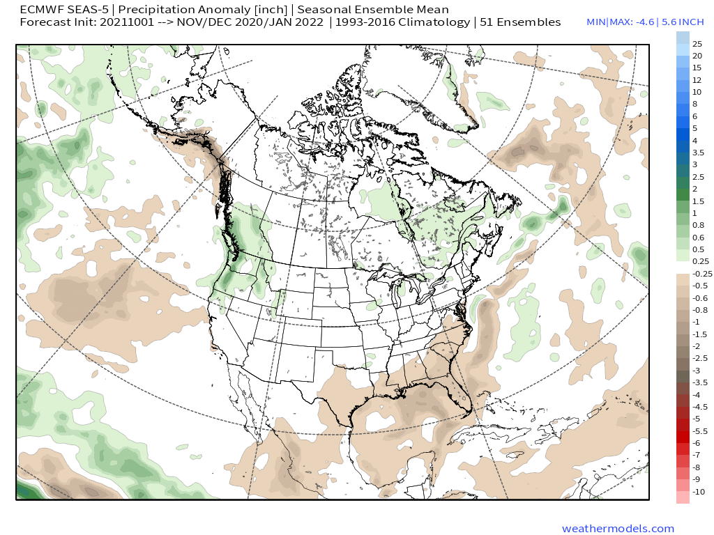
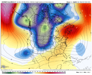
 ECMWF Seasonal Ensemble Mean – Monthly Update from 10-1-2021
around


")

")
")
")
")
Who Are We?
 Steve Taylor – Mammoth Snowman – Over the last 30+ years, Snowman has spent countless hours studying and learning about Mammoth Mountain Weather and Snow Conditions first hand. He has been skiing around the hill with marked ski poles since March of 1991 so he can measure the fresh snowfall amounts out on the hill.
Snowman started blogging this information back in 1990 on the old Mammoth BBS system, then the RSN Forums and then on to MammothSnowman.com in 2004 with Video & Photo Blog report. (No YouTube back then). Facebook got added to the fold back in 2008 and then the Facebook Group in 2016.
Reports, videos, and photos from the website have been featured on both local TV Stations here in Mammoth, along with AP, Fox, ABC, CBS, and NBC News.
 Ted Schlaepfer – Mammoth WeatherGuy – The Powder Forecast – Posted Tuesday and Fridays at 5 PM November into Mid May. These forecasts are now responsible for many people getting multiple powder days on Mammoth Mountain over the years.
Ted’s Bio: Ted has been a full-time Meteorologist (CCM) for the past 25+ years. He has always been fascinated with the weather,” skiing was just a natural extension of my love for snow and rain. I started skiing at age 5, first discovered Mammoth in 1979 as a youth, and have been a regular visitor since the late ’80s.”.
Here is the link to The WeatherGuys Powder Forecast Page.
Click Here to Learn More About the People Who Make MammothSnowman.com a Reality


