Mammoth Mountain Weather Forecast & Discussion

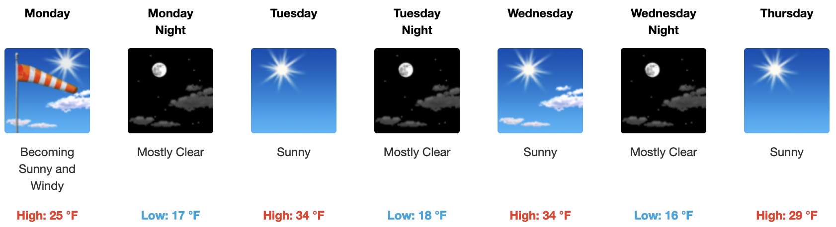
January 23rd @ 8:17 AM – NE Winds on Today, wear face protection off the top and mid-mountain.

An inside slider will continue to bring gusty NE winds and cooler temperatures to Mammoth Mountain through today. Winds gust could reach 80-100 MPH over the top this morning before backing off this afternoon.

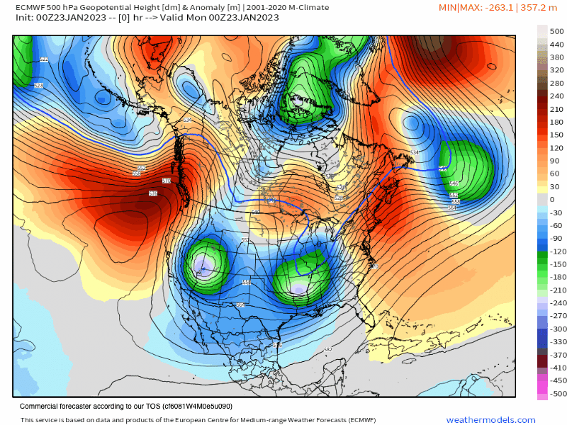
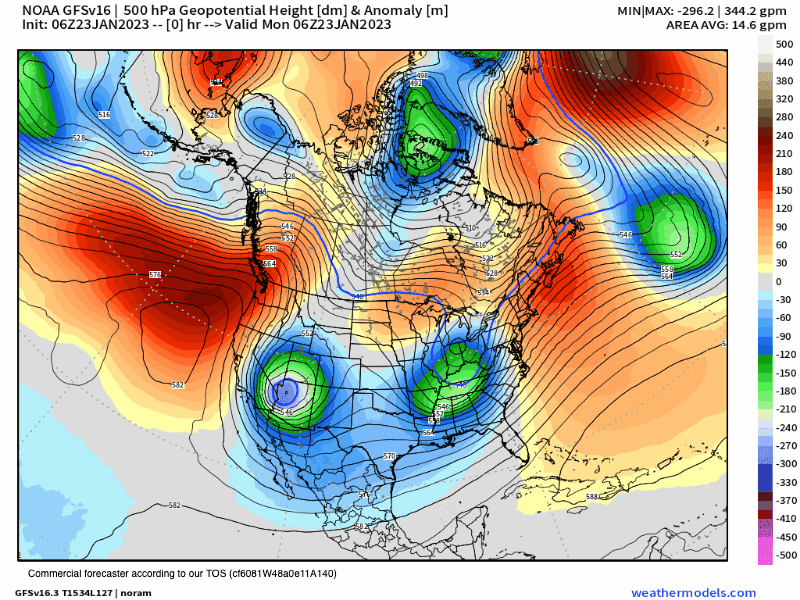
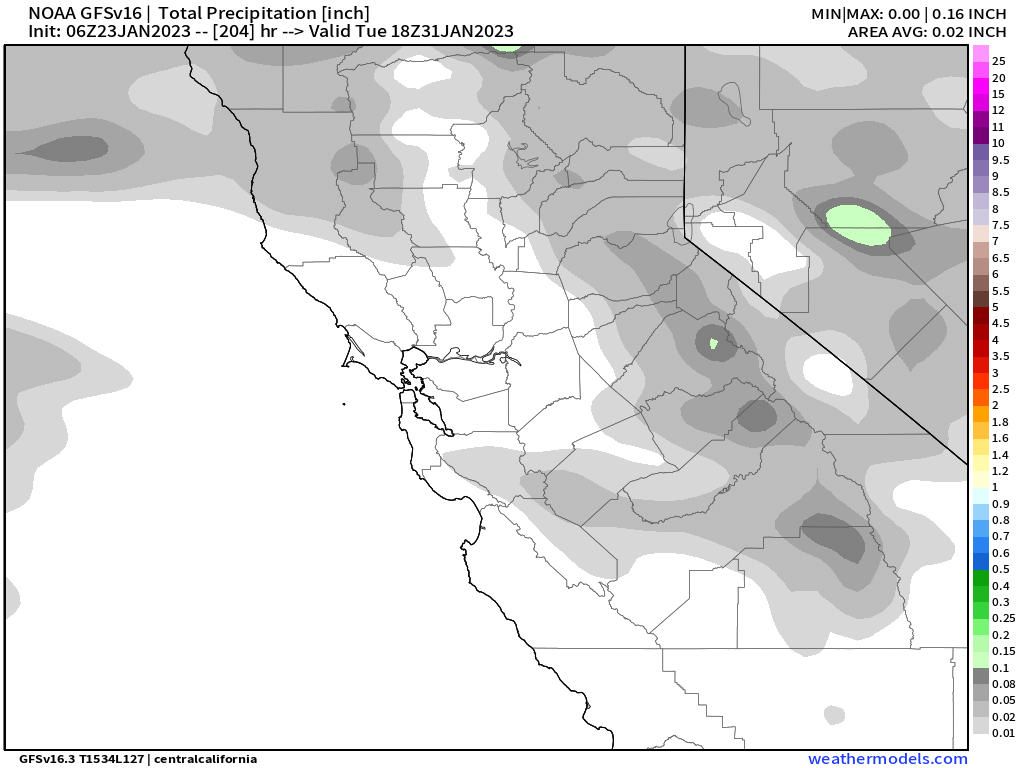
By Tuesday the area will be under the influence of ridging that will bring in a cool and dry N to NE flow that should last through the rest of the week.

If you’re going to be out on the hill on today expect cloudy skies with clearing by the afternoon with temperatures in the teens to start the day with highs in the low to mid-20s.

The wind will be out of the North East around 10 MPH – 15 MPH with gusts to 25-35 mph over lower elevations. Over the mid and upper mountain expect wind chill values as low as -25. With a northeast wind of 35 to 45 mph, with gusts as high as 65-75 mph. 

Weather Discussion & the Fantasy Long-Range Outlook

1-23-21 @ 7:35  AM – Today’s inside slider will keep the cold air and gusty NE winds in place throughout the day. By Tuesday there is a strong ridge of blocking high pressure to the NW of Mammoth. That pattern will bring in dry conditions with northeast winds that shift northerly by Wednesday. Winds look to bounce from the N to NE into Friday, what exact direction will depend on how the ridge evolves this week.

For next weekend the pattern will start to change again as the ridge starts to retrograde to the northwest. That will allow an inside slider to drop in just to our east and bring in a reinforcing shot of cold air with a slight chance of snow showers by next Sunday.

As is the case with many a pattern change models can struggle with what the outcome will be. For next week the ECM model, that we prefer, has the next trough to the west of Mammoth Mountain while the GFS has that trough as an inside slider followed by some flat ridging for Mammoth all next week. If the ECM comes true then early next week there could be some nice fresh powder falling, if the GFS is right then expect sunshine and average tempratures

One thing for sure is the hype I am seeing on you tube that February could be a 200-inch month and the next strong AR is coming in next week is total bull. There are NO signs at this time of the jet ramping up and doing a repeat of late December into mid-January, none.

Snowman

ECM 10 Day Outlook
GFS 10 Day Outlook
ECM Precipitation Outlook into next Tuesday
GFS Precipitation Outlook into next Tuesday

EPS Seasonal Weather Data for Mammoth Mountain – 1-7-2022 – The new run of the EPS Seasonal is out and it continues to show the trend of an average to above-average winter for snowfall. So good vibes moving forward as we continue with this snow season.

See you out on the hill, Snowman

ENSO Outlook

Mammoth Mountain and Eastern Sierra Weather Posts